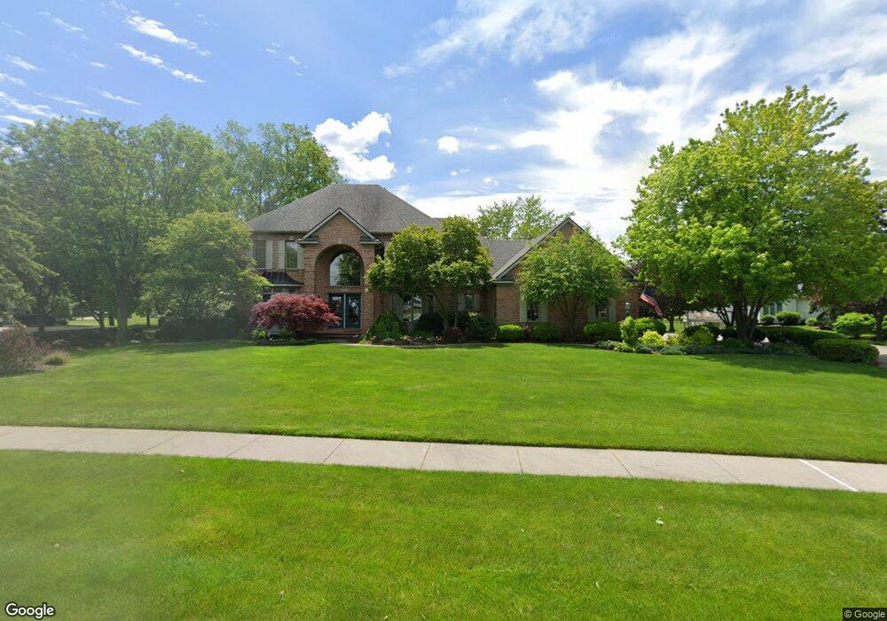
7853 Railside Dr SW Byron Center, MI 49315
Estimated Value: $852,000 - $1,009,000
6
Beds
5
Baths
4,500
Sq Ft
$203/Sq Ft
Est. Value
About This Home
This home is located at 7853 Railside Dr SW, Byron Center, MI 49315 and is currently estimated at $911,993, approximately $202 per square foot. 7853 Railside Dr SW is a home located in Kent County with nearby schools including Brown Elementary School, Robert L. Nickels Intermediate School, and Byron Center West Middle School.
Ownership History
Date
Name
Owned For
Owner Type
Purchase Details
Closed on
Mar 31, 2004
Sold by
Tromp John W and Tromp Gloria J
Bought by
The Gloria J Tromp Trust
Current Estimated Value
Home Financials for this Owner
Home Financials are based on the most recent Mortgage that was taken out on this home.
Original Mortgage
$75,000
Interest Rate
5.66%
Mortgage Type
Purchase Money Mortgage
Create a Home Valuation Report for This Property
The Home Valuation Report is an in-depth analysis detailing your home's value as well as a comparison with similar homes in the area
Home Values in the Area
Average Home Value in this Area
Purchase History
| Date | Buyer | Sale Price | Title Company |
|---|---|---|---|
| The Gloria J Tromp Trust | -- | -- | |
| Tromp John W | $547,000 | -- |
Source: Public Records
Mortgage History
| Date | Status | Borrower | Loan Amount |
|---|---|---|---|
| Closed | Tromp John W | $75,000 |
Source: Public Records
Tax History Compared to Growth
Tax History
| Year | Tax Paid | Tax Assessment Tax Assessment Total Assessment is a certain percentage of the fair market value that is determined by local assessors to be the total taxable value of land and additions on the property. | Land | Improvement |
|---|---|---|---|---|
| 2025 | $5,845 | $438,700 | $0 | $0 |
| 2024 | $5,845 | $411,400 | $0 | $0 |
| 2023 | $5,590 | $334,100 | $0 | $0 |
| 2022 | $7,790 | $303,100 | $0 | $0 |
| 2021 | $7,582 | $298,200 | $0 | $0 |
| 2020 | $5,145 | $281,200 | $0 | $0 |
| 2019 | $7,399 | $281,100 | $0 | $0 |
| 2018 | $7,246 | $265,200 | $36,800 | $228,400 |
| 2017 | $7,058 | $248,000 | $0 | $0 |
| 2016 | $6,798 | $243,000 | $0 | $0 |
| 2015 | $6,681 | $243,000 | $0 | $0 |
| 2013 | -- | $214,700 | $0 | $0 |
Source: Public Records
Map
Nearby Homes
- 8090 Country Rail Ct SW
- 8138 Boardwalk Dr SW
- 8393 Woodhaven Dr SW Unit 1
- 2740 Woodhaven Ct SW Unit 2
- 8030 Lionel Dr
- 8330 Rockledge Way SW Unit 92
- 2581 Ravines Trail Dr SW
- 2569 Ravines Trail Dr SW
- 2567 Ravines Trail Dr SW
- 2553 Ravines Trail Dr SW
- 670 84th St SW
- 3183 Railway Dr SW
- 1942 Creekside Dr SW
- 1912 Creekside Dr SW
- 8581 Troy St SW
- 7998 Byron Depot Dr SW
- 8541 Woodhaven Dr SW
- 8564 Elkwood Dr SW
- 1828 Gloryfield Dr
- 3152 84th St SW
- 2656 Beechtree Dr SW
- 7865 Railside Dr SW
- 2673 Beechtree Dr SW
- 7840 Railside Dr SW
- 7874 Railside Dr SW
- 2706 Beechtree Dr SW
- 2705 Beechtree Dr SW
- 7822 Railside Dr SW
- 2589 Byron Station Dr SW
- 7888 Railside Dr SW
- 2605 Byron Station Dr SW
- 2621 Byron Station Dr SW
- 2585 Byron Station Dr SW Unit APP
- 2728 Beechtree Dr SW
- 2727 Beechtree Dr SW
- 2653 Byron Station Dr SW
- 2700 Railside Ct SW
- 7800 Railside Dr SW
- 7900 Railside Dr SW
- 2697 Byron Station Dr SW