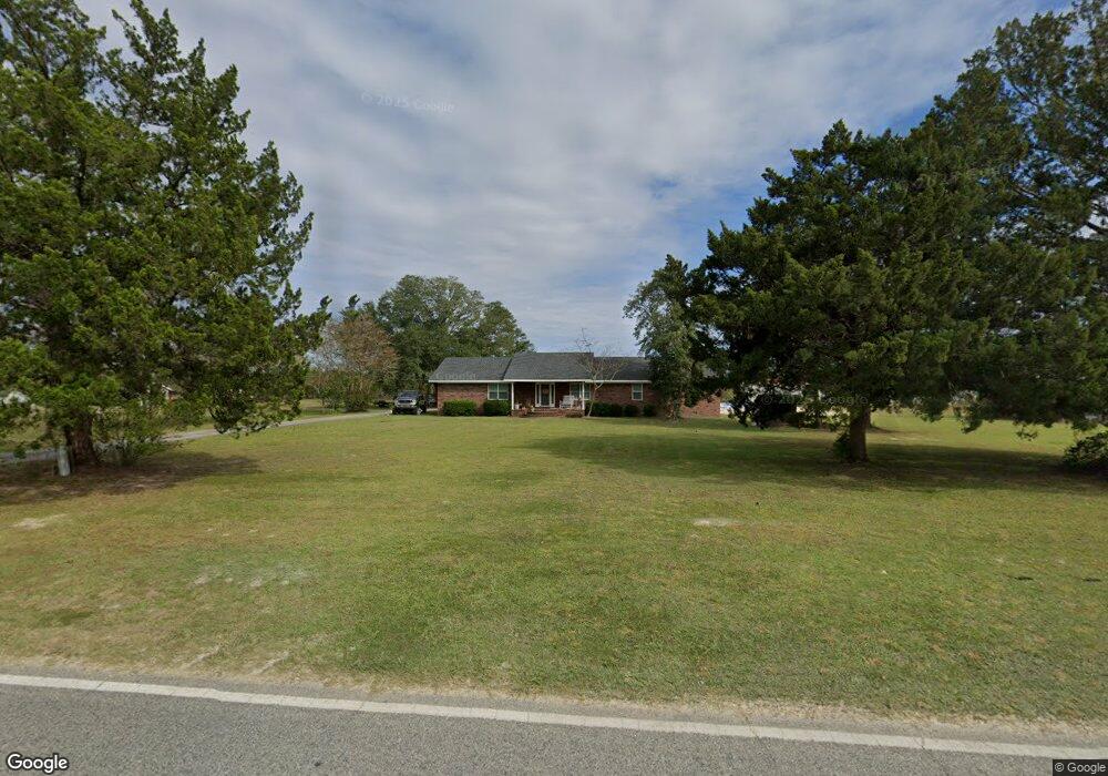
7858 Riverside Rd Nahunta, GA 31553
Estimated Value: $227,000 - $371,000
--
Bed
2
Baths
2,356
Sq Ft
$131/Sq Ft
Est. Value
About This Home
This home is located at 7858 Riverside Rd, Nahunta, GA 31553 and is currently estimated at $308,132, approximately $130 per square foot. 7858 Riverside Rd is a home located in Brantley County with nearby schools including Nahunta Primary School, Nahunta Elementary School, and Brantley County Middle School.
Ownership History
Date
Name
Owned For
Owner Type
Purchase Details
Closed on
Nov 12, 2019
Sold by
Depratter Evelyn Annette Rowell
Bought by
Rowell Brandon Randy and Rowell Elizabeth Jo
Current Estimated Value
Home Financials for this Owner
Home Financials are based on the most recent Mortgage that was taken out on this home.
Original Mortgage
$134,445
Interest Rate
3.6%
Mortgage Type
Commercial
Purchase Details
Closed on
Jan 23, 2019
Sold by
Depratter Evelyn Annette Rowell
Bought by
Depratter David Lamar
Create a Home Valuation Report for This Property
The Home Valuation Report is an in-depth analysis detailing your home's value as well as a comparison with similar homes in the area
Home Values in the Area
Average Home Value in this Area
Purchase History
| Date | Buyer | Sale Price | Title Company |
|---|---|---|---|
| Rowell Brandon Randy | $80,000 | -- | |
| Depratter David Lamar | -- | -- | |
| Rowell Randy Mack | -- | -- | |
| Roberson Alice Gail Rowell | -- | -- | |
| Depratter Hazel Elaine Rowell | -- | -- | |
| Depratter Evelyn Annette Rowell | -- | -- | |
| Depratter Evelyn Annette Rowell | -- | -- |
Source: Public Records
Mortgage History
| Date | Status | Borrower | Loan Amount |
|---|---|---|---|
| Closed | Rowell Brandon Randy | $134,445 |
Source: Public Records
Tax History Compared to Growth
Tax History
| Year | Tax Paid | Tax Assessment Tax Assessment Total Assessment is a certain percentage of the fair market value that is determined by local assessors to be the total taxable value of land and additions on the property. | Land | Improvement |
|---|---|---|---|---|
| 2024 | $3,038 | $90,700 | $3,298 | $87,402 |
| 2023 | $322 | $86,378 | $2,998 | $83,380 |
| 2022 | $2,889 | $85,378 | $2,998 | $82,380 |
| 2021 | $1,786 | $48,202 | $2,998 | $45,204 |
| 2020 | $1,780 | $46,413 | $2,998 | $43,415 |
| 2019 | $1,826 | $57,989 | $12,550 | $45,439 |
| 2018 | $2,269 | $66,742 | $21,303 | $45,439 |
| 2017 | $2,269 | $66,742 | $21,303 | $45,439 |
| 2016 | $1,210 | $66,742 | $21,303 | $45,439 |
Source: Public Records
Map
Nearby Homes
- 0 Riverside Rd Unit 25397127
- 7126 U S 301
- 0 Bachlott Church Rd Unit 25773424
- 0 Bachlott Church Rd Unit 10633876
- 0 Bachlott Church Rd Unit 1657673
- 0 Bachlott Church Rd Unit 163572
- 0-0 Foxwood Rd
- 0 Foxwood Rd
- 29 Chisholm St
- 91 Cane Cir
- 46 Christopher Cir
- 537 Seward Trail
- 105 Crawford Rd
- 0 Caney Bay Rd
- 92 Ervin St
- 76 Ervin St
- 20.55 ACRES U S Highway 82
- 387 Burton St
- 584 Knox St
- 87 Stephen Park Rd
- 7928 Riverside Rd
- 79 White Cir
- 173 White Cir
- 0 Riverside Rock Rd Unit 25999
- 0 Riverside Rock Rd Unit 1576822
- 502 Autumn Ln
- 7638 Riverside Rd
- 5760 Highway 301 S
- 364 Autumn Ln
- 117 Autumn Ln
- 7532 Riverside Rd
- 8221 Riverside Rd
- 207 Autumn Ln
- 29 Autumn Ln
- 83 Autumn Ln
- 165 Mutts Place
- 8350 Riverside Rd
- 8362 Riverside Rd
- 6122 Highway 301 S
- 429 Autumn Ln