Estimated Value: $500,000 - $570,000
2
Beds
4
Baths
2,287
Sq Ft
$230/Sq Ft
Est. Value
About This Home
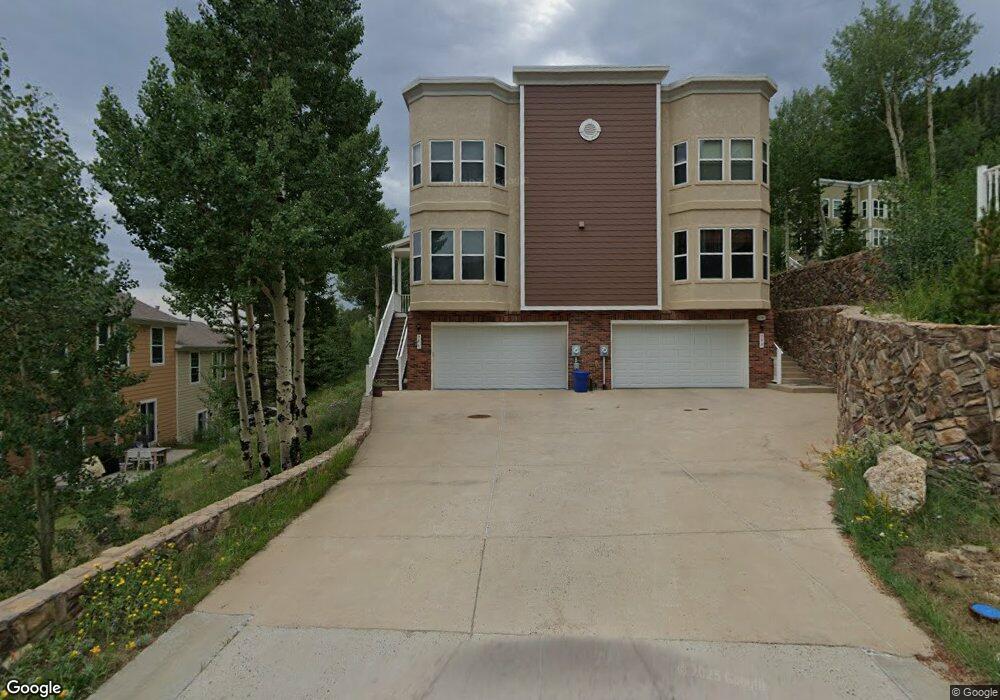
This home is located at 786 Jake Dr, Central City, CO 80427 and is currently estimated at $526,015, approximately $230 per square foot. 786 Jake Dr is a home located in Gilpin County with nearby schools including Gilpin County Elementary School and Gilpin County Undivided High School.
Ownership History
Date
Name
Owned For
Owner Type
Purchase Details
Closed on
Jul 13, 2018
Sold by
David Family Trust
Bought by
Arvik Jordan N
Current Estimated Value
Home Financials for this Owner
Home Financials are based on the most recent Mortgage that was taken out on this home.
Original Mortgage
$258,187
Outstanding Balance
$223,758
Interest Rate
4.5%
Mortgage Type
VA
Estimated Equity
$302,257
Purchase Details
Closed on
Oct 26, 2007
Sold by
Anderson Patrick D and Anderson Susan J
Bought by
Davis Family Trust
Purchase Details
Closed on
Jun 23, 2006
Sold by
Prospectors Run Llc
Bought by
Anderson Patrick D and Anderson Susan J
Home Financials for this Owner
Home Financials are based on the most recent Mortgage that was taken out on this home.
Original Mortgage
$267,127
Interest Rate
5.75%
Mortgage Type
Adjustable Rate Mortgage/ARM
Create a Home Valuation Report for This Property
The Home Valuation Report is an in-depth analysis detailing your home's value as well as a comparison with similar homes in the area
Home Values in the Area
Average Home Value in this Area
Purchase History
| Date | Buyer | Sale Price | Title Company |
|---|---|---|---|
| Arvik Jordan N | $355,000 | None Available | |
| Davis Family Trust | $330,000 | -- | |
| Anderson Patrick D | $333,900 | -- |
Source: Public Records
Mortgage History
| Date | Status | Borrower | Loan Amount |
|---|---|---|---|
| Open | Arvik Jordan N | $258,187 | |
| Previous Owner | Anderson Patrick D | $267,127 |
Source: Public Records
Tax History Compared to Growth
Tax History
| Year | Tax Paid | Tax Assessment Tax Assessment Total Assessment is a certain percentage of the fair market value that is determined by local assessors to be the total taxable value of land and additions on the property. | Land | Improvement |
|---|---|---|---|---|
| 2024 | $754 | $26,010 | $90 | $25,920 |
| 2023 | $754 | $26,010 | $90 | $25,920 |
| 2022 | $827 | $25,730 | $100 | $25,630 |
| 2021 | $830 | $26,480 | $110 | $26,370 |
| 2020 | $797 | $26,570 | $110 | $26,460 |
| 2019 | $687 | $26,570 | $110 | $26,460 |
| 2018 | $626 | $22,950 | $10 | $22,940 |
| 2017 | $627 | $22,950 | $10 | $22,940 |
| 2016 | $623 | $22,720 | $10 | $22,710 |
| 2015 | -- | $22,720 | $10 | $22,710 |
| 2014 | -- | $24,860 | $10 | $24,850 |
Source: Public Records
Map
Nearby Homes
- 736 Martin Dr
- 796 Louis Dr
- 820 Vernon Dr
- 541 Eureka St
- 531 Eureka St
- 2106 Upper Apex Rd
- 801 Eureka St Unit See Appendix B
- 023 Eureka St
- 000 Nevadaville Rd Unit 47,50
- 0001 Academy St
- 2336 Bald Mountain Rd
- 102 E 1st High St
- 00 E Third St
- 0 Upper Apex Rd
- 300 Roworth St
- Lot 1 E 4th High St
- Lot 11 E Seventh St Unit 11
- 234 E 4th High St
- 326 E 1st High St
- 007 Virginia Canyon Rd Unit N002895