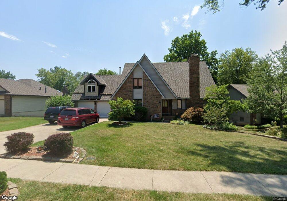
786 W Brookshire Dr Springfield, MO 65810
Southwest Springfield NeighborhoodEstimated Value: $431,669 - $460,000
4
Beds
4
Baths
4,000
Sq Ft
$112/Sq Ft
Est. Value
About This Home
This home is located at 786 W Brookshire Dr, Springfield, MO 65810 and is currently estimated at $449,417, approximately $112 per square foot. 786 W Brookshire Dr is a home located in Greene County with nearby schools including Gray Elementary School, Wilson's Creek Intermediate School, and Cherokee Middle School.
Ownership History
Date
Name
Owned For
Owner Type
Purchase Details
Closed on
Feb 6, 2009
Sold by
Huddleston Michael W and Huddleston Karen L
Bought by
Alfano Marc and Alfano Valerie
Current Estimated Value
Home Financials for this Owner
Home Financials are based on the most recent Mortgage that was taken out on this home.
Original Mortgage
$210,123
Outstanding Balance
$133,320
Interest Rate
5.17%
Mortgage Type
FHA
Estimated Equity
$316,097
Create a Home Valuation Report for This Property
The Home Valuation Report is an in-depth analysis detailing your home's value as well as a comparison with similar homes in the area
Home Values in the Area
Average Home Value in this Area
Purchase History
| Date | Buyer | Sale Price | Title Company |
|---|---|---|---|
| Alfano Marc | -- | Fidelity Title Agency |
Source: Public Records
Mortgage History
| Date | Status | Borrower | Loan Amount |
|---|---|---|---|
| Open | Alfano Marc | $210,123 |
Source: Public Records
Tax History
| Year | Tax Paid | Tax Assessment Tax Assessment Total Assessment is a certain percentage of the fair market value that is determined by local assessors to be the total taxable value of land and additions on the property. | Land | Improvement |
|---|---|---|---|---|
| 2025 | $3,291 | $63,880 | $7,130 | $56,750 |
| 2024 | $3,126 | $56,450 | $5,810 | $50,640 |
| 2023 | $3,110 | $56,450 | $5,810 | $50,640 |
| 2022 | $2,441 | $45,410 | $5,810 | $39,600 |
| 2021 | $2,440 | $45,410 | $5,810 | $39,600 |
| 2020 | $2,420 | $42,710 | $5,810 | $36,900 |
| 2019 | $2,351 | $42,710 | $5,810 | $36,900 |
| 2018 | $2,060 | $37,330 | $5,810 | $31,520 |
| 2017 | $2,039 | $36,100 | $5,810 | $30,290 |
| 2016 | $1,973 | $36,100 | $5,810 | $30,290 |
| 2015 | $1,957 | $36,100 | $5,810 | $30,290 |
| 2014 | $1,926 | $35,240 | $5,810 | $29,430 |
Source: Public Records
Map
Nearby Homes
- 796 W Sherwood Dr
- 4890 S Wellington Dr
- 4916 S Buckingham Ln
- 4907 S Buckingham Ln
- 4782 S Turnberry Ave
- 5955 S Farm Road 163 Unit 209a
- 5955 S Farm Road 163 Unit 206b
- 5955 S Farm Road 163 Unit 101b
- 5955 S Farm Road 163 Unit 106
- 5955 S Farm Road 163 Unit 209b
- 5955 S Farm Road 163 Unit 202a
- 5955 S Farm Road 163 Unit 105
- 5955 S Farm Road 163 Unit 201a
- 5955 S Farm Road 163 Unit 101a
- 5955 S Farm Road 163 Unit 112
- 5955 S Farm Road 163 Unit 205a
- 5955 S Farm Road 163 Unit 102
- 5955 S Farm Road 163 Unit 202b
- 6139 S Dollison Ave
- 4921 S Aaron Ave
- 818 W Brookshire Dr
- 770 W Brookshire Dr
- 834 W Brookshire Dr
- 779 W Brookshire Dr
- 4907 S Wellington Dr
- 795 W Brookshire Dr
- 761 W Brookshire Dr
- 4919 S Wellington Dr
- 850 W Brookshire Dr
- 819 W Brookshire Dr
- 4931 S Wellington Dr
- 835 W Brookshire Dr
- 749 W Brookshire Dr
- 835 W Kingsway Dr
- 819 W Kingsway Dr
- 866 W Brookshire Dr
- 859 W Kingsway Dr
- 4943 S Wellington Dr
- 853 W Brookshire Dr
- 760 W Sherwood Dr
Your Personal Tour Guide
Ask me questions while you tour the home.