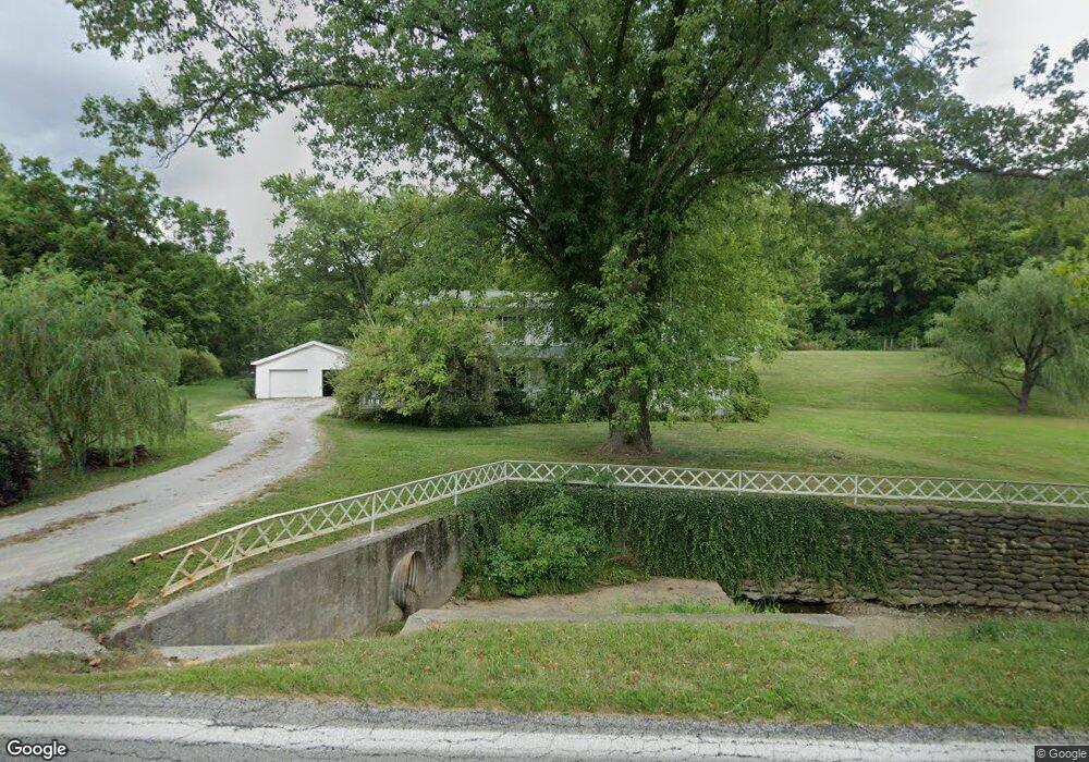
7863 State Route 243 South Point, OH 45680
Estimated Value: $263,000 - $442,000
4
Beds
3
Baths
2,924
Sq Ft
$117/Sq Ft
Est. Value
About This Home
This home is located at 7863 State Route 243, South Point, OH 45680 and is currently estimated at $342,689, approximately $117 per square foot. 7863 State Route 243 is a home located in Lawrence County with nearby schools including Dawson-Bryant Elementary School, Dawson-Bryant Middle School, and Dawson-Bryant High School.
Ownership History
Date
Name
Owned For
Owner Type
Purchase Details
Closed on
Jul 12, 2000
Sold by
Johnson Theodore F
Bought by
Looney Brett A and Looney Robin
Current Estimated Value
Purchase Details
Closed on
Nov 17, 1999
Bought by
Johnson Theodore F
Purchase Details
Closed on
Jun 25, 1997
Bought by
Johnson, Theodore F. & Co
Purchase Details
Closed on
Jul 12, 1996
Sold by
Rice James E and Rice Betty D
Bought by
Moores, William Todd & Pa
Create a Home Valuation Report for This Property
The Home Valuation Report is an in-depth analysis detailing your home's value as well as a comparison with similar homes in the area
Home Values in the Area
Average Home Value in this Area
Purchase History
| Date | Buyer | Sale Price | Title Company |
|---|---|---|---|
| Looney Brett A | $181,200 | -- | |
| Johnson Theodore F | $60,000 | -- | |
| Johnson, Theodore F. & Co | $89,000 | -- | |
| Moores, William Todd & Pa | $69,900 | -- |
Source: Public Records
Tax History Compared to Growth
Tax History
| Year | Tax Paid | Tax Assessment Tax Assessment Total Assessment is a certain percentage of the fair market value that is determined by local assessors to be the total taxable value of land and additions on the property. | Land | Improvement |
|---|---|---|---|---|
| 2024 | -- | $80,490 | $17,380 | $63,110 |
| 2023 | $1,978 | $80,490 | $17,380 | $63,110 |
| 2022 | $1,974 | $80,490 | $17,380 | $63,110 |
| 2021 | $1,733 | $63,660 | $9,960 | $53,700 |
| 2020 | $1,749 | $63,660 | $9,960 | $53,700 |
| 2019 | $1,741 | $63,660 | $9,960 | $53,700 |
| 2018 | $1,793 | $64,560 | $9,770 | $54,790 |
| 2017 | $1,789 | $64,560 | $9,770 | $54,790 |
| 2016 | $1,659 | $64,560 | $9,770 | $54,790 |
| 2015 | $1,933 | $70,300 | $9,780 | $60,520 |
| 2014 | $1,907 | $70,300 | $9,780 | $60,520 |
| 2013 | $1,905 | $70,300 | $9,780 | $60,520 |
Source: Public Records
Map
Nearby Homes
- 6881 State Route 243
- 9040 Ohio 243
- 1122 Township Road 266
- 1122 Township Road 266
- 66 County Road 30
- 4404 County Road 15
- 3569 County Road 6
- 66 Township Road 1523
- 3493 County Road 31
- 25 Township Road 1524
- 1225 County Road 15
- 48 Private Drive 1179
- 3171 County Road 31
- 859 County Road 53
- 885 County Road 53
- 119 County Road 15
- 719 County Road 15
- 6757 County Road 15
- 571 County Road 52
- 6897 County Road 15
- 7842 State Route 243
- 7842 State Route 243
- 7976 State Route 243
- 7685 State Route 243
- 171 Township Road 117
- 8098 State Route 243
- 8114 State Route 243
- 253 Ohio 243 Unit 1357
- 7512 State Route 243
- 8191 State Route 243
- 7561 State Route 243
- 8208 State Route 243
- 651 Township Road 250
- 8256 State Route 243
- 547 Township Road 250
- 7412 State Route 243
- 197 Private Road 2548 Unit 55
- 771 Township Road 250
- 771 Township Road 250 Unit JO-42
- 771 Township Road 250 Unit JO-1