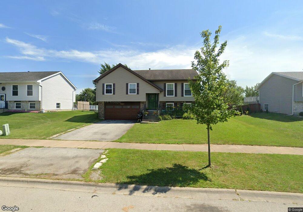
7863 W Carrie Ct Unit 1 Frankfort, IL 60423
Frankfort Square NeighborhoodEstimated Value: $318,000 - $377,000
3
Beds
3
Baths
1,167
Sq Ft
$296/Sq Ft
Est. Value
About This Home
This home is located at 7863 W Carrie Ct Unit 1, Frankfort, IL 60423 and is currently estimated at $345,645, approximately $296 per square foot. 7863 W Carrie Ct Unit 1 is a home located in Will County with nearby schools including Frankfort Square Elementary School, Summit Hill Junior High School, and Lincoln-Way East High School.
Ownership History
Date
Name
Owned For
Owner Type
Purchase Details
Closed on
Jun 4, 2025
Sold by
Erickson Scott M and Erickson Pamela J
Bought by
Erickson Joint Living Trust and Erickson
Current Estimated Value
Purchase Details
Closed on
May 29, 1998
Sold by
Harke David J
Bought by
Erickson Scott M and Erickson Pamela J
Home Financials for this Owner
Home Financials are based on the most recent Mortgage that was taken out on this home.
Original Mortgage
$122,400
Interest Rate
7.22%
Create a Home Valuation Report for This Property
The Home Valuation Report is an in-depth analysis detailing your home's value as well as a comparison with similar homes in the area
Home Values in the Area
Average Home Value in this Area
Purchase History
| Date | Buyer | Sale Price | Title Company |
|---|---|---|---|
| Erickson Joint Living Trust | -- | None Listed On Document | |
| Erickson Scott M | $153,000 | Chicago Title Insurance Co |
Source: Public Records
Mortgage History
| Date | Status | Borrower | Loan Amount |
|---|---|---|---|
| Previous Owner | Erickson Scott M | $122,400 |
Source: Public Records
Tax History Compared to Growth
Tax History
| Year | Tax Paid | Tax Assessment Tax Assessment Total Assessment is a certain percentage of the fair market value that is determined by local assessors to be the total taxable value of land and additions on the property. | Land | Improvement |
|---|---|---|---|---|
| 2024 | $6,942 | $90,303 | $18,671 | $71,632 |
| 2023 | $6,942 | $80,649 | $16,675 | $63,974 |
| 2022 | $6,159 | $73,457 | $15,188 | $58,269 |
| 2021 | $5,762 | $68,722 | $14,209 | $54,513 |
| 2020 | $5,668 | $66,786 | $13,809 | $52,977 |
| 2019 | $5,473 | $64,998 | $13,439 | $51,559 |
| 2018 | $5,267 | $63,130 | $13,053 | $50,077 |
| 2017 | $5,152 | $61,656 | $12,748 | $48,908 |
| 2016 | $4,985 | $59,542 | $12,311 | $47,231 |
| 2015 | $4,798 | $57,445 | $11,877 | $45,568 |
| 2014 | $4,798 | $57,045 | $11,794 | $45,251 |
| 2013 | $4,798 | $57,785 | $11,947 | $45,838 |
Source: Public Records
Map
Nearby Homes
- 20027 S Jessica Ln
- 8025 Stonegate Dr
- 8131 W Evergreen Dr
- 7800 W Kingston Dr
- 7758 W Kingston Dr
- 7959 Brookside Glen Dr Unit VI
- 20137 S Hampton Ct Unit A
- 20130 S Frankfort Square Rd
- 7752 W Almond Ct Unit 135
- 8124 Glenbrook Place Unit 1
- 19708 S Skye Dr
- 20158 S Rosewood Dr
- 7905 Richardson Ln
- 20206 S Frankfort Square Rd Unit A
- 7928 Trinity Cir Unit 2SW
- 7928 Trinity Cir Unit 3NW
- 20301 S Pine Hill Rd Unit 1D
- 20301 S Pine Hill Rd Unit 3A
- 8500 Brookside Glen Dr
- 8026 Bradley Dr
- 7859 W Carrie Ct
- 7901 W Carrie Ct Unit 1
- 7905 W Carrie Ct Unit 1
- 7855 W Carrie Ct
- 7860 W Carrie Ct
- 7900 W Carrie Ct
- 7851 W Carrie Ct
- 7909 W Carrie Ct
- 7908 W Carrie Ct
- 7847 W Carrie Ct
- 7861 W Frankfort Square Rd
- 7913 W Carrie Ct
- 7920 W Carrie Ct
- 7851 W Frankfort Square Rd
- 7909 W Frankfort Square Rd
- 7917 W Carrie Ct
- 7930 W Carrie Ct
- 7843 W Carrie Ct
- 7917 W Frankfort Square Rd
- 7921 W Carrie Ct