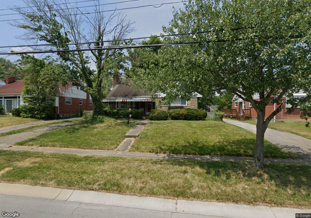
7867 Bobolink Dr Cincinnati, OH 45224
College Hill NeighborhoodEstimated Value: $267,701 - $358,000
4
Beds
1
Bath
1,820
Sq Ft
$164/Sq Ft
Est. Value
About This Home
This home is located at 7867 Bobolink Dr, Cincinnati, OH 45224 and is currently estimated at $298,675, approximately $164 per square foot. 7867 Bobolink Dr is a home located in Hamilton County with nearby schools including Pleasant Hill Elementary School, Robert A. Taft Information Technology High School, and Western Hills High School.
Ownership History
Date
Name
Owned For
Owner Type
Purchase Details
Closed on
Dec 1, 1998
Sold by
Willen Robert W
Bought by
Walker Harold J
Current Estimated Value
Home Financials for this Owner
Home Financials are based on the most recent Mortgage that was taken out on this home.
Original Mortgage
$98,773
Outstanding Balance
$20,660
Interest Rate
6.95%
Mortgage Type
FHA
Estimated Equity
$278,015
Create a Home Valuation Report for This Property
The Home Valuation Report is an in-depth analysis detailing your home's value as well as a comparison with similar homes in the area
Home Values in the Area
Average Home Value in this Area
Purchase History
| Date | Buyer | Sale Price | Title Company |
|---|---|---|---|
| Walker Harold J | $99,000 | -- |
Source: Public Records
Mortgage History
| Date | Status | Borrower | Loan Amount |
|---|---|---|---|
| Open | Walker Harold J | $98,773 |
Source: Public Records
Tax History
| Year | Tax Paid | Tax Assessment Tax Assessment Total Assessment is a certain percentage of the fair market value that is determined by local assessors to be the total taxable value of land and additions on the property. | Land | Improvement |
|---|---|---|---|---|
| 2025 | $3,926 | $63,589 | $11,526 | $52,063 |
| 2024 | $3,807 | $63,589 | $11,526 | $52,063 |
| 2023 | $3,893 | $63,589 | $11,526 | $52,063 |
| 2022 | $2,530 | $36,989 | $9,384 | $27,605 |
| 2021 | $2,431 | $36,989 | $9,384 | $27,605 |
| 2020 | $2,502 | $36,989 | $9,384 | $27,605 |
| 2019 | $2,400 | $32,445 | $8,232 | $24,213 |
| 2018 | $2,404 | $32,445 | $8,232 | $24,213 |
| 2017 | $2,283 | $32,445 | $8,232 | $24,213 |
| 2016 | $2,785 | $39,050 | $8,782 | $30,268 |
| 2015 | $2,511 | $39,050 | $8,782 | $30,268 |
| 2014 | $2,529 | $39,050 | $8,782 | $30,268 |
| 2013 | $2,652 | $40,258 | $9,055 | $31,203 |
Source: Public Records
Map
Nearby Homes
- 7873 Bobolink Dr
- 1280 Brushwood Ave
- 7923 Bobolink Dr
- 7929 Cherrywood Ct
- 1291 W Galbraith Rd
- 6538 S Oak Knoll Dr
- 6669 Kirkland Dr
- 6785 Marvin Ave
- 1165 W Galbraith Rd
- 6577 Kirkland Dr
- 1472 Larrywood Ln
- 6917 Kleindale Ave
- 1387 Teakwood Ave
- 1088 Pinehollow Ln
- 6205 Edwood Ave
- 6531 Hamilton Ave
- 1491 Reid Ave
- 6629 Charann Ln
- 1568 Wittekind Terrace
- 6537 Meis Ave
- 7863 Bobolink Dr
- 7859 Bobolink Dr
- 7879 Bobolink Dr
- 7860 Bankwood Ln
- 7864 Bankwood Ln
- 7856 Bankwood Ln
- 7868 Bankwood Ln
- 7852 Bankwood Ln
- 7885 Bobolink Dr
- 7855 Bobolink Dr
- 7868 Bobolink Dr
- 7872 Bankwood Ln
- 7864 Bobolink Dr
- 7874 Bobolink Dr
- 7848 Bankwood Ln
- 7858 Bobolink Dr
- 7880 Bobolink Dr
- 7876 Bankwood Ln
- 7889 Bobolink Dr
- 7849 Bobolink Dr
Your Personal Tour Guide
Ask me questions while you tour the home.