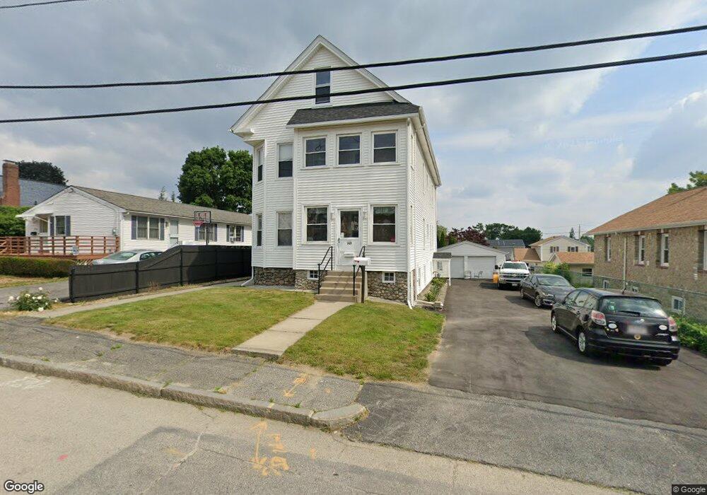
787 Franklin St Worcester, MA 01604
Hamilton NeighborhoodEstimated Value: $583,428 - $672,000
5
Beds
3
Baths
2,935
Sq Ft
$218/Sq Ft
Est. Value
About This Home
This home is located at 787 Franklin St, Worcester, MA 01604 and is currently estimated at $639,107, approximately $217 per square foot. 787 Franklin St is a home located in Worcester County with nearby schools including Jacob Hiatt Magnet School, Chandler Magnet, and Lake View Elementary School.
Ownership History
Date
Name
Owned For
Owner Type
Purchase Details
Closed on
Sep 13, 2022
Sold by
Savastano Andrea G
Bought by
787 Franklin Street Rt
Current Estimated Value
Purchase Details
Closed on
Apr 7, 2009
Sold by
Savastano Paul Thomas
Bought by
Savastano Andrea Gina
Purchase Details
Closed on
Aug 3, 2006
Sold by
Mazzone Pauline C and Mazzone Thomas W
Bought by
Savastano Andrea Gina
Purchase Details
Closed on
Mar 4, 2002
Sold by
Mazzone Dolores A and Mazzone Michael A
Bought by
Mazzone Thomas W
Create a Home Valuation Report for This Property
The Home Valuation Report is an in-depth analysis detailing your home's value as well as a comparison with similar homes in the area
Home Values in the Area
Average Home Value in this Area
Purchase History
| Date | Buyer | Sale Price | Title Company |
|---|---|---|---|
| 787 Franklin Street Rt | -- | None Available | |
| Savastano Andrea Gina | -- | -- | |
| Savastano Andrea Gina | -- | -- | |
| Mazzone Thomas W | $60,000 | -- |
Source: Public Records
Tax History
| Year | Tax Paid | Tax Assessment Tax Assessment Total Assessment is a certain percentage of the fair market value that is determined by local assessors to be the total taxable value of land and additions on the property. | Land | Improvement |
|---|---|---|---|---|
| 2025 | $7,652 | $580,100 | $118,200 | $461,900 |
| 2024 | $7,289 | $530,100 | $118,200 | $411,900 |
| 2023 | $6,826 | $476,000 | $102,700 | $373,300 |
| 2022 | $6,306 | $414,600 | $82,200 | $332,400 |
| 2021 | $5,815 | $357,200 | $65,800 | $291,400 |
| 2020 | $5,467 | $321,600 | $65,800 | $255,800 |
| 2019 | $5,499 | $305,500 | $59,200 | $246,300 |
| 2018 | $5,391 | $285,100 | $59,200 | $225,900 |
| 2017 | $5,145 | $267,700 | $59,200 | $208,500 |
| 2016 | $4,398 | $213,400 | $43,200 | $170,200 |
| 2015 | $4,283 | $213,400 | $43,200 | $170,200 |
| 2014 | $4,170 | $213,400 | $43,200 | $170,200 |
Source: Public Records
Map
Nearby Homes
- 65 Lake Ave Unit 1008
- 65 Lake Ave Unit 830
- 65 Lake Ave Unit 510
- 28 Granby Rd
- 28 Nonquit St
- 28 Adams St Unit 304
- 360 Hamilton St
- 241 Lake Ave
- 496 Hamilton St
- 25 Johnson St
- 19 Middlesex Ave
- 256 Belmont St
- Lot B Crawford St
- 34 Robin Rd
- 12 Brookside Place
- 29 Chilmark St
- 247 Shrewsbury St
- 115 Orient St
- 21 Middlesex Ave Unit 102
- 105 S Quinsigamond Ave
- 785 Franklin St
- 785 Franklin St Unit A
- 791 Franklin St
- 795 Franklin St
- 777 Franklin St
- 42 Marlboro St
- 44 Marlboro St
- 780 Franklin St
- 52 Marlboro St
- 782 Franklin St
- 778 Franklin St
- 32 Marlboro St
- 799 Franklin St
- 784 Franklin St
- 776 Franklin St
- 773 Franklin St
- 54 Marlboro St
- 786 Franklin St
- 1 Kiara Dr Unit 1
- 2 Frongillo Farm Rd
Your Personal Tour Guide
Ask me questions while you tour the home.