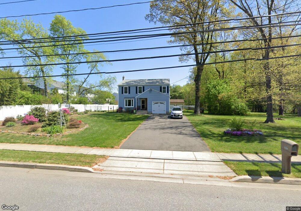
787 Grove Rd West Deptford, NJ 08086
West Deptford Township NeighborhoodEstimated Value: $449,561 - $480,000
--
Bed
--
Bath
2,068
Sq Ft
$224/Sq Ft
Est. Value
About This Home
This home is located at 787 Grove Rd, West Deptford, NJ 08086 and is currently estimated at $462,390, approximately $223 per square foot. 787 Grove Rd is a home located in Gloucester County with nearby schools including Green-Fields Elementary School, Red Bank Elementary School, and Oakview Elementary School.
Ownership History
Date
Name
Owned For
Owner Type
Purchase Details
Closed on
Jul 28, 2011
Sold by
Carel Joanne and Tunis Joanne
Bought by
Carel Joanne
Current Estimated Value
Purchase Details
Closed on
Dec 28, 1999
Sold by
Moore Lawrence L
Bought by
Tunis Joanne and Moore Joanne
Create a Home Valuation Report for This Property
The Home Valuation Report is an in-depth analysis detailing your home's value as well as a comparison with similar homes in the area
Home Values in the Area
Average Home Value in this Area
Purchase History
| Date | Buyer | Sale Price | Title Company |
|---|---|---|---|
| Carel Joanne | -- | None Available | |
| Tunis Joanne | -- | -- |
Source: Public Records
Tax History Compared to Growth
Tax History
| Year | Tax Paid | Tax Assessment Tax Assessment Total Assessment is a certain percentage of the fair market value that is determined by local assessors to be the total taxable value of land and additions on the property. | Land | Improvement |
|---|---|---|---|---|
| 2025 | $9,285 | $265,900 | $58,700 | $207,200 |
| 2024 | $9,007 | $265,900 | $58,700 | $207,200 |
| 2023 | $9,007 | $261,300 | $58,700 | $202,600 |
| 2022 | $8,965 | $261,300 | $58,700 | $202,600 |
| 2021 | $8,934 | $261,300 | $58,700 | $202,600 |
| 2020 | $8,913 | $261,300 | $58,700 | $202,600 |
| 2019 | $8,665 | $261,300 | $58,700 | $202,600 |
| 2018 | $8,430 | $261,300 | $58,700 | $202,600 |
| 2017 | $8,234 | $261,300 | $58,700 | $202,600 |
| 2016 | $8,004 | $261,300 | $58,700 | $202,600 |
| 2015 | $7,625 | $261,300 | $58,700 | $202,600 |
| 2014 | $7,246 | $261,300 | $58,700 | $202,600 |
Source: Public Records
Map
Nearby Homes
- 640 Worcester Dr
- 1091 Buckingham Dr Unit 45
- 1066 Buckingham Dr
- 1012 Moore Rd Unit 6
- 12 Highbridge Ln Unit I2
- 125 Lionheart Ln Unit C125
- 863 Doncaster Dr
- 87 Woodway Dr Unit 87
- 740 Carter Hill Dr
- 1220 Royal Ln
- 1054 Kings Hwy
- 1102 Barnesdale Rd
- 296 Ogden Station Rd
- 94 Aviary Rd
- 14 Aviary Rd
- 1311 Barnesdale Rd
- 90 Ginger Dr
- 4 Saint Emilion Ct
- 1810 Fernwood Dr
- 97 Church St
- 902 Denston Rd
- 900 Denston Rd
- 904 Denston Rd
- 906 Denston Rd
- 908 Denston Rd
- 903 Denston Rd
- 901 Denston Rd
- 905 Denston Rd
- 910 Denston Rd
- 907 Denston Rd
- 909 Denston Rd
- 912 Denston Rd
- 911 Denston Rd
- 745 Grove Rd
- 913 Denston Rd
- 914 Denston Rd
- 917 Denston Rd
- 916 Denston Rd
- 607 Worcester Dr
- 605 Worcester Dr