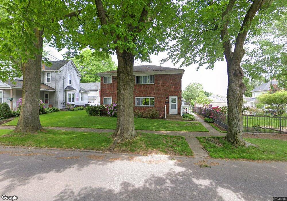
787 N Summit St Barberton, OH 44203
North Barberton NeighborhoodEstimated Value: $130,000 - $169,009
4
Beds
2
Baths
1,768
Sq Ft
$85/Sq Ft
Est. Value
About This Home
This home is located at 787 N Summit St, Barberton, OH 44203 and is currently estimated at $150,502, approximately $85 per square foot. 787 N Summit St is a home located in Summit County with nearby schools including Barberton Middle School, Barberton Intermediate School 3-5, and Barberton High School.
Ownership History
Date
Name
Owned For
Owner Type
Purchase Details
Closed on
Mar 26, 2021
Sold by
Hlas Joseph J and Hlas Brenda K
Bought by
Hlas Joseph and Hlas Brenda Kay
Current Estimated Value
Purchase Details
Closed on
Mar 28, 2019
Sold by
Catrone Michael L
Bought by
Hlas Joseph and Hlas Brenda K
Purchase Details
Closed on
Oct 24, 2017
Sold by
Catrone Michael L
Bought by
Catrone Lucy E and Catrone Lucy E
Purchase Details
Closed on
May 2, 2011
Sold by
Catrone Lucy E and Catrone Michael L
Bought by
Catrone Michael L and Catrone Lucy E
Create a Home Valuation Report for This Property
The Home Valuation Report is an in-depth analysis detailing your home's value as well as a comparison with similar homes in the area
Home Values in the Area
Average Home Value in this Area
Purchase History
| Date | Buyer | Sale Price | Title Company |
|---|---|---|---|
| Hlas Joseph | -- | None Available | |
| Hlas Joseph | $79,000 | None Available | |
| Catrone Lucy E | -- | None Available | |
| Catrone Michael L | -- | None Available |
Source: Public Records
Tax History Compared to Growth
Tax History
| Year | Tax Paid | Tax Assessment Tax Assessment Total Assessment is a certain percentage of the fair market value that is determined by local assessors to be the total taxable value of land and additions on the property. | Land | Improvement |
|---|---|---|---|---|
| 2025 | $2,398 | $43,491 | $7,210 | $36,281 |
| 2024 | $2,398 | $43,491 | $7,210 | $36,281 |
| 2023 | $2,398 | $43,491 | $7,210 | $36,281 |
| 2022 | $1,682 | $28,424 | $4,711 | $23,713 |
| 2021 | $1,680 | $28,424 | $4,711 | $23,713 |
| 2020 | $1,645 | $28,420 | $4,710 | $23,710 |
| 2019 | $1,780 | $27,850 | $4,150 | $23,700 |
| 2018 | $1,754 | $27,850 | $4,150 | $23,700 |
| 2017 | $1,777 | $27,850 | $4,150 | $23,700 |
| 2016 | $1,780 | $27,850 | $4,150 | $23,700 |
| 2015 | $1,777 | $27,850 | $4,150 | $23,700 |
| 2014 | $1,768 | $27,850 | $4,150 | $23,700 |
| 2013 | $1,790 | $29,250 | $4,150 | $25,100 |
Source: Public Records
Map
Nearby Homes
- 30 W Hiram St
- 197 W State St Unit 182
- 714 Orchard Ave
- 0 Romig Ave
- 213 Hermann St
- 76 Hazelwood Ave
- 117 Fernwood Ave
- 1146 Wooster Rd N
- 0 Wooster Rd N
- 1150 Wooster Rd N
- 217 W Summit St
- 613 Wooster Rd N
- 1515 Grand Blvd
- 485 Lloyd St
- 536 Yale Ave
- 526 Wooster Rd N
- 437 Erie St
- 409 Franklin Ave
- 172 & 173 Belcher Ave
- 1288 Tampa Ave
- 787 N Summit St Unit 2
- 791 N Summit St
- 43 W Hiram St
- 788 Graceland Ave
- 792 Graceland Ave
- 33 W Hiram St
- 801 N Summit St
- 780 Graceland Ave
- 782 N Summit St
- 796 Graceland Ave
- 776 N Summit St
- 792 N Summit St
- 806 Graceland Ave
- 798 N Summit St
- 809 N Summit St
- 21 W Hiram St
- 69 W Hiram St
- 36 W Hiram St
- 812 Graceland Ave
- 787 Graceland Ave