Estimated Value: $238,261 - $609,000
Studio
--
Bath
--
Sq Ft
6,186
Sq Ft Lot
About This Home
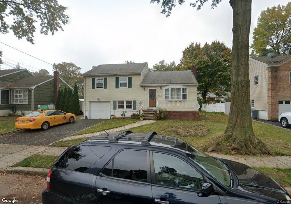
This home is located at 787 Nixon Rd, Union, NJ 07083 and is currently estimated at $482,065. 787 Nixon Rd is a home located in Union County with nearby schools including Livingston Elementary School and Union High School.
Ownership History
Date
Name
Owned For
Owner Type
Purchase Details
Closed on
Aug 15, 2016
Sold by
Philemon Jean C and Philemon Marie J
Bought by
Philemon Nadia
Current Estimated Value
Purchase Details
Closed on
Oct 29, 2004
Sold by
Janeway Carol
Bought by
Jean Philemon and Philemon Marie
Home Financials for this Owner
Home Financials are based on the most recent Mortgage that was taken out on this home.
Original Mortgage
$250,000
Interest Rate
5.71%
Create a Home Valuation Report for This Property
The Home Valuation Report is an in-depth analysis detailing your home's value as well as a comparison with similar homes in the area
Home Values in the Area
Average Home Value in this Area
Purchase History
| Date | Buyer | Sale Price | Title Company |
|---|---|---|---|
| Philemon Nadia | $10 | -- | |
| Jean Philemon | $340,000 | -- |
Source: Public Records
Mortgage History
| Date | Status | Borrower | Loan Amount |
|---|---|---|---|
| Previous Owner | Jean Philemon | $250,000 |
Source: Public Records
Tax History Compared to Growth
Tax History
| Year | Tax Paid | Tax Assessment Tax Assessment Total Assessment is a certain percentage of the fair market value that is determined by local assessors to be the total taxable value of land and additions on the property. | Land | Improvement |
|---|---|---|---|---|
| 2025 | $10,080 | $45,100 | $21,300 | $23,800 |
| 2024 | $9,773 | $45,100 | $21,300 | $23,800 |
Source: Public Records
Map
Nearby Homes
- 875 Salem Rd
- 365 Broadwell Ave
- 1309 Beverly Rd
- 377 Lum Ave
- 790 Green Ln Unit A1
- 969 Arnet Ave
- 569 Scotland Rd
- 578 Winchester Ave
- 925 Woodland Ave
- 1453 Morris Ave
- 1090 Salem Rd
- 437 Durling Rd
- 169 Valley View Rd
- 1376 Brookside Dr
- 130 Valley View Rd
- 305 Hillside Rd Unit 7
- 600 Plymouth Rd
- 399 Martin Rd
- 341 Trotting Rd
- 545 Homer Terrace
- 791 Nixon Rd
- 783 Nixon Rd
- 786 Colonial Arms Rd
- 782 Colonial Arms Rd
- 790 Colonial Arms Rd
- 795 Nixon Rd
- 779 Nixon Rd
- 778 Colonial Arms Rd
- 786 Nixon Rd
- 788 Nixon Rd
- 794 Colonial Arms Rd
- 782 Nixon Rd
- 792 Nixon Rd
- 801 Nixon Rd
- 772 Colonial Arms Rd
- 773 Nixon Rd
- 800 Colonial Arms Rd
- 776 Nixon Rd
- 796 Nixon Rd
- 805 Nixon Rd