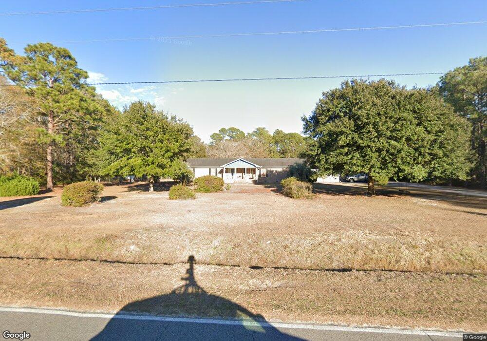
787 Persimmon Rd Calabash, NC 28467
Estimated Value: $129,000 - $284,000
3
Beds
2
Baths
1,512
Sq Ft
$161/Sq Ft
Est. Value
About This Home
This home is located at 787 Persimmon Rd, Calabash, NC 28467 and is currently estimated at $243,637, approximately $161 per square foot. 787 Persimmon Rd is a home located in Brunswick County with nearby schools including Jessie Mae Monroe Elementary School, Shallotte Middle School, and West Brunswick High School.
Ownership History
Date
Name
Owned For
Owner Type
Purchase Details
Closed on
Jan 28, 2025
Sold by
Brown Rogers Linda
Bought by
Alderson Michael Brian and Alderson Katie Louise
Current Estimated Value
Home Financials for this Owner
Home Financials are based on the most recent Mortgage that was taken out on this home.
Original Mortgage
$89,500
Outstanding Balance
$88,935
Interest Rate
6.6%
Mortgage Type
New Conventional
Estimated Equity
$154,702
Purchase Details
Closed on
Apr 1, 1997
Bought by
Rogers Linda B Etvir Lenwood
Create a Home Valuation Report for This Property
The Home Valuation Report is an in-depth analysis detailing your home's value as well as a comparison with similar homes in the area
Home Values in the Area
Average Home Value in this Area
Purchase History
| Date | Buyer | Sale Price | Title Company |
|---|---|---|---|
| Alderson Michael Brian | $128,000 | None Listed On Document | |
| Rogers Linda B Etvir Lenwood | -- | -- |
Source: Public Records
Mortgage History
| Date | Status | Borrower | Loan Amount |
|---|---|---|---|
| Open | Alderson Michael Brian | $89,500 |
Source: Public Records
Tax History Compared to Growth
Tax History
| Year | Tax Paid | Tax Assessment Tax Assessment Total Assessment is a certain percentage of the fair market value that is determined by local assessors to be the total taxable value of land and additions on the property. | Land | Improvement |
|---|---|---|---|---|
| 2025 | $1,088 | $221,890 | $27,000 | $194,890 |
| 2024 | $1,088 | $221,890 | $27,000 | $194,890 |
| 2023 | $1,138 | $221,890 | $27,000 | $194,890 |
| 2022 | $1,138 | $163,830 | $25,270 | $138,560 |
| 2021 | $1,138 | $163,830 | $25,270 | $138,560 |
| 2020 | $1,094 | $163,830 | $25,270 | $138,560 |
| 2019 | $1,094 | $28,310 | $25,270 | $3,040 |
| 2018 | $988 | $28,980 | $25,270 | $3,710 |
| 2017 | $988 | $28,980 | $25,270 | $3,710 |
| 2016 | $963 | $28,980 | $25,270 | $3,710 |
| 2015 | $963 | $150,670 | $25,270 | $125,400 |
| 2014 | $1,154 | $198,918 | $72,210 | $126,708 |
Source: Public Records
Map
Nearby Homes
- 1081 Harbor Dr
- 1009 Harbor Dr
- HARRISBURG Plan at Hunters Trace
- ANNAPOLIS Plan at Hunters Trace
- HARTFORD Plan at Hunters Trace
- ALBANY Plan at Hunters Trace
- DOVER Plan at Hunters Trace
- 1068 Harbor Dr
- 1180 Beach Dr SW
- 2 Thicketwood Dr
- 1012 Harbor Dr
- 3 Thicketwood Dr
- 5 Deer Run Rd
- 17 Calabash Dr
- 1535 Harbour Place Dr
- 63 Pinewood Dr
- 1515 Harbour Place Dr
- 9 Gumwood Dr
- 1104 Captains Ct
- 2030 Manor Parc Dr
- 843 Greenwood Ct
- Lot 21 Greenwood Ct
- Lot 23 Greenwood Ct
- Lot 20 Greenwood Ct
- Lot 24 Greenwood Ct
- 0 Greenwood Ct
- 751 Persimmon Rd
- 786 Persimmon Rd
- 790 Persimmon Rd Unit 1
- 790 Persimmon Rd
- 790 Persimmon Rd Unit A & B
- 762 Persimmon Rd
- 861 Greenwood Ct
- 854 Greenwood Ct
- 841 Greenwood Ct
- 752 Persimmon Rd
- 834 Greenwood Ct
- 840 Greenwood Ct
- 800 Persimmon Rd
- 873 Greenwood Ct