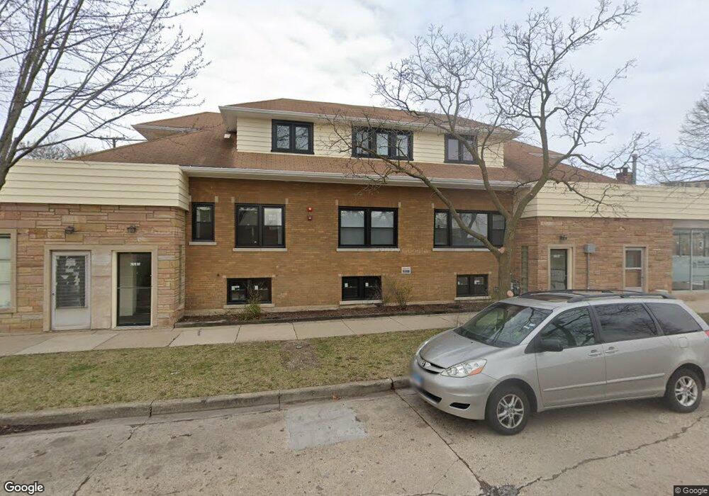
7870 Lincoln Ave Skokie, IL 60077
Southwest Skokie NeighborhoodEstimated Value: $445,786
5
Beds
4
Baths
7,050
Sq Ft
$63/Sq Ft
Est. Value
About This Home
This home is located at 7870 Lincoln Ave, Skokie, IL 60077 and is currently estimated at $445,786, approximately $63 per square foot. 7870 Lincoln Ave is a home located in Cook County with nearby schools including Madison Elementary School, Thomas Edison Elementary School, and Lincoln Junior High School.
Ownership History
Date
Name
Owned For
Owner Type
Purchase Details
Closed on
Oct 26, 2021
Sold by
Zichittella Marilou Mcnett and Mcnett Rosernarie H
Bought by
Barakah Group Llc
Current Estimated Value
Purchase Details
Closed on
Jul 28, 2011
Sold by
Chicago Title Land Trust Company
Bought by
Declaration Mcnett Rosemarie H and Rosemarie H Mcnett Declaration Of Trust
Create a Home Valuation Report for This Property
The Home Valuation Report is an in-depth analysis detailing your home's value as well as a comparison with similar homes in the area
Home Values in the Area
Average Home Value in this Area
Purchase History
| Date | Buyer | Sale Price | Title Company |
|---|---|---|---|
| Barakah Group Llc | $325,000 | None Available | |
| Declaration Mcnett Rosemarie H | -- | Chicago Title Land Trust Co |
Source: Public Records
Tax History Compared to Growth
Tax History
| Year | Tax Paid | Tax Assessment Tax Assessment Total Assessment is a certain percentage of the fair market value that is determined by local assessors to be the total taxable value of land and additions on the property. | Land | Improvement |
|---|---|---|---|---|
| 2024 | $53,480 | $125,000 | $15,902 | $109,098 |
| 2023 | $41,571 | $171,474 | $41,227 | $130,247 |
| 2022 | $41,571 | $133,359 | $41,227 | $92,132 |
| 2021 | $50,838 | $140,376 | $41,226 | $99,150 |
| 2020 | $50,480 | $140,376 | $41,226 | $99,150 |
| 2019 | $45,125 | $140,376 | $41,226 | $99,150 |
| 2018 | $32,434 | $90,596 | $32,392 | $58,204 |
| 2017 | $32,579 | $90,596 | $32,392 | $58,204 |
| 2016 | $30,699 | $90,596 | $32,392 | $58,204 |
| 2015 | $43,580 | $122,047 | $29,447 | $92,600 |
| 2014 | $42,601 | $122,047 | $29,447 | $92,600 |
| 2013 | $47,062 | $133,041 | $29,447 | $103,594 |
Source: Public Records
Map
Nearby Homes
- 7848 Lincoln Ave
- 5207 Galitz St
- 7748 Lincoln Ave
- 5251 Galitz St Unit 410
- 5251 Galitz St Unit 311
- 4953 Oakton St Unit 510
- 4953 Oakton St Unit P11
- 4953 Oakton St Unit 207
- 4907 Hull St
- 4906 Hull St
- 5261 Mulford St
- 5000 Oakton St Unit 505
- 4856 Hull St
- 5153 Dobson St
- 4931 Brummel St
- 4817 Hull St Unit 2B
- 8128 Laramie Ave
- 4838 Howard St Unit 301
- 7507 Frontage Rd
- 7500 Laramie Ave
- 7872 Lincoln Ave
- 7840 Babb Ave
- 7939 Lincoln Ave
- 7890 Lincoln Ave
- 7861 Niles Center Rd Unit 404
- 7861 Niles Center Rd Unit 406
- 7861 Niles Center Rd Unit P12
- 7861 Niles Center Rd Unit P2
- 7861 Niles Center Rd Unit 306
- 7861 Niles Center Rd Unit P11
- 7861 Niles Center Rd Unit P9
- 7861 Niles Center Rd Unit P8
- 7861 Niles Center Rd Unit P7
- 7861 Niles Center Rd Unit P5
- 7861 Niles Center Rd Unit P3
- 7861 Niles Center Rd Unit P1
- 7861 Niles Center Rd Unit 301
- 7861 Niles Center Rd Unit 203
- 7861 Niles Center Rd Unit 202
- 7861 Niles Center Rd Unit 201