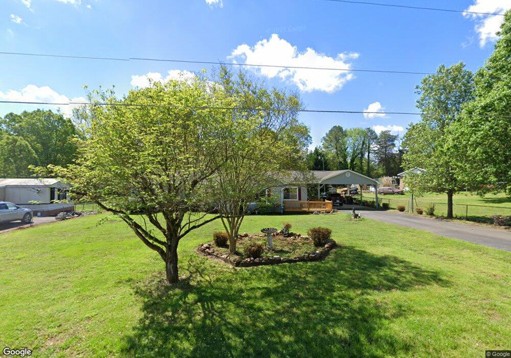
7872 Cherry Point Rd Denver, NC 28037
Estimated Value: $328,000 - $633,000
3
Beds
2
Baths
2,282
Sq Ft
$192/Sq Ft
Est. Value
About This Home
This home is located at 7872 Cherry Point Rd, Denver, NC 28037 and is currently estimated at $438,203, approximately $192 per square foot. 7872 Cherry Point Rd is a home located in Lincoln County with nearby schools including Catawba Springs Elementary School, East Lincoln Middle School, and East Lincoln High School.
Ownership History
Date
Name
Owned For
Owner Type
Purchase Details
Closed on
Sep 29, 2020
Sold by
Merritt Mary Ann
Bought by
Parker Jane C
Current Estimated Value
Purchase Details
Closed on
Oct 11, 2016
Sold by
Cribb Steven and Cribb Tammie B
Bought by
Merritt Mary Ann
Home Financials for this Owner
Home Financials are based on the most recent Mortgage that was taken out on this home.
Original Mortgage
$146,700
Interest Rate
3.43%
Mortgage Type
New Conventional
Create a Home Valuation Report for This Property
The Home Valuation Report is an in-depth analysis detailing your home's value as well as a comparison with similar homes in the area
Purchase History
| Date | Buyer | Sale Price | Title Company |
|---|---|---|---|
| Parker Jane C | -- | None Available | |
| Merritt Mary Ann | $163,000 | None Available |
Source: Public Records
Mortgage History
| Date | Status | Borrower | Loan Amount |
|---|---|---|---|
| Previous Owner | Merritt Mary Ann | $146,700 |
Source: Public Records
Tax History
| Year | Tax Paid | Tax Assessment Tax Assessment Total Assessment is a certain percentage of the fair market value that is determined by local assessors to be the total taxable value of land and additions on the property. | Land | Improvement |
|---|---|---|---|---|
| 2025 | $2,361 | $367,700 | $81,990 | $285,710 |
| 2024 | $2,331 | $367,700 | $81,990 | $285,710 |
| 2023 | $2,331 | $367,700 | $81,990 | $285,710 |
| 2022 | $1,443 | $179,744 | $44,000 | $135,744 |
| 2021 | $1,015 | $121,012 | $44,000 | $77,012 |
| 2020 | $843 | $121,012 | $44,000 | $77,012 |
| 2019 | $843 | $121,012 | $44,000 | $77,012 |
| 2018 | $876 | $110,775 | $41,000 | $69,775 |
| 2017 | $775 | $110,775 | $41,000 | $69,775 |
| 2016 | $772 | $110,775 | $41,000 | $69,775 |
| 2015 | $877 | $110,775 | $41,000 | $69,775 |
| 2014 | $450 | $119,192 | $39,500 | $79,692 |
Source: Public Records
Map
Nearby Homes
- 8078 Blackwood Rd
- 6511 Songbird Ln
- 4222 Millstream Rd
- 910 Prince Garrett Way
- 1855 Cameron Heights Cir
- 4990 Twin River Dr
- 4986 Twin River Dr
- 4982 Twin River Dr
- 913 Prince Garrett Way
- 4197 Millstream Rd
- 956 Prince Garrett Way
- 4178 Millstream Rd
- 7982 King Arthurs Ct
- 4172 Millstream Rd Unit 137
- 1751 Knights Dr
- 4168 Millstream Rd
- 1808 Cameron Heights Cir
- 1374 Cedardale Ln
- 7540 Deer Track Dr Unit 28
- 1156 Nixon Heights Ln
- 7852 Cherry Point Rd
- 7892 Cherry Point Rd
- 7902 Cherry Point Dr
- 7869 Cherry Point Dr
- 7869 Cherry Point Rd
- 7849 Morrell Ln
- 7912 Cherry Point Rd
- 7907 Lucky Creek Ln
- 7913 Cherry Point Rd
- 7843 Lucky Creek Ln
- 7874 Harbor Master Ct
- 7886 Harbor Master Ct
- 7884 Lucky Creek Ln
- 7866 Harbor Master Ct
- 7866 Harbor Master Ct Unit 24
- 7800 Cherry Point Rd
- 7800 Cherry Point Dr
- 7921 Cherry Point Rd
- 7850 Lucky Creek Ln
- 7832 Harbor Master Ct
Your Personal Tour Guide
Ask me questions while you tour the home.