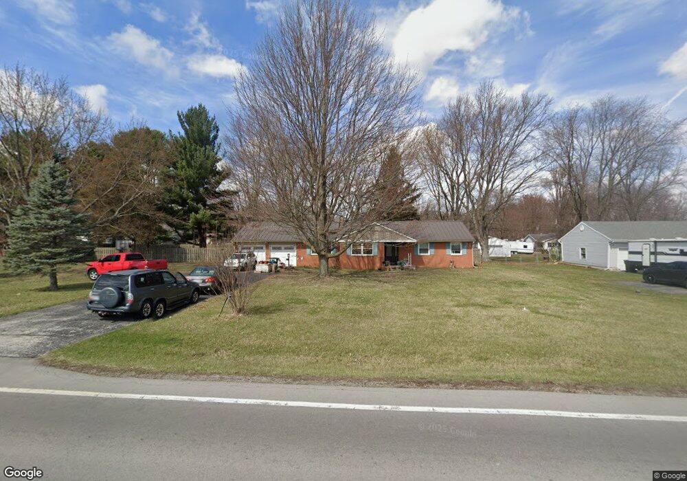
7872 W Us Route 224 Findlay, OH 45840
Estimated Value: $253,000 - $297,000
3
Beds
2
Baths
1,652
Sq Ft
$165/Sq Ft
Est. Value
About This Home
This home is located at 7872 W Us Route 224, Findlay, OH 45840 and is currently estimated at $272,477, approximately $164 per square foot. 7872 W Us Route 224 is a home located in Hancock County with nearby schools including Liberty-Benton Elementary School, Liberty-Benton Middle School, and Liberty-Benton High School.
Ownership History
Date
Name
Owned For
Owner Type
Purchase Details
Closed on
Mar 28, 2014
Sold by
Wilson Jeremy L
Bought by
Newhouse William R and Hovancik Jeannine M
Current Estimated Value
Home Financials for this Owner
Home Financials are based on the most recent Mortgage that was taken out on this home.
Original Mortgage
$141,835
Outstanding Balance
$107,821
Interest Rate
4.34%
Mortgage Type
New Conventional
Estimated Equity
$164,656
Purchase Details
Closed on
Nov 26, 2008
Sold by
Russell Eric P and Russell Barbara J
Bought by
Wilson Jeremy L
Home Financials for this Owner
Home Financials are based on the most recent Mortgage that was taken out on this home.
Original Mortgage
$141,754
Interest Rate
6.48%
Mortgage Type
FHA
Purchase Details
Closed on
Mar 15, 2000
Sold by
Naus Russell E
Bought by
Russell Eric P
Create a Home Valuation Report for This Property
The Home Valuation Report is an in-depth analysis detailing your home's value as well as a comparison with similar homes in the area
Home Values in the Area
Average Home Value in this Area
Purchase History
| Date | Buyer | Sale Price | Title Company |
|---|---|---|---|
| Newhouse William R | $149,267 | Mid Am Title Agency | |
| Wilson Jeremy L | $143,633 | Assured Title | |
| Russell Eric P | $115,500 | -- |
Source: Public Records
Mortgage History
| Date | Status | Borrower | Loan Amount |
|---|---|---|---|
| Open | Newhouse William R | $141,835 | |
| Closed | Wilson Jeremy L | $141,754 |
Source: Public Records
Tax History Compared to Growth
Tax History
| Year | Tax Paid | Tax Assessment Tax Assessment Total Assessment is a certain percentage of the fair market value that is determined by local assessors to be the total taxable value of land and additions on the property. | Land | Improvement |
|---|---|---|---|---|
| 2024 | $2,334 | $62,740 | $18,490 | $44,250 |
| 2023 | $2,279 | $62,740 | $18,490 | $44,250 |
| 2022 | $2,257 | $62,740 | $18,490 | $44,250 |
| 2021 | $2,161 | $53,050 | $18,480 | $34,570 |
| 2020 | $2,180 | $53,050 | $18,480 | $34,570 |
| 2019 | $2,091 | $53,050 | $18,480 | $34,570 |
| 2018 | $1,656 | $46,360 | $16,070 | $30,290 |
| 2017 | $854 | $46,360 | $16,070 | $30,290 |
| 2016 | $1,650 | $45,930 | $16,070 | $29,860 |
| 2015 | $1,787 | $48,740 | $16,070 | $32,670 |
| 2014 | $1,803 | $48,740 | $16,070 | $32,670 |
| 2012 | $1,884 | $48,740 | $16,070 | $32,670 |
Source: Public Records
Map
Nearby Homes
- 7780 Township Road 89
- 8922 Township Road 94
- 9960 W Us Route 224
- 0 County Road 140
- 9307 W State Route 12
- 0 County Road 95 Unit 6097574
- 8179 Hazelwood Dr
- 8256 Silverwood Dr
- 9220 Colonel Dr
- 2201 W Main Cross St
- 9307 Hiegel Dr
- 9653 Early Dr
- 6535 Silver Lake Dr
- 0 County Road 223
- 2014 W Sandusky St
- 0 Rock Candy Rd Unit Lot 159
- 0 Rock Candy Rd Unit Lot 170
- 0 Rock Candy Rd Unit Lot 172 206819
- 0 Rock Candy Rd Unit Lot 162
- 0 Rock Candy Rd Unit Lot 171
- 7872 State Route 224 W
- 7834 W Us Route 224
- 7892 W Us Route 224
- 7867 Driftwood Dr
- 7847 Driftwood Dr
- 7885 Driftwood Dr
- 7829 Driftwood Dr
- 7906 W Us Route 224
- 7905 Driftwood Dr
- 7811 Driftwood Dr
- 7940 W Us Route 224
- 7940 State Route 224
- 7940 W Us Route 224
- 7923 Driftwood Dr
- 7866 Driftwood Dr
- 7866 Driftwood Dr
- 7848 Driftwood Dr
- 7848 Driftwood Dr
- 7786 U S 224
- 7786 W Us Route 224