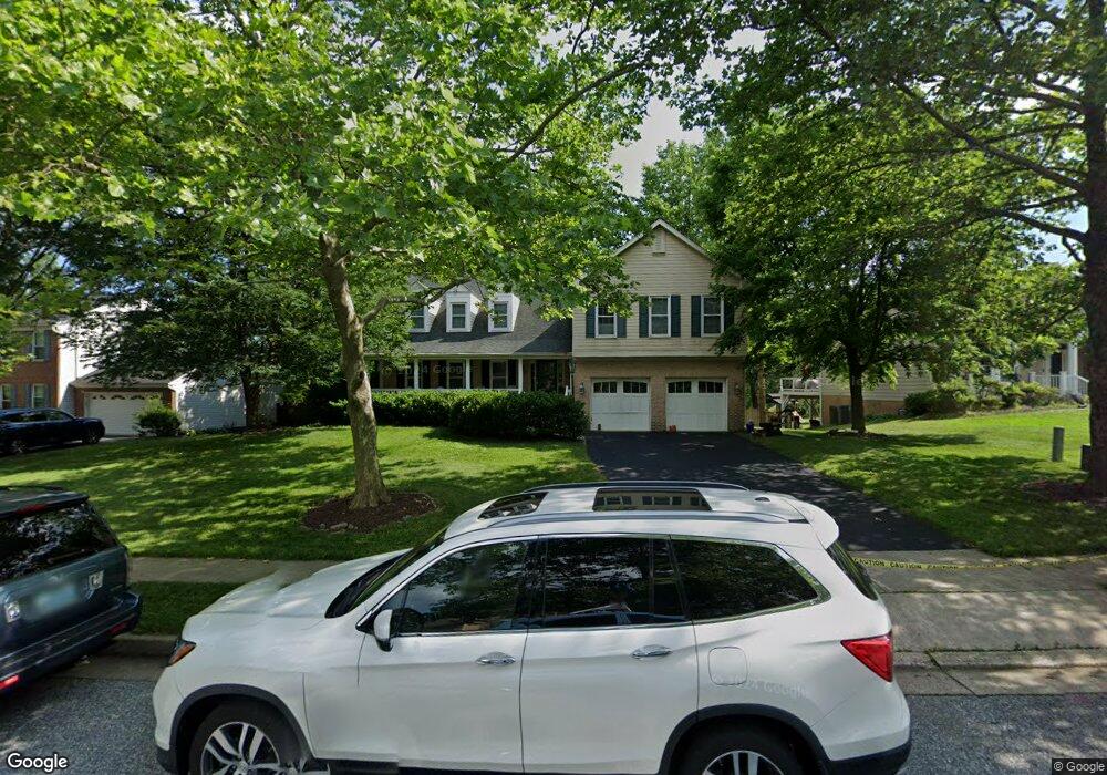
7879 Rockburn Dr Ellicott City, MD 21043
Estimated Value: $716,790 - $886,000
--
Bed
2
Baths
2,420
Sq Ft
$334/Sq Ft
Est. Value
About This Home
This home is located at 7879 Rockburn Dr, Ellicott City, MD 21043 and is currently estimated at $807,448, approximately $333 per square foot. 7879 Rockburn Dr is a home located in Howard County with nearby schools including Rockburn Elementary School, Long Reach High School, and Trinity School.
Ownership History
Date
Name
Owned For
Owner Type
Purchase Details
Closed on
Nov 19, 1993
Sold by
Moscioni R J
Bought by
Schmittle George A
Current Estimated Value
Home Financials for this Owner
Home Financials are based on the most recent Mortgage that was taken out on this home.
Original Mortgage
$232,200
Interest Rate
6.77%
Purchase Details
Closed on
Sep 10, 1990
Sold by
Ryland Group Inc The
Bought by
Moscioni Richard J
Home Financials for this Owner
Home Financials are based on the most recent Mortgage that was taken out on this home.
Original Mortgage
$229,200
Interest Rate
10.19%
Purchase Details
Closed on
Jul 19, 1989
Sold by
Rockburn Township
Bought by
Ryland Group Inc The
Create a Home Valuation Report for This Property
The Home Valuation Report is an in-depth analysis detailing your home's value as well as a comparison with similar homes in the area
Home Values in the Area
Average Home Value in this Area
Purchase History
| Date | Buyer | Sale Price | Title Company |
|---|---|---|---|
| Schmittle George A | $258,000 | -- | |
| Moscioni Richard J | $286,500 | -- | |
| Ryland Group Inc The | $825,000 | -- |
Source: Public Records
Mortgage History
| Date | Status | Borrower | Loan Amount |
|---|---|---|---|
| Closed | Schmittle George A | $232,200 | |
| Previous Owner | Moscioni Richard J | $229,200 |
Source: Public Records
Tax History Compared to Growth
Tax History
| Year | Tax Paid | Tax Assessment Tax Assessment Total Assessment is a certain percentage of the fair market value that is determined by local assessors to be the total taxable value of land and additions on the property. | Land | Improvement |
|---|---|---|---|---|
| 2025 | $7,119 | $589,933 | $0 | $0 |
| 2024 | $7,119 | $545,467 | $0 | $0 |
| 2023 | $7,654 | $501,000 | $202,700 | $298,300 |
| 2022 | $7,426 | $487,933 | $0 | $0 |
| 2021 | $7,051 | $474,867 | $0 | $0 |
| 2020 | $7,051 | $461,800 | $202,200 | $259,600 |
| 2019 | $7,154 | $461,800 | $202,200 | $259,600 |
| 2018 | $6,904 | $461,800 | $202,200 | $259,600 |
| 2017 | $7,456 | $503,600 | $0 | $0 |
| 2016 | -- | $496,000 | $0 | $0 |
| 2015 | -- | $488,400 | $0 | $0 |
| 2014 | -- | $480,800 | $0 | $0 |
Source: Public Records
Map
Nearby Homes
- 7718 Briarstone Ct
- 7712 Sandstone Ct
- 5983 Glen Willow Way
- 5317 Tims Ct
- 5908 Clear Ridge Rd
- 6021 Charles Crossing
- 6022 Maple Hill Rd
- 5905-2 Logans Way Unit 2
- 5948 Logans Way
- 5816 Rockburn Woods Way
- 5812 Lois Ln
- 5810 Lois Ln
- 5803 Lois Ln
- 8301 Elko Dr
- 6051 Talbot Dr
- 8378 Montgomery Run Rd Unit D
- 8393 Montgomery Run Rd Unit UTH
- 8385 Montgomery Run Rd Unit C
- 8511 Falls Run Rd Unit K
- 8571 Falls Run Rd
- 7883 Rockburn Dr
- 7887 Rockburn Dr
- 7874 Rockburn Dr
- 7891 Rockburn Dr
- 7878 Rockburn Dr
- 7870 Rockburn Dr
- 7882 Rockburn Dr
- 7866 Rockburn Dr
- 7895 Rockburn Dr
- 7804 Brookstone Ct
- 7862 Rockburn Dr
- 7806 Fieldstone Ct
- 7801 Brookstone Ct
- 7810 Fieldstone Ct
- 7858 Rockburn Dr
- 7899 Rockburn Dr
- 7849 Rockburn Dr
- 7854 Rockburn Dr
- 7830 Farmstone Ct
- 5615 Montgomery Rd