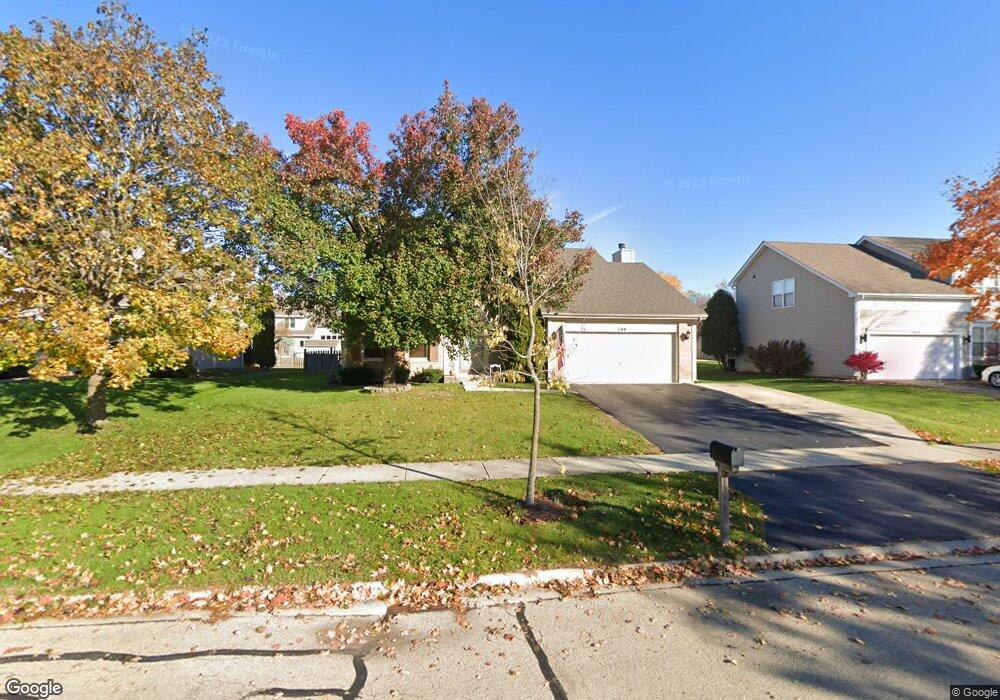
788 Wheatland Ln Bolingbrook, IL 60490
Sunset Park-Old Plank NeighborhoodEstimated Value: $414,333 - $502,000
--
Bed
1
Bath
--
Sq Ft
8,712
Sq Ft Lot
About This Home
This home is located at 788 Wheatland Ln, Bolingbrook, IL 60490 and is currently estimated at $461,333. 788 Wheatland Ln is a home located in Will County with nearby schools including Liberty Elementary School, John F Kennedy Middle School, and Plainfield East High School.
Ownership History
Date
Name
Owned For
Owner Type
Purchase Details
Closed on
Oct 23, 1998
Sold by
Richard Smykal Inc
Bought by
Wirth Richard J and Wirth Patricia M
Current Estimated Value
Home Financials for this Owner
Home Financials are based on the most recent Mortgage that was taken out on this home.
Original Mortgage
$124,383
Outstanding Balance
$26,951
Interest Rate
6.78%
Estimated Equity
$434,382
Create a Home Valuation Report for This Property
The Home Valuation Report is an in-depth analysis detailing your home's value as well as a comparison with similar homes in the area
Home Values in the Area
Average Home Value in this Area
Purchase History
| Date | Buyer | Sale Price | Title Company |
|---|---|---|---|
| Wirth Richard J | $189,500 | Chicago Title Insurance Co |
Source: Public Records
Mortgage History
| Date | Status | Borrower | Loan Amount |
|---|---|---|---|
| Open | Wirth Richard J | $124,383 |
Source: Public Records
Tax History Compared to Growth
Tax History
| Year | Tax Paid | Tax Assessment Tax Assessment Total Assessment is a certain percentage of the fair market value that is determined by local assessors to be the total taxable value of land and additions on the property. | Land | Improvement |
|---|---|---|---|---|
| 2024 | $9,478 | $135,914 | $17,733 | $118,181 |
| 2023 | $9,478 | $122,291 | $15,956 | $106,335 |
| 2022 | $9,017 | $110,251 | $14,385 | $95,866 |
| 2021 | $7,977 | $103,086 | $13,450 | $89,636 |
| 2020 | $7,800 | $99,697 | $13,008 | $86,689 |
| 2019 | $7,594 | $94,950 | $12,389 | $82,561 |
| 2018 | $7,348 | $90,879 | $11,858 | $79,021 |
| 2017 | $7,170 | $86,141 | $11,240 | $74,901 |
| 2016 | $7,074 | $82,000 | $10,700 | $71,300 |
| 2015 | $6,703 | $78,700 | $10,300 | $68,400 |
| 2014 | $6,703 | $74,900 | $9,800 | $65,100 |
| 2013 | $6,703 | $74,900 | $9,800 | $65,100 |
Source: Public Records
Map
Nearby Homes
- 1437 Sage Dr
- 584 Lakewood Farms Dr
- 1488 Schoenherr Ave
- 652 Timberline Dr
- 1631 Farmside Ln Unit 3B
- 1433 White Pine Ln
- 558 Pinebrook Dr
- 725 Delacourte Ave
- 812 Metropolitan Ave Unit 1
- 1536 Trails End Ln Unit 5A
- 406 S Palmer Dr Unit 2B
- 1544 Suncrest Ln
- 402 S Palmer Dr Unit 2B
- 402 Marshall Ash St Unit 3
- 400 Callery Dr
- 1152 Partridge Ave
- 333 Inner Circle Dr
- 1132 Partridge Ave
- 1692 Trails End Ln Unit 6
- 1133 Bramble Ave
- 792 Wheatland Ln
- 784 Wheatland Ln
- 1341 Farmstead Ln
- 1337 Farmstead Ln
- 1345 Farmstead Ln
- 796 Wheatland Ln
- 780 Wheatland Ln
- 1349 Farmstead Ln
- 789 Wheatland Ln
- 793 Wheatland Ln
- 800 Wheatland Ln
- 776 Wheatland Ln
- 797 Wheatland Ln
- 1329 Farmstead Ln
- 1353 Farmstead Ln
- 801 Wheatland Ln
- 821 Clearcroft Ave
- 824 Clearcroft Ave
- 804 Wheatland Ln
- 772 Wheatland Ln