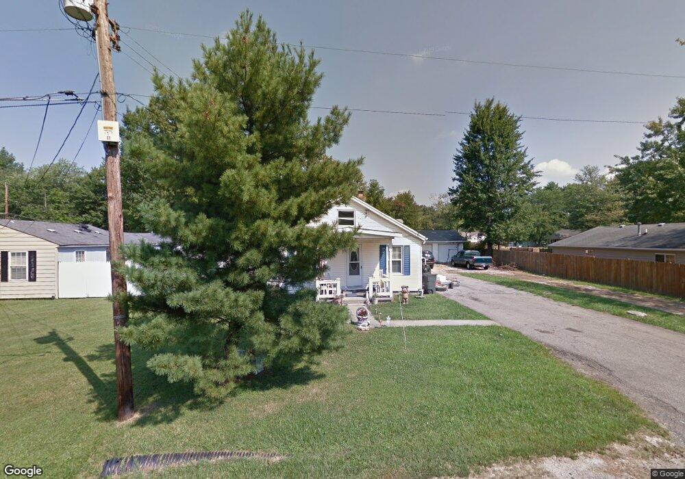
7888 Columbia Ave Cincinnati, OH 45249
Highpoint NeighborhoodEstimated Value: $147,932 - $197,000
2
Beds
1
Bath
1,166
Sq Ft
$157/Sq Ft
Est. Value
About This Home
This home is located at 7888 Columbia Ave, Cincinnati, OH 45249 and is currently estimated at $182,733, approximately $156 per square foot. 7888 Columbia Ave is a home located in Hamilton County with nearby schools including Stewart Elementary School, Princeton Community Middle School, and Princeton High School.
Ownership History
Date
Name
Owned For
Owner Type
Purchase Details
Closed on
Jun 16, 1994
Sold by
Wheeler Oliver Forrest
Bought by
Mcferron Denton R and Mcferron Rebecca L
Current Estimated Value
Home Financials for this Owner
Home Financials are based on the most recent Mortgage that was taken out on this home.
Original Mortgage
$42,350
Interest Rate
8.78%
Mortgage Type
FHA
Create a Home Valuation Report for This Property
The Home Valuation Report is an in-depth analysis detailing your home's value as well as a comparison with similar homes in the area
Home Values in the Area
Average Home Value in this Area
Purchase History
| Date | Buyer | Sale Price | Title Company |
|---|---|---|---|
| Mcferron Denton R | -- | -- |
Source: Public Records
Mortgage History
| Date | Status | Borrower | Loan Amount |
|---|---|---|---|
| Closed | Mcferron Denton R | $42,350 |
Source: Public Records
Tax History Compared to Growth
Tax History
| Year | Tax Paid | Tax Assessment Tax Assessment Total Assessment is a certain percentage of the fair market value that is determined by local assessors to be the total taxable value of land and additions on the property. | Land | Improvement |
|---|---|---|---|---|
| 2024 | $1,384 | $30,569 | $6,804 | $23,765 |
| 2023 | $1,389 | $30,569 | $6,804 | $23,765 |
| 2022 | $1,536 | $27,220 | $6,787 | $20,433 |
| 2021 | $1,494 | $27,220 | $6,787 | $20,433 |
| 2020 | $1,514 | $27,220 | $6,787 | $20,433 |
| 2019 | $1,446 | $23,878 | $5,954 | $17,924 |
| 2018 | $1,367 | $23,878 | $5,954 | $17,924 |
| 2017 | $1,287 | $23,878 | $5,954 | $17,924 |
| 2016 | $1,163 | $21,263 | $5,782 | $15,481 |
| 2015 | $1,175 | $21,263 | $5,782 | $15,481 |
| 2014 | $1,178 | $21,263 | $5,782 | $15,481 |
| 2013 | $1,136 | $20,846 | $5,670 | $15,176 |
Source: Public Records
Map
Nearby Homes
- 12105 4th Ave
- 12152 3rd Ave
- 12121 3rd Ave
- 11863 Whittington Ln
- 9729 Old Stable Ct
- 9731 Montclaire Dr
- 9669 Old Stable Ct
- 9609 Cedar Knoll Dr
- 6712 Hummingbird Dr
- 7199 Fieldstone Ct
- 11934 Snider Rd
- 8372 Heritage Dr
- 9787 Snider Rd
- 9743 Snider Rd
- 12102 Paulmeadows Dr
- 6424 Camp Superior Dr
- 6520 Lewis Clark Trail
- 5857 Fawn Run Dr
- 5852 Fawn Run Dr
- 9867 Kensington Ln
- 7890 Columbia Ave
- 12067 7th Ave
- 7880 Columbia Ave
- 12081 7th Ave
- 12082 6th Ave
- 12109 7th Ave
- 12083 7th Ave
- 11975 7th Ave
- 11953 7th Ave Unit 124
- 12087 7th Ave
- 12068 7th Ave
- 12066 7th Ave
- 12060 7th Ave
- 12074 7th Ave
- 7893 Columbia Ave
- 12103 7th Ave
- 12073 6th Ave
- 12088 7th Ave
- 12050 6th Ave
- 12081 6th Ave