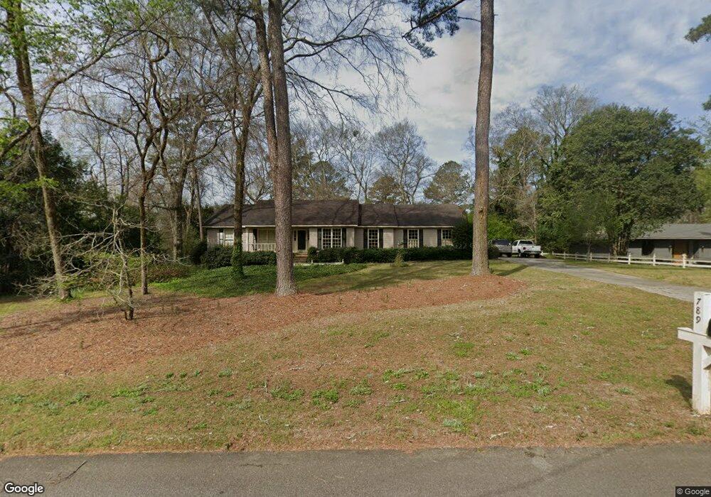
789 Middlesex Dr Macon, GA 31210
Estimated Value: $299,000 - $361,000
3
Beds
3
Baths
2,515
Sq Ft
$128/Sq Ft
Est. Value
About This Home
This home is located at 789 Middlesex Dr, Macon, GA 31210 and is currently estimated at $322,666, approximately $128 per square foot. 789 Middlesex Dr is a home located in Bibb County with nearby schools including Carter Elementary School, Howard Middle School, and Howard High School.
Ownership History
Date
Name
Owned For
Owner Type
Purchase Details
Closed on
Jul 10, 2020
Sold by
Davis Mary Isabel Kinnett
Bought by
Galloway Donley D
Current Estimated Value
Home Financials for this Owner
Home Financials are based on the most recent Mortgage that was taken out on this home.
Original Mortgage
$169,420
Outstanding Balance
$149,559
Interest Rate
3.1%
Mortgage Type
New Conventional
Estimated Equity
$173,107
Purchase Details
Closed on
Jul 12, 2010
Sold by
Davis Malcolm Cole
Bought by
Davis Mary Isabel Kinnett
Create a Home Valuation Report for This Property
The Home Valuation Report is an in-depth analysis detailing your home's value as well as a comparison with similar homes in the area
Purchase History
| Date | Buyer | Sale Price | Title Company |
|---|---|---|---|
| Galloway Donley D | $197,000 | None Available | |
| Davis Mary Isabel Kinnett | -- | None Available |
Source: Public Records
Mortgage History
| Date | Status | Borrower | Loan Amount |
|---|---|---|---|
| Open | Galloway Donley D | $169,420 |
Source: Public Records
Tax History Compared to Growth
Tax History
| Year | Tax Paid | Tax Assessment Tax Assessment Total Assessment is a certain percentage of the fair market value that is determined by local assessors to be the total taxable value of land and additions on the property. | Land | Improvement |
|---|---|---|---|---|
| 2025 | $2,070 | $91,250 | $20,000 | $71,250 |
| 2024 | $2,140 | $91,250 | $20,000 | $71,250 |
| 2023 | $1,683 | $91,250 | $20,000 | $71,250 |
| 2022 | $2,174 | $69,780 | $13,201 | $56,579 |
| 2021 | $2,386 | $69,780 | $13,201 | $56,579 |
| 2020 | $1,977 | $64,781 | $13,201 | $51,580 |
| 2019 | $1,992 | $64,781 | $13,201 | $51,580 |
| 2018 | $3,230 | $64,781 | $13,201 | $51,580 |
| 2017 | $1,896 | $64,781 | $13,201 | $51,580 |
| 2016 | $1,968 | $71,334 | $13,201 | $58,133 |
| 2015 | $2,789 | $71,334 | $13,201 | $58,133 |
| 2014 | $2,789 | $71,334 | $13,201 | $58,133 |
Source: Public Records
Map
Nearby Homes
- 820 & 810 Wimbledon Rd
- 230 Carriage Trail
- 670 Middlesex Dr
- 650 Crawford Rd
- 820 Wimbledon Rd
- 112 Covington Place
- 6111 Peake Rd
- 1183 Saint Andrews Dr
- 5181 Zebulon Rd
- 131 Ashford Park
- 111 the Vinings
- 106 Trillium Terrace
- 148 Ashford Trace Ln
- 118 Ashford Park
- 139 Ashford Trace Ln
- 278 Northridge Dr
- 241 Northridge Dr
- 311 Castlegate Rd
- 242 York Ln
- 200 Autumn Trace Ct
- 777 Middlesex Dr
- 1015 Tucker Rd
- 1023 Tucker Rd
- 788 Middlesex Dr
- 1029 Tucker Rd
- 765 Middlesex Dr
- 776 Middlesex Dr
- 104 Weatherby Dr
- 764 Middlesex Dr
- 1041 Tucker Rd
- 950 Tucker Rd
- 935 Tucker Rd
- 990 Saint Andrews Rd
- 108 Weatherby Dr
- 1020 Saint Andrews Rd
- 1006 Saint Andrews Rd
- 958 Saint Andrews Rd
- 825 Wimbledon Cir
- 1034 Saint Andrews Rd
- 936 Saint Andrews Rd