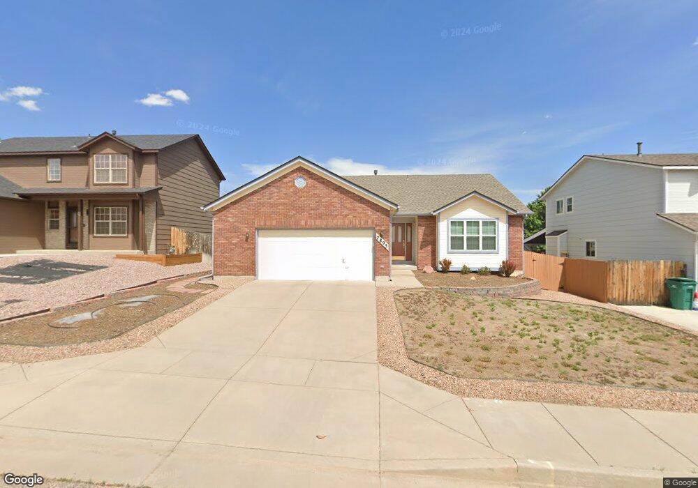
7895 Manston Dr Colorado Springs, CO 80920
Briargate NeighborhoodEstimated Value: $444,384 - $493,000
3
Beds
2
Baths
1,466
Sq Ft
$316/Sq Ft
Est. Value
About This Home
This home is located at 7895 Manston Dr, Colorado Springs, CO 80920 and is currently estimated at $463,596, approximately $316 per square foot. 7895 Manston Dr is a home located in El Paso County with nearby schools including Prairie Hills Elementary School, Timberview Middle School, and Liberty High School.
Ownership History
Date
Name
Owned For
Owner Type
Purchase Details
Closed on
Aug 27, 2002
Sold by
Reloaction
Bought by
Walker Samuel R and Walker Karen E
Current Estimated Value
Home Financials for this Owner
Home Financials are based on the most recent Mortgage that was taken out on this home.
Original Mortgage
$29,775
Interest Rate
6.33%
Mortgage Type
Credit Line Revolving
Purchase Details
Closed on
Aug 7, 1998
Sold by
Hallmark Building Company Ltd I
Bought by
French Forrest J and French Renita M
Home Financials for this Owner
Home Financials are based on the most recent Mortgage that was taken out on this home.
Original Mortgage
$156,605
Interest Rate
6.95%
Create a Home Valuation Report for This Property
The Home Valuation Report is an in-depth analysis detailing your home's value as well as a comparison with similar homes in the area
Home Values in the Area
Average Home Value in this Area
Purchase History
| Date | Buyer | Sale Price | Title Company |
|---|---|---|---|
| Walker Samuel R | $198,500 | Land Title | |
| Reloaction | -- | Land Title | |
| French Forrest J | $161,500 | Stewart Title |
Source: Public Records
Mortgage History
| Date | Status | Borrower | Loan Amount |
|---|---|---|---|
| Closed | Reloaction | $29,775 | |
| Open | Walker Samuel R | $158,800 | |
| Previous Owner | French Forrest J | $156,605 |
Source: Public Records
Tax History Compared to Growth
Tax History
| Year | Tax Paid | Tax Assessment Tax Assessment Total Assessment is a certain percentage of the fair market value that is determined by local assessors to be the total taxable value of land and additions on the property. | Land | Improvement |
|---|---|---|---|---|
| 2025 | $1,886 | $31,970 | -- | -- |
| 2024 | $1,393 | $33,190 | $5,360 | $27,830 |
| 2023 | $1,393 | $33,190 | $5,360 | $27,830 |
| 2022 | $1,159 | $23,370 | $4,340 | $19,030 |
| 2021 | $1,206 | $24,030 | $4,460 | $19,570 |
| 2020 | $1,116 | $21,640 | $3,720 | $17,920 |
| 2019 | $1,104 | $21,640 | $3,720 | $17,920 |
| 2018 | $874 | $18,470 | $2,880 | $15,590 |
| 2017 | $870 | $18,470 | $2,880 | $15,590 |
| 2016 | $774 | $17,970 | $2,930 | $15,040 |
| 2015 | $772 | $17,970 | $2,930 | $15,040 |
| 2014 | $1,273 | $16,490 | $2,930 | $13,560 |
Source: Public Records
Map
Nearby Homes
- 7820 Swiftrun Rd
- 7691 Scarborough Dr
- 7775 Manston Dr
- 5026 Plumstead Dr
- 5050 Plumstead Dr
- 7985 Interlaken Dr
- 7705 Chancellor Dr
- 8030 Chancellor Dr
- 7590 Chancellor Dr
- 5305 Plumstead Dr
- 8313 Scarborough Dr
- 8372 Wilmington Dr
- 8387 Snow Cap View
- Fairview Plan at Trailside at Cottonwood Creek
- Deerfield Plan at Trailside at Cottonwood Creek
- Ethridge Plan at Trailside at Cottonwood Creek
- Bryanwood Plan at Trailside at Cottonwood Creek
- Cherry Oak Plan at Trailside at Cottonwood Creek
- Alpine Plan at Trailside at Cottonwood Creek
- 5095 Chaise Dr
- 7885 Manston Dr
- 7915 Manston Dr
- 7830 Potomac Dr
- 7834 Potomac Dr
- 7875 Manston Dr
- 7925 Manston Dr
- 7838 Potomac Dr
- 7826 Potomac Dr
- 7842 Potomac Dr
- 7880 Manston Dr
- 7890 Manston Dr
- 7865 Manston Dr
- 7935 Manston Dr
- 7870 Manston Dr
- 7822 Potomac Dr
- 7910 Manston Dr
- 7846 Potomac Dr
- 7860 Manston Dr
- 7920 Manston Dr
- 7855 Manston Dr