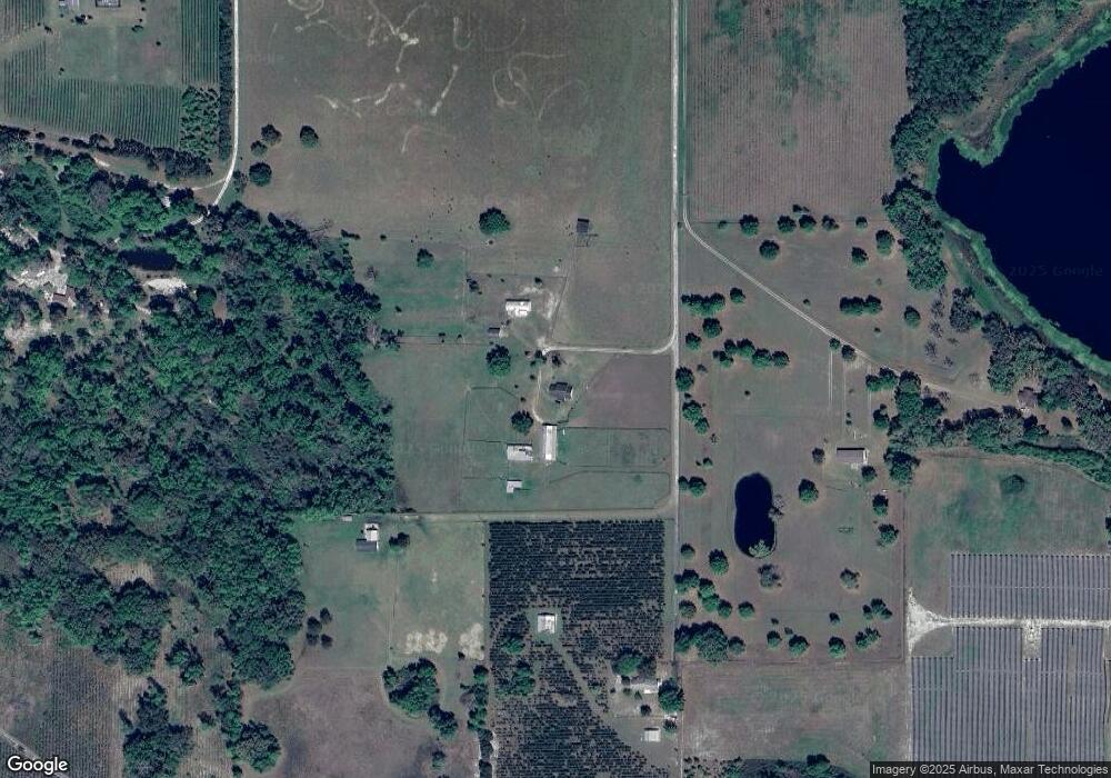
7899 63rd Path Live Oak, FL 32060
Estimated Value: $303,596 - $436,000
Studio
--
Bath
1,832
Sq Ft
$195/Sq Ft
Est. Value
About This Home
This home is located at 7899 63rd Path, Live Oak, FL 32060 and is currently estimated at $357,899, approximately $195 per square foot. 7899 63rd Path is a home located in Suwannee County with nearby schools including Suwannee Riverside Elementary School, Suwannee Springcrest Elementary School, and Suwannee Pineview Elementary School.
Ownership History
Date
Name
Owned For
Owner Type
Purchase Details
Closed on
Jan 21, 2016
Sold by
Boyle Marvin C and Boyle Dorthy J
Bought by
Crosby Mark K and Crosby Sally H
Current Estimated Value
Home Financials for this Owner
Home Financials are based on the most recent Mortgage that was taken out on this home.
Original Mortgage
$165,000
Outstanding Balance
$130,259
Interest Rate
3.98%
Mortgage Type
Purchase Money Mortgage
Estimated Equity
$227,640
Create a Home Valuation Report for This Property
The Home Valuation Report is an in-depth analysis detailing your home's value as well as a comparison with similar homes in the area
Purchase History
| Date | Buyer | Sale Price | Title Company |
|---|---|---|---|
| Crosby Mark K | $385,000 | Attorney |
Source: Public Records
Mortgage History
| Date | Status | Borrower | Loan Amount |
|---|---|---|---|
| Open | Crosby Mark K | $165,000 |
Source: Public Records
Tax History Compared to Growth
Tax History
| Year | Tax Paid | Tax Assessment Tax Assessment Total Assessment is a certain percentage of the fair market value that is determined by local assessors to be the total taxable value of land and additions on the property. | Land | Improvement |
|---|---|---|---|---|
| 2025 | $2,976 | $217,140 | $14,100 | $203,040 |
| 2024 | $2,803 | $204,381 | $14,100 | $190,281 |
| 2023 | $2,803 | $148,587 | $0 | $0 |
| 2022 | $2,413 | $144,435 | $14,100 | $130,335 |
| 2021 | $2,229 | $122,799 | $0 | $0 |
| 2020 | $2,002 | $115,098 | $0 | $0 |
| 2019 | $2,019 | $115,098 | $0 | $0 |
| 2018 | $2,021 | $115,098 | $0 | $0 |
| 2017 | $2,010 | $112,561 | $0 | $0 |
| 2016 | $1,334 | $107,717 | $0 | $0 |
| 2015 | $1,337 | $106,969 | $0 | $0 |
| 2014 | $1,326 | $106,121 | $0 | $0 |
Source: Public Records
Map
Nearby Homes
- 7474 65th Dr
- 7470 65th Dr
- LOT 4 72nd Trace
- 0 72nd Trace Unit 122310
- 0 72nd Trace Unit 122309
- 5926 County Road 136
- 00 County Road 136a
- 0 52nd St Unit 111302
- 11242 Hogan Rd
- TBD Hogan Rd
- 0 County Road 136a
- 11711 72nd St
- 5676 75th Rd
- 000 66th St
- 40AC 89th Rd
- TBD Cr 137
- 000 64th Place
- TBD Us Hwy 90 - 1 14 Ac
- 3766 64th Terrace
- TBD Cr 137 & I-10
- 6336 County Road 136
- 8021 63rd Path
- 0 63rd Path Unit 83893
- 8001 Hogan Rd
- 6177 County Road 136
- 6106 County Road 136
- 7896 Hogan Rd
- 6305 County Road 136
- 6578 County Road 136
- 7898 Hogan Rd
- 5972 County Road 136
- 7847 Hogan Rd
- TBD Hogan Rd
- 7686 Hogan Rd
- 0 Corner of 65th &76th
- TBD 63rd Ct
- 0 Tbd 65 Th Dr Unit 108614
- 6536 76th St
- 0 Tbd 65th Dr
- 7484 63rd Ct
