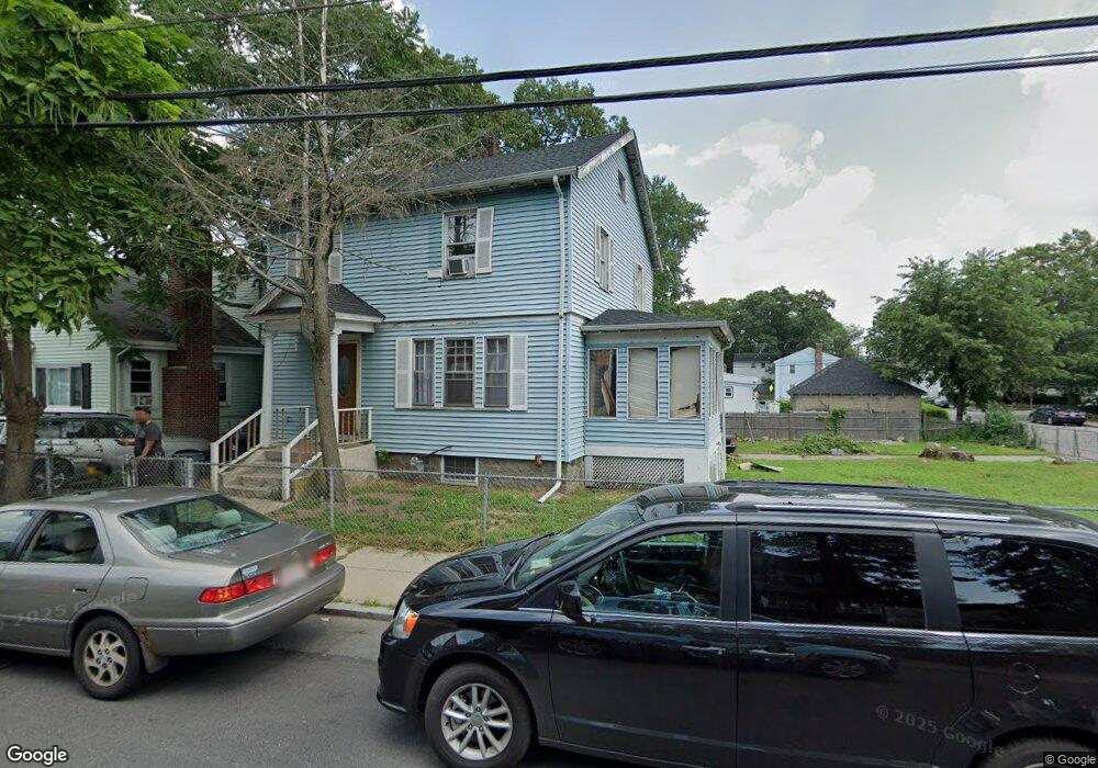
79 Blake St Mattapan, MA 02126
Hyde Park NeighborhoodEstimated Value: $587,000 - $635,000
3
Beds
1
Bath
1,468
Sq Ft
$417/Sq Ft
Est. Value
About This Home
This home is located at 79 Blake St, Mattapan, MA 02126 and is currently estimated at $612,394, approximately $417 per square foot. 79 Blake St is a home located in Suffolk County with nearby schools including Boston Preparatory Charter Public School and Berea Seventh-day Adventist Academy.
Ownership History
Date
Name
Owned For
Owner Type
Purchase Details
Closed on
Dec 11, 2006
Sold by
Womack Laneice P and Scott Quentin T
Bought by
Johnson Charles M
Current Estimated Value
Home Financials for this Owner
Home Financials are based on the most recent Mortgage that was taken out on this home.
Original Mortgage
$318,000
Outstanding Balance
$191,072
Interest Rate
6.4%
Mortgage Type
Purchase Money Mortgage
Estimated Equity
$421,322
Create a Home Valuation Report for This Property
The Home Valuation Report is an in-depth analysis detailing your home's value as well as a comparison with similar homes in the area
Home Values in the Area
Average Home Value in this Area
Purchase History
| Date | Buyer | Sale Price | Title Company |
|---|---|---|---|
| Johnson Charles M | $318,000 | -- |
Source: Public Records
Mortgage History
| Date | Status | Borrower | Loan Amount |
|---|---|---|---|
| Open | Johnson Charles M | $318,000 |
Source: Public Records
Tax History Compared to Growth
Tax History
| Year | Tax Paid | Tax Assessment Tax Assessment Total Assessment is a certain percentage of the fair market value that is determined by local assessors to be the total taxable value of land and additions on the property. | Land | Improvement |
|---|---|---|---|---|
| 2025 | $5,335 | $460,700 | $149,200 | $311,500 |
| 2024 | $4,784 | $438,900 | $146,800 | $292,100 |
| 2023 | $4,365 | $406,400 | $135,900 | $270,500 |
| 2022 | $4,131 | $379,700 | $127,000 | $252,700 |
| 2021 | $3,721 | $348,700 | $122,100 | $226,600 |
| 2020 | $3,570 | $338,100 | $115,100 | $223,000 |
| 2019 | $2,994 | $284,100 | $86,300 | $197,800 |
| 2018 | $2,835 | $270,500 | $86,300 | $184,200 |
| 2017 | $2,629 | $248,300 | $86,300 | $162,000 |
| 2016 | $2,576 | $234,200 | $86,300 | $147,900 |
| 2015 | $2,602 | $214,900 | $85,300 | $129,600 |
| 2014 | $2,498 | $198,600 | $85,300 | $113,300 |
Source: Public Records
Map
Nearby Homes
- 7 Winborough St
- 34 Ridlon Rd
- 25 Alpine St Unit 7
- 23 Caton St
- 0 Tina Ave
- 90 Hollingsworth St
- 645 River St
- 839-843 Cummins Hwy
- 20 Massasoit St
- 265 Hebron St
- 42 Osceola St
- 770 Cummins Hwy Unit 1
- 770 Cummins Hwy Unit 22
- 48-50 Rockdale St
- 231 Itasca St
- 10 Brockton St
- 179 Hebron St
- 112 Brush Hill Rd
- 16 Concord Ave Unit 1
- 95 Woodhaven St
- 77 Blake St
- 83 Blake St
- 137 Ruskindale Rd
- 141 Ruskindale Rd
- 65 Radcliffe Rd
- 65 Radcliffe Rd
- 78 Blake St
- 145 Ruskindale Rd
- 82 Blake St Unit B
- 73 Blake St
- 80 Blake St Unit 82
- 75 Taunton Ave
- 127 Ruskindale Rd
- 127 Ruskindale Rd Unit 2
- 74 Blake St
- 127 Ruskindale Rd
- 79 Taunton Ave
- 140 Ruskindale Rd
- 52 Blake St
- 89 Blake St Unit 91