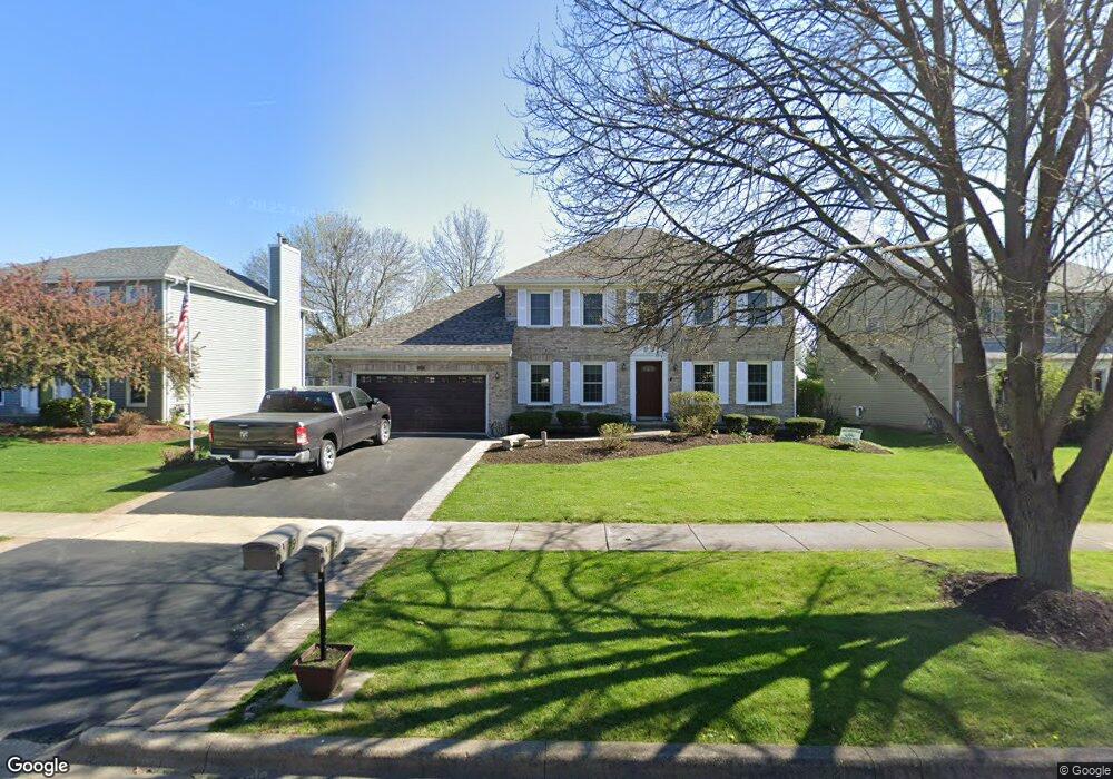
79 Briarcliff Rd Montgomery, IL 60538
Briarcliff Woods NeighborhoodEstimated Value: $380,000 - $407,000
Studio
1
Bath
2,268
Sq Ft
$173/Sq Ft
Est. Value
About This Home
This home is located at 79 Briarcliff Rd, Montgomery, IL 60538 and is currently estimated at $392,390, approximately $173 per square foot. 79 Briarcliff Rd is a home located in Kendall County with nearby schools including Boulder Hill Elementary School, Thompson Jr. High School, and Oswego High School.
Ownership History
Date
Name
Owned For
Owner Type
Purchase Details
Closed on
Jun 17, 1994
Bought by
Tossing Robert C and Tossing Melodye M
Current Estimated Value
Purchase Details
Closed on
May 31, 1990
Bought by
Krughoff Robert D
Purchase Details
Closed on
Sep 1, 1988
Purchase Details
Closed on
Jan 1, 1988
Create a Home Valuation Report for This Property
The Home Valuation Report is an in-depth analysis detailing your home's value as well as a comparison with similar homes in the area
Home Values in the Area
Average Home Value in this Area
Purchase History
| Date | Buyer | Sale Price | Title Company |
|---|---|---|---|
| Tossing Robert C | $197,000 | -- | |
| Krughoff Robert D | $139,600 | -- | |
| -- | $118,500 | -- | |
| -- | $390,700 | -- |
Source: Public Records
Mortgage History
| Date | Status | Borrower | Loan Amount |
|---|---|---|---|
| Closed | Krughoff Robert D | -- |
Source: Public Records
Tax History
| Year | Tax Paid | Tax Assessment Tax Assessment Total Assessment is a certain percentage of the fair market value that is determined by local assessors to be the total taxable value of land and additions on the property. | Land | Improvement |
|---|---|---|---|---|
| 2024 | $9,222 | $117,468 | $26,298 | $91,170 |
| 2023 | $8,008 | $105,827 | $23,692 | $82,135 |
| 2022 | $8,008 | $97,089 | $21,736 | $75,353 |
| 2021 | $7,687 | $90,737 | $20,314 | $70,423 |
| 2020 | $7,280 | $85,601 | $19,164 | $66,437 |
| 2019 | $7,074 | $82,438 | $19,164 | $63,274 |
| 2018 | $7,489 | $82,438 | $19,164 | $63,274 |
| 2017 | $7,084 | $77,771 | $18,079 | $59,692 |
| 2016 | $6,958 | $75,505 | $17,552 | $57,953 |
| 2015 | $7,588 | $72,951 | $16,958 | $55,993 |
| 2014 | -- | $70,826 | $16,464 | $54,362 |
| 2013 | -- | $71,541 | $16,630 | $54,911 |
Source: Public Records
Map
Nearby Homes
- 4 Ingleshire Rd
- 107 Fellemore Ln
- 46 Ingleshire Rd
- 142 Jefferson St
- 1620 Lexington Dr
- 19 Wyndham Dr Unit 10
- 30 Hampton Rd
- 38 Surrey Rd Unit 10
- 215 Fernwood Rd
- 1417 Manning Ave
- 1405 Manning Ave
- 1855 Grandview Place Unit 2B
- 28 Seneca Dr
- 27 S Bereman Rd
- 11 Greenfield Rd
- 117 Boulder Hill Pass Unit 117
- 119 Garden Dr
- 209 Huntington Ct
- 1 Highway 30
- 207 Long Beach Rd
- 85 Briarcliff Rd
- 1875 Ridgemont Ct
- 89 Briarcliff Rd
- 65 Briarcliff Rd Unit 2
- 1885 Ridgemont Ct Unit 2
- 1870 Ridgemont Ct
- 1795 Turnbridge Ct Unit 2
- 95 Briarcliff Rd
- 70 Briarcliff Rd
- 60 Red Fox Run Unit 2
- 64 Red Fox Run
- 1895 Ridgemont Ct
- 90 Briarcliff Rd
- 1785 Turnbridge Ct
- 97 Briarcliff Rd
- 63 Winter Hill Cir
- 1880 Ridgemont Ct Unit 2
- 60 Winter Hill Cir
- 94 Briarcliff Rd
- 1915 Ridgemont Ct