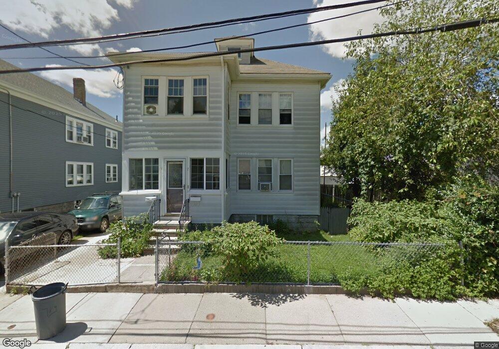
79 Byrd Ave Roslindale, MA 02131
Roslindale NeighborhoodEstimated Value: $830,000 - $1,008,000
4
Beds
2
Baths
2,288
Sq Ft
$403/Sq Ft
Est. Value
About This Home
This home is located at 79 Byrd Ave, Roslindale, MA 02131 and is currently estimated at $921,525, approximately $402 per square foot. 79 Byrd Ave is a home located in Suffolk County with nearby schools including Brooke Charter School Roslindale, Sacred Heart STEM School, and St. Clare High School.
Ownership History
Date
Name
Owned For
Owner Type
Purchase Details
Closed on
Aug 11, 2022
Sold by
Vieux Michel and Vieux Lyloche H
Bought by
Vieux Misheleeando H and Vieux Dimetry H
Current Estimated Value
Purchase Details
Closed on
Jun 30, 2004
Sold by
Musto Darlene and Musto Angelo
Bought by
Vieux Lyloche H and Vieux Michel
Home Financials for this Owner
Home Financials are based on the most recent Mortgage that was taken out on this home.
Original Mortgage
$417,500
Interest Rate
6.3%
Mortgage Type
Purchase Money Mortgage
Create a Home Valuation Report for This Property
The Home Valuation Report is an in-depth analysis detailing your home's value as well as a comparison with similar homes in the area
Home Values in the Area
Average Home Value in this Area
Purchase History
| Date | Buyer | Sale Price | Title Company |
|---|---|---|---|
| Vieux Misheleeando H | -- | None Available | |
| Vieux Misheleeando H | -- | None Available | |
| Vieux Lyloche H | $475,000 | -- | |
| Vieux Lyloche H | $475,000 | -- |
Source: Public Records
Mortgage History
| Date | Status | Borrower | Loan Amount |
|---|---|---|---|
| Previous Owner | Vieux Lyloche H | $417,500 |
Source: Public Records
Tax History
| Year | Tax Paid | Tax Assessment Tax Assessment Total Assessment is a certain percentage of the fair market value that is determined by local assessors to be the total taxable value of land and additions on the property. | Land | Improvement |
|---|---|---|---|---|
| 2025 | $8,174 | $705,900 | $215,800 | $490,100 |
| 2024 | $7,213 | $661,700 | $196,000 | $465,700 |
| 2023 | $6,769 | $630,300 | $186,700 | $443,600 |
| 2022 | $6,350 | $583,600 | $172,900 | $410,700 |
| 2021 | $5,874 | $550,500 | $163,100 | $387,400 |
| 2020 | $5,068 | $479,900 | $151,400 | $328,500 |
| 2019 | $4,861 | $461,200 | $120,600 | $340,600 |
| 2018 | $4,475 | $427,000 | $120,600 | $306,400 |
| 2017 | $4,224 | $398,900 | $120,600 | $278,300 |
| 2016 | $4,179 | $379,900 | $120,600 | $259,300 |
| 2015 | $3,828 | $316,100 | $114,200 | $201,900 |
| 2014 | $3,682 | $292,700 | $114,200 | $178,500 |
Source: Public Records
Map
Nearby Homes
- 40 Catherine St Unit 2
- 472 Hyde Park Ave Unit 472
- 375 Hyde Park Ave Unit 3
- 602 Canterbury St Unit 14
- 602 Canterbury St Unit 10
- 602 Canterbury St Unit 13
- 602 Canterbury St Unit 5
- 602 Canterbury St Unit 9
- 23 Rowe St Unit 23 Rowe
- 60 Stella Rd
- 586 Canterbury St
- 8 Mount Calvary Rd Unit 4
- 543 Hyde Park Ave Unit 1
- 68 Rowe St Unit 3
- 68 Rowe St Unit 2
- 61 Fawndale Rd
- 35 Eldridge Rd Unit 209
- 4 Rowe Ct
- 132 Sycamore St
- 31 Rodman St Unit 2
- 11 Byrd Ave Unit 13
- 79 Neponset Ave Unit 81
- 75 Neponset Ave Unit 77
- 75 Neponset Ave Unit 1
- 15 Byrd Ave
- 71 Neponset Ave Unit 73
- 10 Charme Ave Unit 12
- 68 Charme Ave
- 83-85 Neponset Ave
- 83 Neponset Ave Unit 85
- 83 Neponset Ave Unit 1
- 85 Neponset Ave Unit 2
- 83-85 Neponset Ave Unit 2
- 8 Byrd Ave
- 14 Charme Ave Unit 16
- 19 Byrd Ave
- 12 Byrd Ave
- 67 Neponset Ave Unit 69
- 67 Neponset Ave Unit 1
- 69 Neponset Ave Unit 1
Your Personal Tour Guide
Ask me questions while you tour the home.