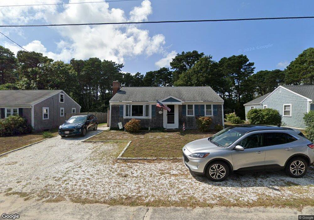
79 Captain Chase Rd Dennis Port, MA 02639
Dennis Port NeighborhoodEstimated Value: $568,000 - $639,000
2
Beds
1
Bath
1,144
Sq Ft
$534/Sq Ft
Est. Value
About This Home
This home is located at 79 Captain Chase Rd, Dennis Port, MA 02639 and is currently estimated at $610,747, approximately $533 per square foot. 79 Captain Chase Rd is a home located in Barnstable County with nearby schools including Dennis-Yarmouth Regional High School and St. Pius X. School.
Ownership History
Date
Name
Owned For
Owner Type
Purchase Details
Closed on
Dec 5, 2024
Sold by
Collins Geraldine F and Collins Dennis M
Bought by
Collins
Current Estimated Value
Purchase Details
Closed on
May 24, 1991
Sold by
Marois Richard J and Marois Maureen A
Bought by
Collins Geraldine F and Collins Dennis M
Home Financials for this Owner
Home Financials are based on the most recent Mortgage that was taken out on this home.
Original Mortgage
$55,000
Interest Rate
9.36%
Mortgage Type
Purchase Money Mortgage
Create a Home Valuation Report for This Property
The Home Valuation Report is an in-depth analysis detailing your home's value as well as a comparison with similar homes in the area
Home Values in the Area
Average Home Value in this Area
Purchase History
| Date | Buyer | Sale Price | Title Company |
|---|---|---|---|
| Collins | -- | None Available | |
| Collins | -- | None Available | |
| Collins Geraldine F | $105,000 | -- | |
| Collins Geraldine F | $105,000 | -- |
Source: Public Records
Mortgage History
| Date | Status | Borrower | Loan Amount |
|---|---|---|---|
| Previous Owner | Collins Geraldine F | $58,000 | |
| Previous Owner | Collins Geraldine F | $55,000 |
Source: Public Records
Tax History Compared to Growth
Tax History
| Year | Tax Paid | Tax Assessment Tax Assessment Total Assessment is a certain percentage of the fair market value that is determined by local assessors to be the total taxable value of land and additions on the property. | Land | Improvement |
|---|---|---|---|---|
| 2025 | $2,504 | $578,300 | $193,500 | $384,800 |
| 2024 | $2,361 | $537,900 | $186,100 | $351,800 |
| 2023 | $2,305 | $493,600 | $169,200 | $324,400 |
| 2022 | $2,204 | $393,600 | $152,400 | $241,200 |
| 2021 | $2,237 | $371,000 | $170,800 | $200,200 |
| 2020 | $2,019 | $331,000 | $149,400 | $181,600 |
| 2019 | $1,899 | $307,800 | $146,500 | $161,300 |
| 2018 | $1,814 | $286,100 | $139,500 | $146,600 |
| 2017 | $1,669 | $271,400 | $129,500 | $141,900 |
| 2016 | $1,703 | $260,800 | $139,500 | $121,300 |
| 2015 | $1,669 | $260,800 | $139,500 | $121,300 |
| 2014 | $1,529 | $240,800 | $119,500 | $121,300 |
Source: Public Records
Map
Nearby Homes
- 31 Easy St
- 80 Michaels Ave
- 22 Wixon Rd
- 19 Standish Way
- 37 Ocean Dr Unit 2
- 64 Beaten Rd
- 37 Beach Hills Rd
- 262 Old Wharf Rd Unit 67
- 262 Old Wharf Rd Unit 5
- 262 Old Wharf Rd Unit 5
- 262 Old Wharf Rd Unit 20
- 262 Old Wharf Rd Unit 87
- 37-A Beach Hills Rd
- 22 Ferncliff Rd
- 154 Old Wharf Rd Unit 26
- 154 Old Wharf Rd Unit 14
- 72 Bassett Ln
- 4 Coffey Ln
- 112 Old Wharf Rd Unit E4
- 112 Old Wharf Rd Unit E1
- 75 Captain Chase Rd
- 81 Captain Chase Rd
- 73 Captain Chase Rd
- 85 Captain Chase Rd
- 8 Uncle Ezras Path
- 0 Uncle Toms Path
- 87 Captain Chase Rd
- 9 Uncle Ezras Path
- 12 Uncle Ezras Path
- 70 Captain Chase Rd
- 67 Captain Chase Rd
- 91 Captain Chase Rd
- 9 1st Mate Row
- 4 1st Mate Row
- 13 Uncle Ezras Path
- 83 Siasconset Ave
- 85 Siasconset Ave
- 16 Uncle Ezras Path
- 17 Lorree Ln
- 81 Siasconset Ave