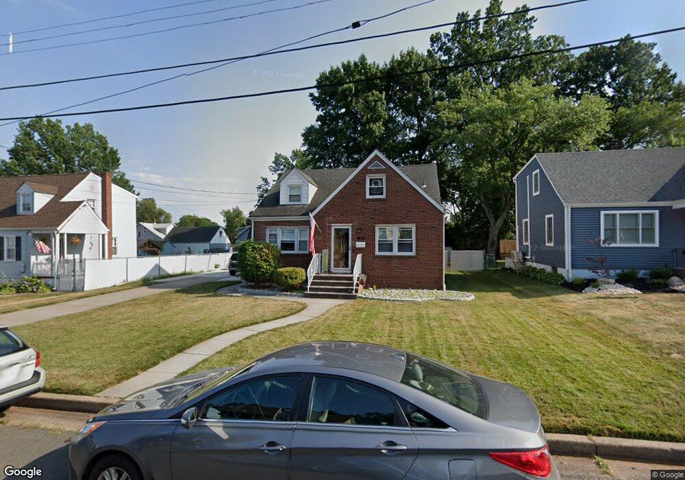
79 Craske St Woodbridge, NJ 07095
Estimated Value: $350,946 - $487,000
--
Bed
--
Bath
1,068
Sq Ft
$412/Sq Ft
Est. Value
About This Home
This home is located at 79 Craske St, Woodbridge, NJ 07095 and is currently estimated at $440,237, approximately $412 per square foot. 79 Craske St is a home located in Middlesex County with nearby schools including Port Reading Elementary School, Woodbridge Middle School, and Woodbridge High School.
Ownership History
Date
Name
Owned For
Owner Type
Purchase Details
Closed on
Dec 31, 2003
Sold by
Nevins William
Bought by
Avila Eddy R and Avila Annmarie
Current Estimated Value
Purchase Details
Closed on
Jul 3, 1997
Sold by
Estate Of Julia Konick
Bought by
Avila Eddy and Annmarie Avila
Home Financials for this Owner
Home Financials are based on the most recent Mortgage that was taken out on this home.
Original Mortgage
$133,000
Interest Rate
7.86%
Create a Home Valuation Report for This Property
The Home Valuation Report is an in-depth analysis detailing your home's value as well as a comparison with similar homes in the area
Home Values in the Area
Average Home Value in this Area
Purchase History
| Date | Buyer | Sale Price | Title Company |
|---|---|---|---|
| Avila Eddy R | -- | -- | |
| Avila Eddy | $140,000 | -- |
Source: Public Records
Mortgage History
| Date | Status | Borrower | Loan Amount |
|---|---|---|---|
| Previous Owner | Avila Eddy | $133,000 |
Source: Public Records
Tax History Compared to Growth
Tax History
| Year | Tax Paid | Tax Assessment Tax Assessment Total Assessment is a certain percentage of the fair market value that is determined by local assessors to be the total taxable value of land and additions on the property. | Land | Improvement |
|---|---|---|---|---|
| 2025 | $11,153 | $82,400 | $26,500 | $55,900 |
| 2024 | $10,877 | $82,400 | $26,500 | $55,900 |
| 2023 | $10,877 | $82,400 | $26,500 | $55,900 |
| 2022 | $10,214 | $82,400 | $26,500 | $55,900 |
| 2021 | $10,109 | $82,400 | $26,500 | $55,900 |
| 2020 | $9,776 | $82,400 | $26,500 | $55,900 |
| 2019 | $9,528 | $82,400 | $26,500 | $55,900 |
| 2018 | $9,277 | $82,400 | $26,500 | $55,900 |
| 2017 | $9,090 | $82,400 | $26,500 | $55,900 |
| 2016 | $9,004 | $82,400 | $26,500 | $55,900 |
| 2015 | $8,827 | $82,400 | $26,500 | $55,900 |
| 2014 | $8,617 | $82,400 | $26,500 | $55,900 |
Source: Public Records
Map
Nearby Homes
- 682 Leone St
- 660 Leone St
- 59 Trinity Ln
- 54 Freeman St
- 587 Ellis Place
- 657 Barron Ave
- 52 Martin Terrace
- 116 Harrell Ave
- 884 Sylvia Place
- 633 Harrell Ave
- 60 Crampton Ave
- 110 Church St
- 46 Melbourne Ct
- 783 Aborn Ave
- 622 Linden Ave
- 532 Bamford Ave
- 20 Burnet St
- 29 Claire Ave
- 7 Coke Ave Unit 56
- 524 Bamford Ave