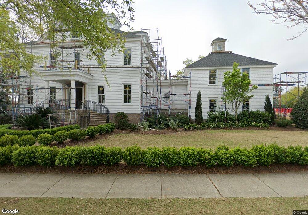
79 Dalton St Daniel Island, SC 29492
Daniel Island NeighborhoodEstimated Value: $4,349,000 - $4,895,000
Studio
2
Baths
6,656
Sq Ft
$698/Sq Ft
Est. Value
About This Home
This home is located at 79 Dalton St, Daniel Island, SC 29492 and is currently estimated at $4,647,362, approximately $698 per square foot. 79 Dalton St is a home located in Berkeley County with nearby schools including Daniel Island School and Bishop England High School.
Ownership History
Date
Name
Owned For
Owner Type
Purchase Details
Closed on
Dec 27, 2021
Sold by
Schimpf Dennis
Bought by
Ohara Katherine A and Ohara Gregory A
Current Estimated Value
Purchase Details
Closed on
Mar 19, 2013
Sold by
Hagerty Michael P and Coulombe Hagerty Michelle
Bought by
Hagerty Michael P and Coulombe Hagerty Michelle
Purchase Details
Closed on
Jan 4, 2012
Sold by
Black Jennifer M
Bought by
Hagerty Michael P and Coulombe Hagerty Michelle
Purchase Details
Closed on
Oct 14, 2004
Sold by
Historic Traditions Llc #5
Bought by
Black Jennifer M
Purchase Details
Closed on
Mar 10, 2003
Sold by
Historic Traditions Inc
Bought by
Historic Traditions Llc #5
Create a Home Valuation Report for This Property
The Home Valuation Report is an in-depth analysis detailing your home's value as well as a comparison with similar homes in the area
Home Values in the Area
Average Home Value in this Area
Purchase History
| Date | Buyer | Sale Price | Title Company |
|---|---|---|---|
| Ohara Katherine A | $3,500,000 | None Available | |
| Hagerty Michael P | -- | -- | |
| Hagerty Michael P | $1,825,000 | -- | |
| Black Jennifer M | $2,064,445 | -- | |
| Historic Traditions Llc #5 | -- | -- |
Source: Public Records
Tax History
| Year | Tax Paid | Tax Assessment Tax Assessment Total Assessment is a certain percentage of the fair market value that is determined by local assessors to be the total taxable value of land and additions on the property. | Land | Improvement |
|---|---|---|---|---|
| 2025 | $29,678 | $1,596,400 | $1,540,000 | $56,400 |
| 2024 | -- | $95,784 | $92,400 | $3,384 |
| 2023 | $71,517 | $227,742 | $92,400 | $135,342 |
| 2022 | $66,978 | $207,552 | $93,750 | $113,802 |
| 2021 | $23,071 | $133,620 | $24,200 | $109,416 |
| 2020 | $23,545 | $133,616 | $24,200 | $109,416 |
| 2019 | $23,993 | $133,616 | $24,200 | $109,416 |
| 2018 | $21,237 | $118,164 | $20,680 | $97,484 |
| 2017 | $21,202 | $118,164 | $20,680 | $97,484 |
| 2016 | $21,509 | $118,160 | $20,680 | $97,480 |
| 2015 | $36,835 | $115,870 | $16,000 | $99,870 |
| 2014 | $34,519 | $106,760 | $17,760 | $89,000 |
| 2013 | -- | $106,760 | $17,760 | $89,000 |
Source: Public Records
Map
Nearby Homes
- 75 Delahow St
- 205 Delahow St
- 26 Woodford St
- 290 Delahow St
- 131 Balfour Dr
- 136 Iron Bottom Ln
- 215 Ferryman Ln
- 57 Iron Bottom Ln
- 167 Etta Way Unit Lot 40
- 343 Simone Dr Unit Lot 53
- 347 Simone Dr Unit Lot 54
- 142 Etta Way
- 140 Etta Way
- 138 Etta Way
- 335 Simone Dr Unit Lot 51
- 136 Etta Way
- 134 Etta Way
- 132 Etta Way
- 122 Fairbanks Dr
- 130 Fairbanks Dr
Your Personal Tour Guide
Ask me questions while you tour the home.