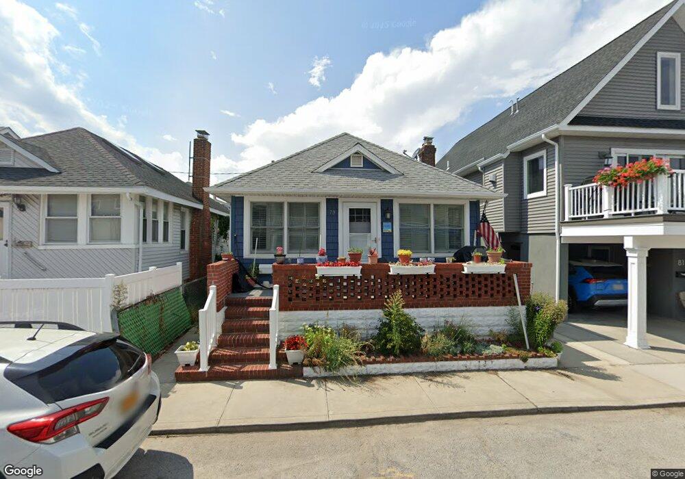
79 Delaware Ave Long Beach, NY 11561
Estimated Value: $777,564 - $836,000
3
Beds
2
Baths
1,004
Sq Ft
$804/Sq Ft
Est. Value
About This Home
This home is located at 79 Delaware Ave, Long Beach, NY 11561 and is currently estimated at $806,782, approximately $803 per square foot. 79 Delaware Ave is a home located in Nassau County with nearby schools including Lido Elementary School, West Elementary School, and Lindell Elementary School.
Ownership History
Date
Name
Owned For
Owner Type
Purchase Details
Closed on
Dec 6, 2010
Sold by
Callanan Barbara
Bought by
Lesanti Nicholas
Current Estimated Value
Purchase Details
Closed on
Nov 30, 2001
Sold by
Conrad Sarah
Bought by
Callanan Barbara
Purchase Details
Closed on
Oct 3, 1997
Sold by
Cutulo Florentino Frances
Bought by
Florentino Frances
Purchase Details
Closed on
Nov 22, 1995
Sold by
Fiorentino Frances
Bought by
Clement Fiorentino and Clement Frances Fiorentino Revocabl
Create a Home Valuation Report for This Property
The Home Valuation Report is an in-depth analysis detailing your home's value as well as a comparison with similar homes in the area
Home Values in the Area
Average Home Value in this Area
Purchase History
| Date | Buyer | Sale Price | Title Company |
|---|---|---|---|
| Lesanti Nicholas | $412,500 | -- | |
| Callanan Barbara | -- | James Spiess | |
| Florentino Frances | -- | -- | |
| Conrad Sarah | $144,900 | -- | |
| Clement Fiorentino | -- | -- |
Source: Public Records
Tax History Compared to Growth
Tax History
| Year | Tax Paid | Tax Assessment Tax Assessment Total Assessment is a certain percentage of the fair market value that is determined by local assessors to be the total taxable value of land and additions on the property. | Land | Improvement |
|---|---|---|---|---|
| 2025 | $6,811 | $481 | $214 | $267 |
| 2024 | $843 | $487 | $216 | $271 |
| 2023 | $6,268 | $476 | $215 | $261 |
| 2022 | $6,268 | $504 | $228 | $276 |
| 2021 | $12,286 | $482 | $218 | $264 |
| 2020 | $8,763 | $585 | $513 | $72 |
| 2019 | $5,491 | $585 | $415 | $170 |
| 2018 | $5,200 | $600 | $0 | $0 |
| 2017 | $4,665 | $701 | $548 | $153 |
| 2016 | $865 | $743 | $552 | $191 |
| 2015 | $962 | $784 | $500 | $284 |
| 2014 | $962 | $784 | $500 | $284 |
| 2013 | $968 | $825 | $526 | $299 |
Source: Public Records
Map
Nearby Homes
- 88 Oregon St
- 77 Nebraska St
- 84 Nebraska St
- 56 Oregon St
- 59 Delaware Ave
- 93 Nebraska St
- 92 Nebraska St
- 49 Oregon St
- 853 W Park Ave
- 74 Wisconsin St
- 62 Wisconsin St
- 101 California St
- 100 California St
- 30 Delaware Ave
- 66 Virginia Ave
- 821 W Park Ave
- 91 Virginia Ave
- 839 Oceanfront
- 82 Tennessee Ave
- 64 Tennessee Ave
- 81 Delaware Ave
- 77 Delaware Ave
- 80 Alabama St
- 83 Delaware Ave
- 75 Delaware Ave
- 82 Alabama St
- 78 Alabama St
- 76 Alabama St
- 85 Delaware Ave
- 73 Delaware Ave
- 73 Delaware Ave Unit House
- 86 Alabama St
- 74 Alabama St
- 80 Delaware Ave
- 80 Delaware Ave Unit House
- 82 Delaware Ave
- 87 Delaware Ave
- 71 Delaware Ave
- 71 Delaware Ave Unit House
- 84 Delaware Ave