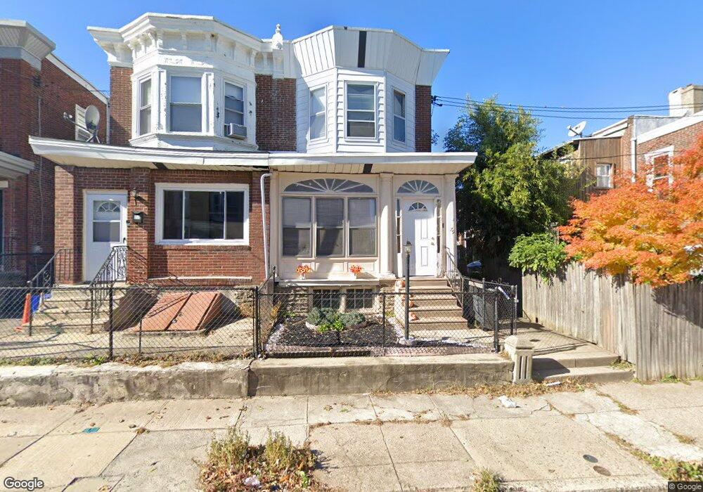
79 E Slocum St Philadelphia, PA 19119
East Mount Airy NeighborhoodEstimated Value: $241,000 - $307,000
4
Beds
1
Bath
1,760
Sq Ft
$158/Sq Ft
Est. Value
About This Home
This home is located at 79 E Slocum St, Philadelphia, PA 19119 and is currently estimated at $278,873, approximately $158 per square foot. 79 E Slocum St is a home located in Philadelphia County with nearby schools including Eleanor C. Emlen School, Roosevelt Theodore Middle School, and Martin Luther King High School.
Ownership History
Date
Name
Owned For
Owner Type
Purchase Details
Closed on
Aug 3, 2005
Sold by
Thompson Alvin B
Bought by
Williams John H
Current Estimated Value
Home Financials for this Owner
Home Financials are based on the most recent Mortgage that was taken out on this home.
Original Mortgage
$101,650
Outstanding Balance
$53,398
Interest Rate
5.66%
Mortgage Type
FHA
Estimated Equity
$225,475
Purchase Details
Closed on
Jul 17, 1997
Sold by
Thompson Ann L and Thompson Alvin B
Bought by
Thompson Alvin B
Create a Home Valuation Report for This Property
The Home Valuation Report is an in-depth analysis detailing your home's value as well as a comparison with similar homes in the area
Home Values in the Area
Average Home Value in this Area
Purchase History
| Date | Buyer | Sale Price | Title Company |
|---|---|---|---|
| Williams John H | $75,000 | -- | |
| Thompson Alvin B | -- | -- |
Source: Public Records
Mortgage History
| Date | Status | Borrower | Loan Amount |
|---|---|---|---|
| Open | Williams John H | $101,650 |
Source: Public Records
Tax History Compared to Growth
Tax History
| Year | Tax Paid | Tax Assessment Tax Assessment Total Assessment is a certain percentage of the fair market value that is determined by local assessors to be the total taxable value of land and additions on the property. | Land | Improvement |
|---|---|---|---|---|
| 2025 | $2,604 | $235,700 | $47,140 | $188,560 |
| 2024 | $2,604 | $235,700 | $47,140 | $188,560 |
| 2023 | $2,604 | $186,000 | $37,200 | $148,800 |
| 2022 | $1,949 | $186,000 | $37,200 | $148,800 |
| 2021 | $1,949 | $0 | $0 | $0 |
| 2020 | $1,949 | $0 | $0 | $0 |
| 2019 | $2,034 | $0 | $0 | $0 |
| 2018 | $2,121 | $0 | $0 | $0 |
| 2017 | $2,121 | $0 | $0 | $0 |
| 2016 | $2,121 | $0 | $0 | $0 |
| 2015 | $1,763 | $0 | $0 | $0 |
| 2014 | -- | $131,600 | $15,346 | $116,254 |
| 2012 | -- | $13,248 | $2,099 | $11,149 |
Source: Public Records
Map
Nearby Homes
- 203 E Slocum St Unit A
- 221 E Slocum St
- 122 E Meehan Ave
- 135 E Pleasant St
- 6833 Musgrave St
- 224 E Dorset St
- 101 E Phil Ellena St
- 6714 Bass St
- 213 E E Phil Ellena St
- 231 E Phil Ellena St
- 135 E Springer St
- 20 Pelham Rd
- 70 E Springer St
- 244 E Springer St
- 6807 Chew Ave
- 305 E Vernon Rd
- 6631 Musgrave St
- 6638 Ross St
- 6641 Crowson St
- 6627 Musgrave St
- 77 E Slocum St
- 75 E Slocum St
- 6768 Musgrave St
- 6766 Musgrave St
- 6772 Musgrave St
- 73 E Slocum St
- 6770 Musgrave St
- 6774 Musgrave St
- 6764 Musgrave St
- 71 E Slocum St
- 48 E Pleasant St
- 50 E Pleasant St
- 46 E Pleasant St
- 52 E Pleasant St
- 44 E Pleasant St
- 69 E Slocum St
- 54 E Pleasant St
- 42 E Pleasant St
- 6762 Musgrave St
- 56 E Pleasant St