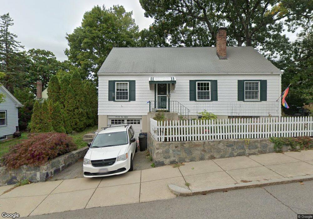
79 Eastland Rd Jamaica Plain, MA 02130
Jamaica Plain NeighborhoodEstimated Value: $694,857 - $891,000
2
Beds
2
Baths
1,368
Sq Ft
$571/Sq Ft
Est. Value
About This Home
This home is located at 79 Eastland Rd, Jamaica Plain, MA 02130 and is currently estimated at $780,964, approximately $570 per square foot. 79 Eastland Rd is a home located in Suffolk County with nearby schools including Brooke Charter School Roslindale, The Croft School - Jamaica Plain, and St. Clare High School.
Ownership History
Date
Name
Owned For
Owner Type
Purchase Details
Closed on
Apr 27, 1994
Sold by
Harris Kathryn R and Venman Thomas C
Bought by
Preble Margaret
Current Estimated Value
Home Financials for this Owner
Home Financials are based on the most recent Mortgage that was taken out on this home.
Original Mortgage
$96,000
Interest Rate
7.7%
Mortgage Type
Purchase Money Mortgage
Create a Home Valuation Report for This Property
The Home Valuation Report is an in-depth analysis detailing your home's value as well as a comparison with similar homes in the area
Home Values in the Area
Average Home Value in this Area
Purchase History
| Date | Buyer | Sale Price | Title Company |
|---|---|---|---|
| Preble Margaret | $128,000 | -- |
Source: Public Records
Mortgage History
| Date | Status | Borrower | Loan Amount |
|---|---|---|---|
| Closed | Preble Margaret | $96,000 |
Source: Public Records
Tax History Compared to Growth
Tax History
| Year | Tax Paid | Tax Assessment Tax Assessment Total Assessment is a certain percentage of the fair market value that is determined by local assessors to be the total taxable value of land and additions on the property. | Land | Improvement |
|---|---|---|---|---|
| 2025 | $6,853 | $591,800 | $179,700 | $412,100 |
| 2024 | $6,419 | $588,900 | $187,800 | $401,100 |
| 2023 | $5,908 | $550,100 | $175,400 | $374,700 |
| 2022 | $5,490 | $504,600 | $160,900 | $343,700 |
| 2021 | $5,227 | $489,900 | $156,200 | $333,700 |
| 2020 | $4,844 | $458,700 | $154,700 | $304,000 |
| 2019 | $4,606 | $437,000 | $126,500 | $310,500 |
| 2018 | $4,088 | $390,100 | $126,500 | $263,600 |
| 2017 | $4,052 | $382,600 | $126,500 | $256,100 |
| 2016 | $4,126 | $375,100 | $126,500 | $248,600 |
| 2015 | $4,130 | $341,000 | $134,600 | $206,400 |
| 2014 | $3,756 | $298,600 | $134,600 | $164,000 |
Source: Public Records
Map
Nearby Homes
- 24 Waterman Rd
- 50 Southbourne Rd
- 105 Neponset Ave Unit 105
- 103 Neponset Ave Unit 103A
- 103-105 Neponset Ave
- 71 Wyvern St
- 602 Canterbury St Unit 14
- 602 Canterbury St Unit 4
- 602 Canterbury St Unit 5
- 602 Canterbury St Unit 2
- 602 Canterbury St Unit 9
- 348-350 Hyde Park Ave Unit 2
- 18-20 Northbourne Rd Unit 18
- 36 Neponset Ave Unit 1
- 579 American Legion Hwy
- 31 Rodman St Unit 2
- 31 Rodman St Unit 1
- 577-579 American Legion Hwy
- 32 Jewett St
- 158 Wachusett St Unit 3
- 75 Eastland Rd
- 114 Bourne St
- 110 Bourne St
- 80 Eastland Rd
- 76 Eastland Rd
- 68 Eastland Rd
- 71 Eastland Rd
- 124 Bourne St
- 64 Eastland Rd
- 106 Bourne St Unit 108
- 42 Wayburn Rd
- 67 Eastland Rd
- 133 Bourne St Unit 135
- 62 Eastland Rd
- 27 Wayburn Rd
- 9 Catherine St
- 102 Bourne St Unit 104
- 38 Wayburn Rd
- 23 Wayburn Rd
- 4 Catherine St Unit 4