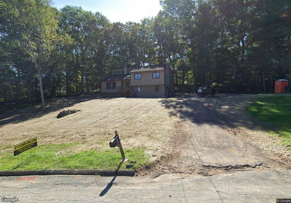
79 Fox Ridge Ln Tolland, CT 06084
Estimated Value: $314,000 - $377,000
3
Beds
3
Baths
1,236
Sq Ft
$287/Sq Ft
Est. Value
About This Home
This home is located at 79 Fox Ridge Ln, Tolland, CT 06084 and is currently estimated at $354,540, approximately $286 per square foot. 79 Fox Ridge Ln is a home located in Tolland County with nearby schools including Birch Grove Primary School, Tolland Intermediate School, and Tolland Middle School.
Ownership History
Date
Name
Owned For
Owner Type
Purchase Details
Closed on
Feb 14, 1995
Sold by
Lacorata Christopher and Lacorata Rhonda
Bought by
Dandurand Mark
Current Estimated Value
Home Financials for this Owner
Home Financials are based on the most recent Mortgage that was taken out on this home.
Original Mortgage
$106,000
Interest Rate
9.18%
Mortgage Type
Unknown
Purchase Details
Closed on
May 29, 1990
Sold by
Zurbrigen Jean
Bought by
Lacorata Chrsitopher
Create a Home Valuation Report for This Property
The Home Valuation Report is an in-depth analysis detailing your home's value as well as a comparison with similar homes in the area
Home Values in the Area
Average Home Value in this Area
Purchase History
| Date | Buyer | Sale Price | Title Company |
|---|---|---|---|
| Dandurand Mark | $136,000 | -- | |
| Dandurand Mark | $136,000 | -- | |
| Lacorata Chrsitopher | $162,000 | -- |
Source: Public Records
Mortgage History
| Date | Status | Borrower | Loan Amount |
|---|---|---|---|
| Closed | Lacorata Chrsitopher | $60,000 | |
| Closed | Lacorata Chrsitopher | $100,000 | |
| Closed | Lacorata Chrsitopher | $106,000 |
Source: Public Records
Tax History Compared to Growth
Tax History
| Year | Tax Paid | Tax Assessment Tax Assessment Total Assessment is a certain percentage of the fair market value that is determined by local assessors to be the total taxable value of land and additions on the property. | Land | Improvement |
|---|---|---|---|---|
| 2025 | $5,218 | $191,900 | $67,800 | $124,100 |
| 2024 | $4,997 | $132,300 | $64,600 | $67,700 |
| 2023 | $3,651 | $97,800 | $64,600 | $33,200 |
| 2022 | $3,578 | $97,800 | $64,600 | $33,200 |
| 2021 | $3,629 | $97,800 | $64,600 | $33,200 |
| 2020 | $3,526 | $97,800 | $64,600 | $33,200 |
| 2019 | $4,787 | $132,800 | $66,600 | $66,200 |
| 2018 | $4,648 | $132,800 | $66,600 | $66,200 |
| 2017 | $4,540 | $132,800 | $66,600 | $66,200 |
| 2016 | $4,540 | $132,800 | $66,600 | $66,200 |
| 2015 | $4,430 | $132,800 | $66,600 | $66,200 |
| 2014 | $4,493 | $144,700 | $74,000 | $70,700 |
Source: Public Records
Map
Nearby Homes
- 10 Depot Rd Unit 25
- 6 Timber Ln
- 527 Merrow Rd
- 38 Homestead Dr
- 454 Merrow Rd
- 10 Summit Dr
- 88 Anthony Rd
- 18 Navratil Rd
- 25 Ridgewood Rd
- 35 Fern Dr
- 45 Luchon Rd
- 312 Merrow Rd
- 97 Cassidy Hill Rd
- 152 Cedar Swamp Rd
- 19 Thomas Dr
- 284 Merrow Rd
- 38 Crystal Ln Unit D
- 45 Crystal Ln Unit D
- 0 Tolland Turnpike Unit 24107059
- 226 Goose Ln
- 80 Fox Ridge Ln
- 87 Fox Ridge Ln
- 70 Fox Ridge Ln
- 73 Fox Ridge Ln
- 97 Fox Ridge Ln
- 69 Fox Ridge Ln
- 105 Fox Ridge Ln
- 62 Fox Ridge Ln
- 63 Fox Ridge Ln
- 59 Fox Ridge Ln
- 92 Fox Ridge Ln
- 115 Fox Ridge Ln
- 63 Nedwied Rd
- 100 Fox Ridge Ln
- 55 Fox Ridge Ln
- 52 Fox Ridge Ln
- 106 Fox Ridge Ln
- 123 Fox Ridge Ln
- 74 Nedwied Rd
- 116 Fox Ridge Ln