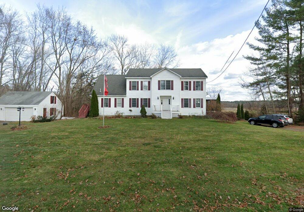
79 Hawthorne Ln Concord, MA 01742
Estimated Value: $1,749,543 - $1,981,000
4
Beds
4
Baths
3,080
Sq Ft
$617/Sq Ft
Est. Value
About This Home
This home is located at 79 Hawthorne Ln, Concord, MA 01742 and is currently estimated at $1,899,136, approximately $616 per square foot. 79 Hawthorne Ln is a home located in Middlesex County with nearby schools including Alcott Elementary School, Concord Middle School, and Concord Carlisle High School.
Ownership History
Date
Name
Owned For
Owner Type
Purchase Details
Closed on
Aug 4, 1992
Sold by
Dalton John P and Dalton Ethel I
Bought by
Dalton David L and Dalton Carol A
Current Estimated Value
Create a Home Valuation Report for This Property
The Home Valuation Report is an in-depth analysis detailing your home's value as well as a comparison with similar homes in the area
Home Values in the Area
Average Home Value in this Area
Purchase History
| Date | Buyer | Sale Price | Title Company |
|---|---|---|---|
| Dalton David L | $209,000 | -- |
Source: Public Records
Mortgage History
| Date | Status | Borrower | Loan Amount |
|---|---|---|---|
| Open | Dalton David L | $232,000 | |
| Closed | Dalton David L | $231,000 | |
| Closed | Dalton David L | $23,000 |
Source: Public Records
Tax History
| Year | Tax Paid | Tax Assessment Tax Assessment Total Assessment is a certain percentage of the fair market value that is determined by local assessors to be the total taxable value of land and additions on the property. | Land | Improvement |
|---|---|---|---|---|
| 2025 | $211 | $1,589,100 | $854,700 | $734,400 |
| 2024 | $20,865 | $1,589,100 | $854,700 | $734,400 |
| 2023 | $19,326 | $1,491,200 | $783,500 | $707,700 |
| 2022 | $18,199 | $1,233,000 | $641,100 | $591,900 |
| 2021 | $17,836 | $1,211,700 | $641,100 | $570,600 |
| 2020 | $17,344 | $1,218,800 | $641,100 | $577,700 |
| 2019 | $16,445 | $1,158,900 | $624,300 | $534,600 |
| 2018 | $16,163 | $1,131,100 | $597,900 | $533,200 |
| 2017 | $15,599 | $1,108,700 | $569,600 | $539,100 |
| 2016 | $15,542 | $1,116,500 | $569,600 | $546,900 |
| 2015 | $14,787 | $1,034,800 | $527,900 | $506,900 |
Source: Public Records
Map
Nearby Homes
- 97 Hawthorne Ln
- 212 Hawthorne Ln
- 612 Lexington Rd
- 96 Independence Rd
- 44 Sarah Way
- 50 Wayside Rd
- 646 Cambridge Turnpike
- 105 Lexington Rd
- 61B Walden St
- 181 Stow St
- 381 Thoreau St
- 143 Everett St
- 165 Everett St
- 150 Hubbard St Unit B
- 46 Sudbury Rd
- 6 Smith Hill Rd
- 9 Garland Rd
- 16 Old Cambridge Turnpike
- 34 Thoreau St
- 34 Thoreau St Unit 34
- 76 Hawthorne Ln
- 54 Hawthorne Ln
- 109 Hawthorne Ln
- 109 Hawthorne Ln Unit 2
- 109 Hawthorne Ln Unit 1
- 121 Hawthorne Ln
- 478 Lexington Rd
- 140 Hawthorne Ln
- 141 Hawthorne Ln
- 21 Hawthorne Ln
- 462 Lexington Rd
- 490 Lexington Rd
- 148 Hawthorne Ln
- 155 Hawthorne Ln
- 500 Lexington Rd
- 162 Hawthorne Ln
- 162 Hawthorne Ln Unit 162
- 510 Lexington Rd
- 410 Lexington Rd
- 532 Lexington Rd
Your Personal Tour Guide
Ask me questions while you tour the home.