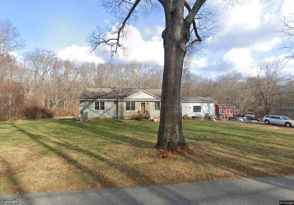
79 Hennequin Rd Columbia, CT 06237
Estimated Value: $353,000 - $413,000
4
Beds
3
Baths
1,920
Sq Ft
$199/Sq Ft
Est. Value
About This Home
This home is located at 79 Hennequin Rd, Columbia, CT 06237 and is currently estimated at $382,245, approximately $199 per square foot. 79 Hennequin Rd is a home located in Tolland County with nearby schools including Horace W. Porter School.
Ownership History
Date
Name
Owned For
Owner Type
Purchase Details
Closed on
Jun 19, 2006
Sold by
Eaton Jason
Bought by
Lembo Philip
Current Estimated Value
Home Financials for this Owner
Home Financials are based on the most recent Mortgage that was taken out on this home.
Original Mortgage
$174,400
Outstanding Balance
$102,442
Interest Rate
6.65%
Estimated Equity
$279,803
Purchase Details
Closed on
Oct 1, 1998
Sold by
Foster Michael and Foster Lisa
Bought by
Eaton Jason
Home Financials for this Owner
Home Financials are based on the most recent Mortgage that was taken out on this home.
Original Mortgage
$102,761
Interest Rate
6.89%
Purchase Details
Closed on
Jul 20, 1987
Sold by
Mozzer Anthony
Bought by
Fosler Michael
Create a Home Valuation Report for This Property
The Home Valuation Report is an in-depth analysis detailing your home's value as well as a comparison with similar homes in the area
Home Values in the Area
Average Home Value in this Area
Purchase History
| Date | Buyer | Sale Price | Title Company |
|---|---|---|---|
| Lembo Philip | $218,000 | -- | |
| Eaton Jason | $102,900 | -- | |
| Fosler Michael | $122,650 | -- |
Source: Public Records
Mortgage History
| Date | Status | Borrower | Loan Amount |
|---|---|---|---|
| Open | Fosler Michael | $174,400 | |
| Closed | Fosler Michael | $43,600 | |
| Previous Owner | Fosler Michael | $102,761 | |
| Previous Owner | Fosler Michael | $102,000 |
Source: Public Records
Tax History Compared to Growth
Tax History
| Year | Tax Paid | Tax Assessment Tax Assessment Total Assessment is a certain percentage of the fair market value that is determined by local assessors to be the total taxable value of land and additions on the property. | Land | Improvement |
|---|---|---|---|---|
| 2025 | $4,520 | $154,420 | $44,940 | $109,480 |
| 2024 | $4,342 | $154,420 | $44,940 | $109,480 |
| 2023 | $4,001 | $154,420 | $44,940 | $109,480 |
| 2022 | $3,995 | $154,420 | $44,940 | $109,480 |
| 2021 | $359 | $135,100 | $45,400 | $89,700 |
| 2020 | $3,962 | $135,100 | $45,400 | $89,700 |
| 2019 | $3,962 | $135,100 | $45,400 | $89,700 |
| 2018 | $3,962 | $135,100 | $45,400 | $89,700 |
| 2017 | $3,902 | $135,100 | $45,400 | $89,700 |
| 2016 | $3,416 | $124,500 | $45,400 | $79,100 |
| 2015 | $3,378 | $124,500 | $45,400 | $79,100 |
| 2014 | $3,378 | $124,500 | $45,400 | $79,100 |
Source: Public Records
Map
Nearby Homes
- 77 Hennequin Rd
- 83 Hennequin Rd
- 250 Route 66
- 80 Hennequin Rd
- 250A Route 66
- 75 Hennequin Rd
- 87 Hennequin Rd
- 252A Route 66
- 0 Pine St Unit G538217
- 0 Pine St Unit G544419
- 0 Pine St Unit G606585
- 0 Pine St Unit G676170
- 0 Pine St Unit G10040247
- 0 Pine St Unit G10108460
- 0 Pine St Unit 24072955
- 0 Pine St Unit 170366670
- 0 Pine St Unit G568519
- 86 Hennequin Rd
- 248 Route 66
- 256 Route 66