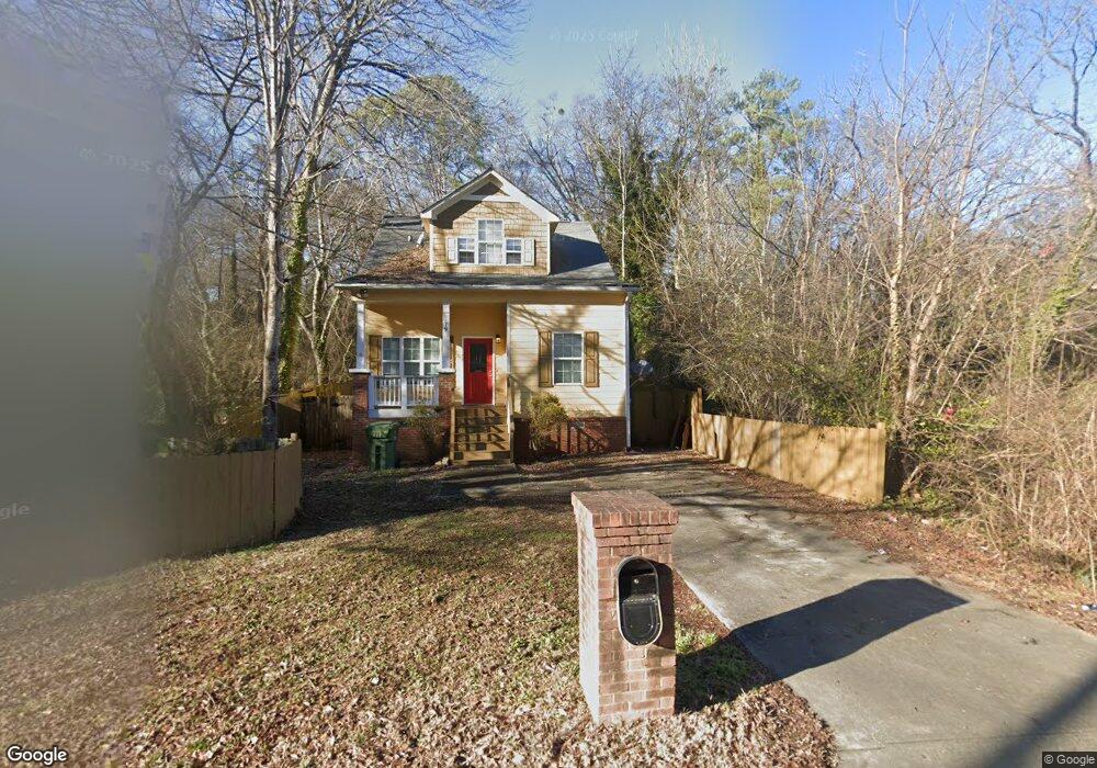
79 Johnson Rd NW Atlanta, GA 30318
Grove Park NeighborhoodEstimated Value: $297,000 - $396,000
4
Beds
3
Baths
1,715
Sq Ft
$199/Sq Ft
Est. Value
About This Home
This home is located at 79 Johnson Rd NW, Atlanta, GA 30318 and is currently estimated at $341,070, approximately $198 per square foot. 79 Johnson Rd NW is a home located in Fulton County with nearby schools including Boyd Elementary School, John Lewis Invictus Academy, and Frederick Douglass High School.
Ownership History
Date
Name
Owned For
Owner Type
Purchase Details
Closed on
Jan 23, 2008
Sold by
Us Bank Na
Bought by
Ram Properties Llc
Current Estimated Value
Purchase Details
Closed on
Sep 4, 2007
Sold by
Brown Laquetta S
Bought by
Us Bank Na
Purchase Details
Closed on
Jul 13, 2006
Sold by
Housedeals Net Inc
Bought by
Brown Laquetta S
Home Financials for this Owner
Home Financials are based on the most recent Mortgage that was taken out on this home.
Original Mortgage
$51,000
Interest Rate
6.6%
Mortgage Type
Stand Alone Refi Refinance Of Original Loan
Purchase Details
Closed on
May 3, 2004
Sold by
Lili Properties Inc & +
Bought by
Habitat Choice Llc
Purchase Details
Closed on
Dec 2, 2003
Sold by
Sheriff Of Fulton County
Bought by
Lili Properties Inc
Create a Home Valuation Report for This Property
The Home Valuation Report is an in-depth analysis detailing your home's value as well as a comparison with similar homes in the area
Home Values in the Area
Average Home Value in this Area
Purchase History
| Date | Buyer | Sale Price | Title Company |
|---|---|---|---|
| Ram Properties Llc | $65,000 | -- | |
| Us Bank Na | $122,400 | -- | |
| Brown Laquetta S | $255,000 | -- | |
| Habitat Choice Llc | $29,500 | -- | |
| Lili Properties Inc | $12,300 | -- |
Source: Public Records
Mortgage History
| Date | Status | Borrower | Loan Amount |
|---|---|---|---|
| Previous Owner | Brown Laquetta S | $51,000 |
Source: Public Records
Tax History Compared to Growth
Tax History
| Year | Tax Paid | Tax Assessment Tax Assessment Total Assessment is a certain percentage of the fair market value that is determined by local assessors to be the total taxable value of land and additions on the property. | Land | Improvement |
|---|---|---|---|---|
| 2025 | $3,226 | $103,320 | $35,520 | $67,800 |
| 2023 | $3,860 | $93,240 | $51,080 | $42,160 |
| 2022 | $3,773 | $93,240 | $51,080 | $42,160 |
| 2021 | $3,853 | $95,120 | $54,160 | $40,960 |
| 2020 | $3,130 | $76,400 | $27,120 | $49,280 |
| 2019 | $485 | $38,080 | $17,200 | $20,880 |
| 2018 | $757 | $18,280 | $4,360 | $13,920 |
| 2017 | $698 | $16,160 | $4,000 | $12,160 |
| 2016 | $700 | $16,160 | $4,000 | $12,160 |
| 2015 | $1,170 | $16,160 | $4,000 | $12,160 |
| 2014 | $713 | $15,720 | $7,720 | $8,000 |
Source: Public Records
Map
Nearby Homes
- 1974 Lois Place NW
- 1981 Lois Place NW
- 1985 Lois Place NW
- 75 Johnson Rd NW
- 2015 Lois Place NW
- 1987 Ruth St NW
- 1039 Margaret Place NW
- 1075 Cato St NW
- 37 Johnson Rd NW
- 965 Cato St NW
- 30 Johnson Rd NW
- 1131 Cato St NW
- 1050 Cato St NW
- 25 Johnson Rd NW
- 1055 Johnson Grove
- 923 N Eugenia Place NW
- 15 Johnson Rd NW
- 81 Johnson Rd NW
- 77 Johnson Rd NW
- 1081 Jones Ave NW
- 114 Johnson Rd NW
- 1978 Lois Place NW
- 1976 Lois Place NW
- 116 Johnson Rd NW
- 1972 Lois Place NW
- 1964 Lois Place NW
- 71 Johnson Rd NW
- 74 Johnson Rd NW
- 1042 Sims Ave NW
- 1074 Jones Ave NW
- 1966 Lois Place NW
- 1952 Lois Place NW
- 72 Johnson Rd NW
- 67 Johnson Rd NW
- 118 Johnson Rd NW Unit A
- 118 Johnson Rd NW
- 118 Johnson Rd NW Unit B