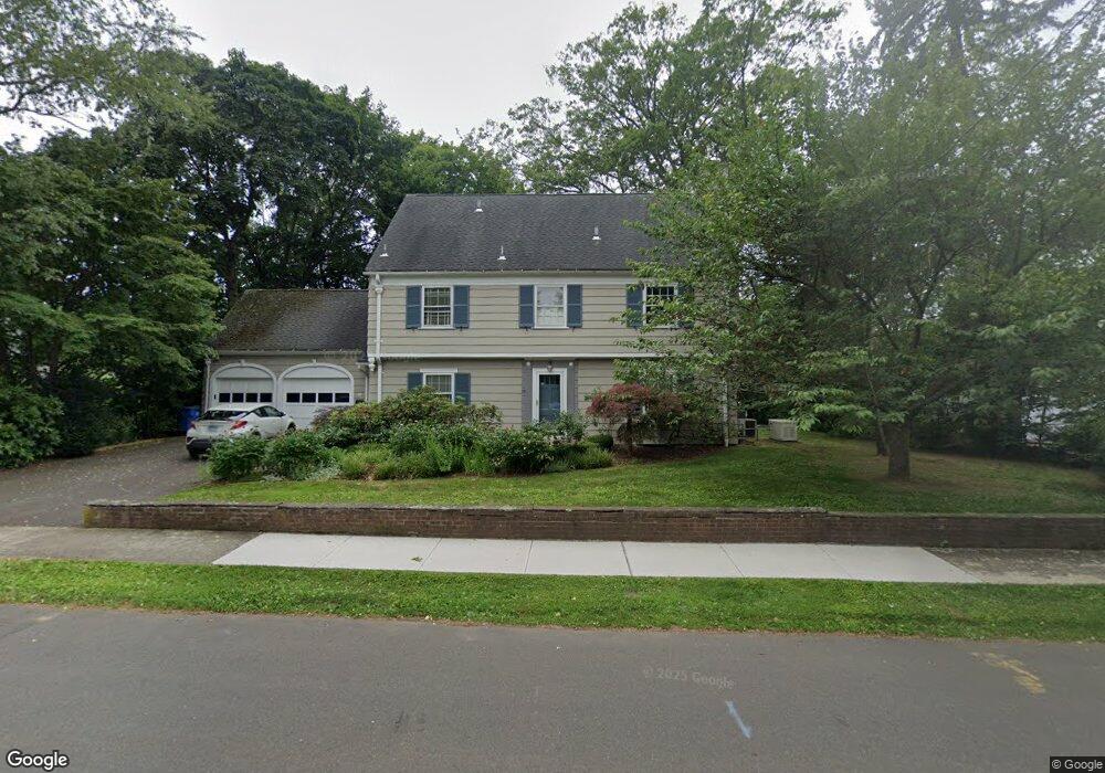
79 Killdeer Rd Hamden, CT 06517
Estimated Value: $745,000 - $1,088,000
6
Beds
4
Baths
3,522
Sq Ft
$243/Sq Ft
Est. Value
About This Home
This home is located at 79 Killdeer Rd, Hamden, CT 06517 and is currently estimated at $856,433, approximately $243 per square foot. 79 Killdeer Rd is a home located in New Haven County with nearby schools including Ridge Hill School, Hamden Middle School, and Hamden High School.
Ownership History
Date
Name
Owned For
Owner Type
Purchase Details
Closed on
Jun 13, 1995
Sold by
Arnstein Robert L
Bought by
Siegel Lesley P and Levenson Lawrence N
Current Estimated Value
Home Financials for this Owner
Home Financials are based on the most recent Mortgage that was taken out on this home.
Original Mortgage
$240,000
Interest Rate
8.21%
Mortgage Type
Unknown
Create a Home Valuation Report for This Property
The Home Valuation Report is an in-depth analysis detailing your home's value as well as a comparison with similar homes in the area
Home Values in the Area
Average Home Value in this Area
Purchase History
| Date | Buyer | Sale Price | Title Company |
|---|---|---|---|
| Siegel Lesley P | $305,000 | -- |
Source: Public Records
Mortgage History
| Date | Status | Borrower | Loan Amount |
|---|---|---|---|
| Closed | Siegel Lesley P | $176,500 | |
| Closed | Siegel Lesley P | $227,000 | |
| Closed | Siegel Lesley P | $240,000 | |
| Previous Owner | Siegel Lesley P | $50,000 |
Source: Public Records
Tax History
| Year | Tax Paid | Tax Assessment Tax Assessment Total Assessment is a certain percentage of the fair market value that is determined by local assessors to be the total taxable value of land and additions on the property. | Land | Improvement |
|---|---|---|---|---|
| 2025 | $29,594 | $570,430 | $135,520 | $434,910 |
| 2024 | $22,955 | $412,790 | $95,900 | $316,890 |
| 2023 | $23,273 | $412,790 | $95,900 | $316,890 |
| 2022 | $22,902 | $412,790 | $95,900 | $316,890 |
| 2021 | $21,647 | $412,790 | $95,900 | $316,890 |
| 2020 | $22,643 | $435,610 | $180,180 | $255,430 |
| 2019 | $21,284 | $435,610 | $180,180 | $255,430 |
| 2018 | $20,892 | $435,610 | $180,180 | $255,430 |
| 2017 | $19,716 | $435,610 | $180,180 | $255,430 |
| 2016 | $19,759 | $435,610 | $180,180 | $255,430 |
| 2015 | $14,714 | $360,010 | $142,100 | $217,910 |
| 2014 | $14,375 | $360,010 | $142,100 | $217,910 |
Source: Public Records
Map
Nearby Homes
- 126 Hartford Turnpike
- 37 Quaker Rd
- 135 London Dr
- 272 Franklin Rd
- 207 Franklin Rd Unit 207
- 1165 Whitney Ave
- 1150 Whitney Ave Unit 5
- 1204 Whitney Ave Unit 118
- 195 Hepburn Rd
- 110 Corbin Rd
- 133 Blake Rd
- 200 Foote St
- 210 Foote St
- 86 Foote St
- 520 Hartford Turnpike
- 42 Carroll Rd
- 159 Augur St
- 2022 Whitney Ave
- 63 Park Rd
- 1412 Whitney Ave Unit J1
- 69 Killdeer Rd
- 89 Killdeer Rd
- 49 Lillibridge Ct
- 80 Killdeer Rd
- 70 Killdeer Rd
- 88 Killdeer Rd
- 47 Lillibridge Ct
- 55 Killdeer Rd
- 96 Killdeer Rd
- 60 Killdeer Rd
- 109 Killdeer Rd
- 53 Lillibridge Ct
- 39 Lillibridge Ct
- 45 Killdeer Rd
- 10 Marshall Rd
- 65 Mulberry Hill
- 110 Killdeer Rd
- 55 Mulberry Hill
- 73 Mulberry Hill
- 31 Lillibridge Ct
Your Personal Tour Guide
Ask me questions while you tour the home.