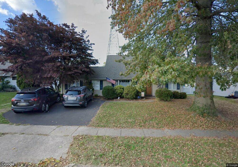
79 Long Loop Rd Levittown, PA 19056
Estimated Value: $420,899 - $463,000
3
Beds
2
Baths
2,147
Sq Ft
$207/Sq Ft
Est. Value
About This Home
This home is located at 79 Long Loop Rd, Levittown, PA 19056 and is currently estimated at $444,725, approximately $207 per square foot. 79 Long Loop Rd is a home located in Bucks County with nearby schools including Walter Miller Elementary School, Sandburg Middle School, and Neshaminy High School.
Ownership History
Date
Name
Owned For
Owner Type
Purchase Details
Closed on
Apr 30, 2019
Sold by
Feuerstein Albert V and Feuerstein Joan
Bought by
Feuerstein Caitlin Marie
Current Estimated Value
Home Financials for this Owner
Home Financials are based on the most recent Mortgage that was taken out on this home.
Original Mortgage
$224,000
Outstanding Balance
$196,941
Interest Rate
4.2%
Mortgage Type
New Conventional
Estimated Equity
$247,784
Purchase Details
Closed on
Apr 6, 1989
Sold by
Bodnar James and Bodnar Joan
Bought by
Feuerstein Albert and Feuerstein Joan
Create a Home Valuation Report for This Property
The Home Valuation Report is an in-depth analysis detailing your home's value as well as a comparison with similar homes in the area
Purchase History
| Date | Buyer | Sale Price | Title Company |
|---|---|---|---|
| Feuerstein Caitlin Marie | $280,000 | First Partners Abstract Co | |
| Feuerstein Albert | $125,000 | -- |
Source: Public Records
Mortgage History
| Date | Status | Borrower | Loan Amount |
|---|---|---|---|
| Open | Feuerstein Caitlin Marie | $224,000 |
Source: Public Records
Tax History
| Year | Tax Paid | Tax Assessment Tax Assessment Total Assessment is a certain percentage of the fair market value that is determined by local assessors to be the total taxable value of land and additions on the property. | Land | Improvement |
|---|---|---|---|---|
| 2025 | $4,426 | $20,330 | $3,720 | $16,610 |
| 2024 | $4,426 | $20,330 | $3,720 | $16,610 |
| 2023 | $4,356 | $20,330 | $3,720 | $16,610 |
| 2022 | $4,241 | $20,330 | $3,720 | $16,610 |
| 2021 | $4,241 | $20,330 | $3,720 | $16,610 |
| 2020 | $4,190 | $20,330 | $3,720 | $16,610 |
| 2019 | $4,097 | $20,330 | $3,720 | $16,610 |
| 2018 | $4,022 | $20,330 | $3,720 | $16,610 |
| 2017 | $3,919 | $20,330 | $3,720 | $16,610 |
| 2016 | $3,919 | $20,330 | $3,720 | $16,610 |
| 2015 | $4,108 | $20,330 | $3,720 | $16,610 |
| 2014 | $4,108 | $20,330 | $3,720 | $16,610 |
Source: Public Records
Map
Nearby Homes
- 43 Petunia Rd
- 6 Unity Turn
- 10 Inbrook Rd
- 24 Rose Apple Rd
- 111 Border Rock Rd
- 21 Border Rock Rd
- 122 Ivy Hill Rd
- 131 Ivy Hill Rd
- 10 Macintosh Rd
- 56 Indian Red Rd
- 194 Cobalt Ridge Dr S Unit S
- 53 Pamela Ct Unit 318
- 1019 Green Ln
- 51 Hollybrooke Dr
- 56 Goldenridge Dr
- 12 Geranium Rd
- 76 Cobalt Ridge Dr E Unit E
- 90 Cobalt Ridge Dr E Unit E
- 2519 Woodlawn Dr
- 2822 Avenue E
- 75 Long Loop Rd
- 83 Long Loop Rd
- 71 Long Loop Rd
- 84 Long Loop Rd
- 85 Long Loop Rd
- 78 Long Loop Rd
- 74 Long Loop Rd
- 86 Long Loop Rd
- 67 Long Loop Rd
- 89 Long Loop Rd
- 30 Limewood Rd
- 33 Limewood Rd
- 65 Long Loop Rd
- 90 Long Loop Rd
- 28 Lower Orchard Dr
- 93 Long Loop Rd
- 6 Larkspur Rd
- 8 Larkspur Rd
- 26 Limewood Rd
- 2 Larkspur Rd
Your Personal Tour Guide
Ask me questions while you tour the home.