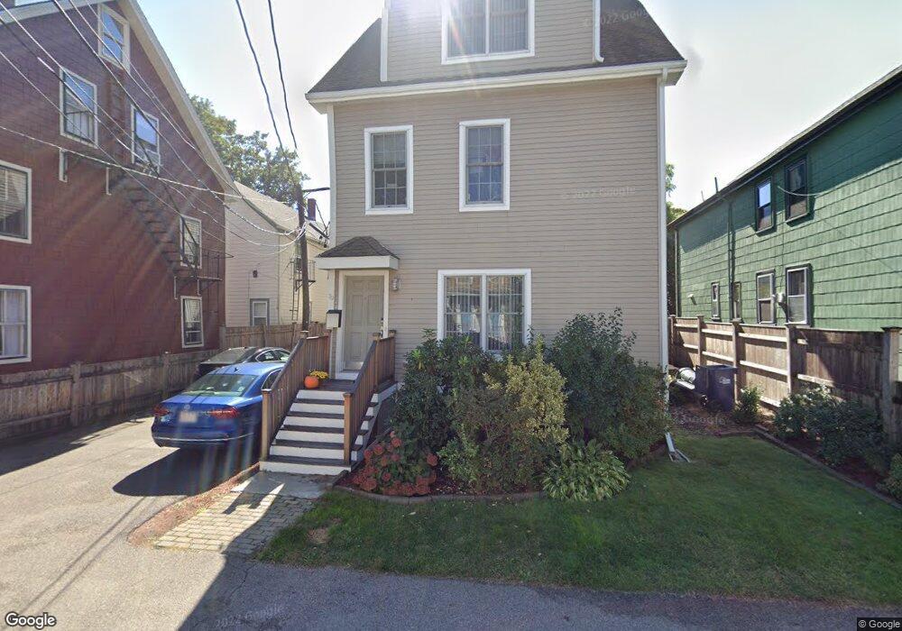
79 Mcbride St Unit 81 Jamaica Plain, MA 02130
Jamaica Plain NeighborhoodEstimated Value: $944,946 - $1,201,000
3
Beds
3
Baths
1,544
Sq Ft
$660/Sq Ft
Est. Value
About This Home
This home is located at 79 Mcbride St Unit 81, Jamaica Plain, MA 02130 and is currently estimated at $1,018,487, approximately $659 per square foot. 79 Mcbride St Unit 81 is a home located in Suffolk County with nearby schools including The Croft School - Jamaica Plain and Neighborhood School.
Ownership History
Date
Name
Owned For
Owner Type
Purchase Details
Closed on
Apr 13, 2010
Sold by
Bryan David R and Bryan Lee W
Bought by
Bryan D Rice
Current Estimated Value
Purchase Details
Closed on
Mar 12, 2007
Sold by
Urban Dev Llc
Bought by
Hanvy Phillip
Home Financials for this Owner
Home Financials are based on the most recent Mortgage that was taken out on this home.
Original Mortgage
$372,000
Interest Rate
6.3%
Mortgage Type
Purchase Money Mortgage
Create a Home Valuation Report for This Property
The Home Valuation Report is an in-depth analysis detailing your home's value as well as a comparison with similar homes in the area
Home Values in the Area
Average Home Value in this Area
Purchase History
| Date | Buyer | Sale Price | Title Company |
|---|---|---|---|
| Bryan D Rice | -- | -- | |
| Hanvy Phillip | $465,000 | -- |
Source: Public Records
Mortgage History
| Date | Status | Borrower | Loan Amount |
|---|---|---|---|
| Previous Owner | Hanvy Phillip | $372,000 |
Source: Public Records
Tax History Compared to Growth
Tax History
| Year | Tax Paid | Tax Assessment Tax Assessment Total Assessment is a certain percentage of the fair market value that is determined by local assessors to be the total taxable value of land and additions on the property. | Land | Improvement |
|---|---|---|---|---|
| 2025 | $9,930 | $857,500 | $0 | $857,500 |
| 2024 | $8,562 | $785,500 | $0 | $785,500 |
| 2023 | $8,032 | $747,900 | $0 | $747,900 |
| 2022 | $7,677 | $705,600 | $0 | $705,600 |
| 2021 | $7,170 | $672,000 | $0 | $672,000 |
| 2020 | $7,122 | $674,400 | $0 | $674,400 |
| 2019 | $6,833 | $648,300 | $0 | $648,300 |
| 2018 | $6,596 | $629,400 | $0 | $629,400 |
| 2017 | $6,289 | $593,900 | $0 | $593,900 |
| 2016 | $6,105 | $555,000 | $0 | $555,000 |
| 2015 | $5,882 | $485,700 | $0 | $485,700 |
| 2014 | $5,940 | $472,200 | $0 | $472,200 |
Source: Public Records
Map
Nearby Homes
- 16 Mcbride St Unit 1
- 16 Mcbride St
- 9-11 Boynton St Unit 2
- 156A South St Unit 1L
- 3531 Washington St Unit 316
- 3531 Washington St Unit 411
- 3531 Washington St Unit 419
- 3531 Washington St Unit 507
- 3531 Washington St Unit 206
- 44 Newbern St
- 96 Jamaica St
- 5 View South Ave Unit 1
- 55 South St
- 55 South St Unit 3
- 76 Elm St Unit G05
- 5 Hampstead Ln Unit 1
- 36 Alveston St
- 69 Williams St Unit 202
- 41 Jamaica St
- 27-29 Ballard St
- 79 Mcbride St Unit 81
- 79 Mcbride St
- 79 Mcbride St
- 79 Mcbride St
- 79 Mcbride St
- 81 Mcbride St Unit 81 Rear
- 81 Mcbride St
- 75 Mcbride St
- 85R Mcbride St
- 85R Mcbride St Unit 1
- 85 Mcbride St
- 85 Mcbride St Unit 1
- 71 Mcbride St
- 71 Mcbride St Unit 2
- 71 Mcbride St Unit 1
- 87 Mcbride St Unit 89
- 88 McBride St 429 000 To
- 69 Mcbride St
- 95 Mcbride St Unit 97
- 58 Boynton St Unit 3