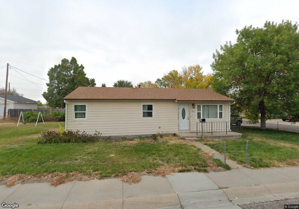
79 Michael St Gering, NE 69341
Estimated Value: $135,000 - $155,000
3
Beds
1
Bath
924
Sq Ft
$156/Sq Ft
Est. Value
About This Home
This home is located at 79 Michael St, Gering, NE 69341 and is currently estimated at $144,006, approximately $155 per square foot. 79 Michael St is a home located in Scotts Bluff County with nearby schools including Gering High School and Community Christian Elementary/Middle School.
Ownership History
Date
Name
Owned For
Owner Type
Purchase Details
Closed on
May 10, 2011
Sold by
Ferreyra Daniel R and Ferreyra Carol A
Bought by
Olenick Nathaniel D and Olenick Emily J
Current Estimated Value
Home Financials for this Owner
Home Financials are based on the most recent Mortgage that was taken out on this home.
Original Mortgage
$60,500
Outstanding Balance
$41,726
Interest Rate
4.87%
Mortgage Type
New Conventional
Estimated Equity
$102,280
Purchase Details
Closed on
Jun 15, 2009
Sold by
Lindquist Eric H
Bought by
Ferreyra Daniel R and Ferreyra Carol A
Purchase Details
Closed on
Oct 6, 2005
Sold by
Mendoza Mary Ann and Mendoza Louis
Bought by
Mendoza Frank A
Home Financials for this Owner
Home Financials are based on the most recent Mortgage that was taken out on this home.
Original Mortgage
$17,700
Interest Rate
6.29%
Mortgage Type
New Conventional
Create a Home Valuation Report for This Property
The Home Valuation Report is an in-depth analysis detailing your home's value as well as a comparison with similar homes in the area
Home Values in the Area
Average Home Value in this Area
Purchase History
| Date | Buyer | Sale Price | Title Company |
|---|---|---|---|
| Olenick Nathaniel D | $68,000 | -- | |
| Ferreyra Daniel R | $17,050 | -- | |
| Mendoza Frank A | -- | -- |
Source: Public Records
Mortgage History
| Date | Status | Borrower | Loan Amount |
|---|---|---|---|
| Open | Olenick Nathaniel D | $60,500 | |
| Previous Owner | Mendoza Frank A | $17,700 |
Source: Public Records
Tax History
| Year | Tax Paid | Tax Assessment Tax Assessment Total Assessment is a certain percentage of the fair market value that is determined by local assessors to be the total taxable value of land and additions on the property. | Land | Improvement |
|---|---|---|---|---|
| 2025 | $1,984 | $113,865 | $13,650 | $100,215 |
| 2024 | $1,834 | $102,690 | $10,750 | $91,940 |
| 2023 | $1,977 | $88,911 | $9,100 | $79,811 |
| 2022 | $1,977 | $88,911 | $9,100 | $79,811 |
| 2021 | $2,000 | $88,911 | $9,100 | $79,811 |
| 2020 | $1,693 | $73,987 | $9,100 | $64,887 |
| 2019 | $1,603 | $69,742 | $9,100 | $60,642 |
| 2018 | $1,613 | $69,742 | $9,100 | $60,642 |
| 2017 | $1,556 | $66,854 | $9,100 | $57,754 |
| 2016 | $1,458 | $66,854 | $9,100 | $57,754 |
| 2015 | $1,463 | $66,854 | $9,100 | $57,754 |
| 2014 | $1,442 | $65,172 | $9,100 | $56,072 |
| 2012 | -- | $65,172 | $9,100 | $56,072 |
Source: Public Records
Map
Nearby Homes
Your Personal Tour Guide
Ask me questions while you tour the home.