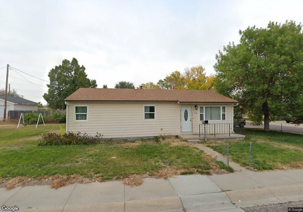
79 Michael St Gering, NE 69341
Estimated Value: $140,000 - $153,000
About This Home
This home is located at 79 Michael St, Gering, NE 69341 and is currently estimated at $146,922, approximately $159 per square foot. 79 Michael St is a home located in Scotts Bluff County with nearby schools including Gering High School and Community Christian Elementary/Middle School.
Ownership History
We collect this data history from publicly available records. To have your information removed, we recommend requesting removal directly through your county’s website.
Purchase Details
Home Financials for this Owner
Home Financials are based on the most recent Mortgage that was taken out on this home.Purchase Details
Purchase Details
Home Financials for this Owner
Home Financials are based on the most recent Mortgage that was taken out on this home.Home Values in the Area
Average Home Value in this Area
Purchase History
We collect this data history from publicly available records. To have your information removed, we recommend requesting removal directly through your county’s website.
| Date | Buyer | Sale Price | Title Company |
|---|---|---|---|
| $68,000 | -- | ||
| $17,050 | -- | ||
| -- | -- |
Mortgage History
We collect this data history from publicly available records. To have your information removed, we recommend requesting removal directly through your county’s website.
| Date | Status | Borrower | Loan Amount |
|---|---|---|---|
| Open | $60,500 | ||
| Previous Owner | $17,700 |
Tax History
We collect this data history from publicly available records. To have your information removed, we recommend requesting removal directly through your county’s website.
| Year | Tax Paid | Tax Assessment Tax Assessment Total Assessment is a certain percentage of the fair market value that is determined by local assessors to be the total taxable value of land and additions on the property. | Land | Improvement |
|---|---|---|---|---|
| 2025 | $1,984 | $113,865 | $13,650 | $100,215 |
| 2024 | $1,834 | $102,690 | $10,750 | $91,940 |
| 2023 | $1,977 | $88,911 | $9,100 | $79,811 |
| 2022 | $1,977 | $88,911 | $9,100 | $79,811 |
| 2021 | $2,000 | $88,911 | $9,100 | $79,811 |
| 2020 | $1,693 | $73,987 | $9,100 | $64,887 |
| 2019 | $1,603 | $69,742 | $9,100 | $60,642 |
| 2018 | $1,613 | $69,742 | $9,100 | $60,642 |
| 2017 | $1,556 | $66,854 | $9,100 | $57,754 |
| 2016 | $1,458 | $66,854 | $9,100 | $57,754 |
| 2015 | $1,463 | $66,854 | $9,100 | $57,754 |
| 2014 | $1,442 | $65,172 | $9,100 | $56,072 |
| 2012 | -- | $65,172 | $9,100 | $56,072 |
Map
- 1730 Nelson Ave
- 2610 Pacific Blvd
- 1925 Country Club Rd
- 11 Toluca Ln
- 1745 Laurel Ave
- 47 Western Dr
- 2210 Pacific Blvd
- 1850 Kings Rd
- 30 Ridge Dr Unit 30 1/2
- 54 Ridge Dr
- 2340 Lariat Loop
- 2130 21st St
- 1805 Bluff View Dr
- 2775 Grandview Rd
- 1955 12th St
- 1970 20th St
- 802 9th Ave
- 1750 6th St
- Lot 3B O St
- Lot 3A O St
- 24 Michael St
- 23 Michael St
- 25 Michael St
- 22 Michael St
- 26 Michael St
- 9 Country Club Rd
- 8 Country Club Rd
- 10 Country Club Rd
- 7 Country Club Rd
- 21 Michael St
- 11 Country Club Rd
- 80 Michael St
- 81 Michael St
- 6 Country Club Rd
- 78 Barbara Ln
- 82 Michael St
- 12 Country Club Rd
- 28 Michael St
- 20 Michael St
- 83 Michael St
Ask me questions while you tour the home.