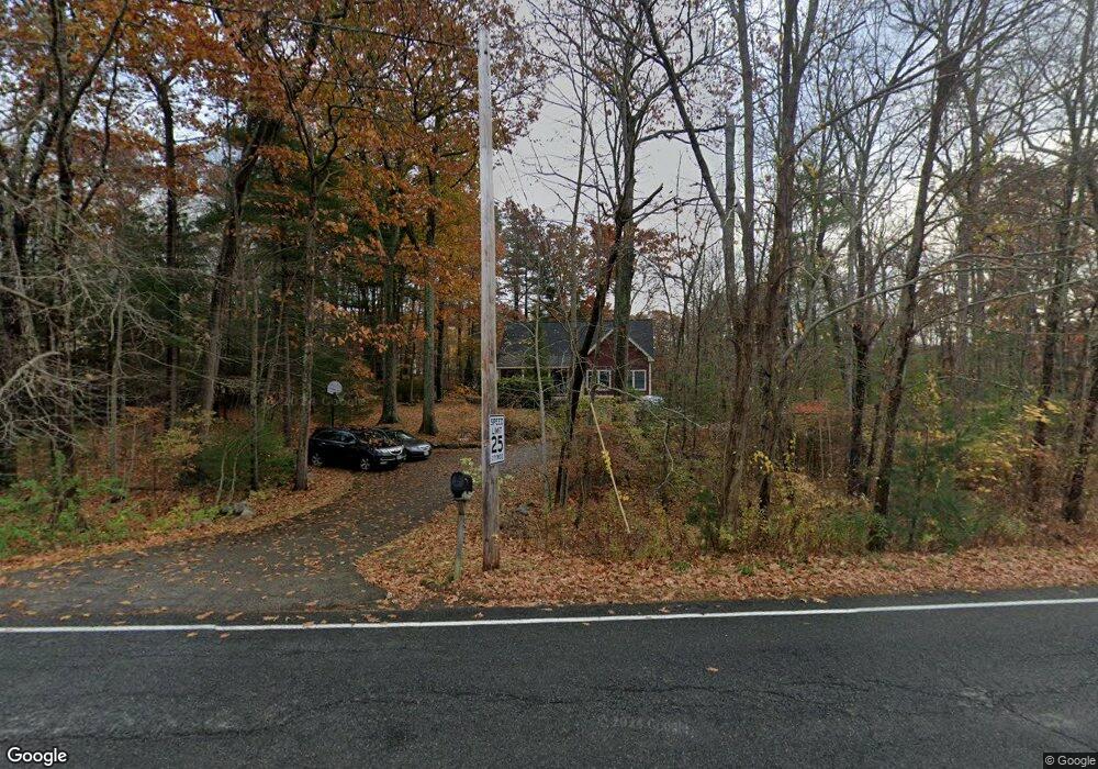
79 Middle Rd Amesbury, MA 01913
Estimated Value: $798,000 - $957,000
3
Beds
2
Baths
2,520
Sq Ft
$348/Sq Ft
Est. Value
About This Home
This home is located at 79 Middle Rd, Amesbury, MA 01913 and is currently estimated at $876,878, approximately $347 per square foot. 79 Middle Rd is a home located in Essex County with nearby schools including Amesbury High School and Amesbury Seventh-Day Adventist School.
Ownership History
Date
Name
Owned For
Owner Type
Purchase Details
Closed on
Jul 3, 2018
Sold by
White Emily
Bought by
White Emily and Hauck Matthew
Current Estimated Value
Purchase Details
Closed on
Jul 28, 2011
Sold by
Fhlmc
Bought by
White Emily
Home Financials for this Owner
Home Financials are based on the most recent Mortgage that was taken out on this home.
Original Mortgage
$130,000
Interest Rate
4.52%
Mortgage Type
Purchase Money Mortgage
Purchase Details
Closed on
Oct 4, 2010
Sold by
Abt Michael P
Bought by
Fhlmc
Purchase Details
Closed on
Sep 12, 2003
Sold by
Abt Michael P and Maracas Myriam A
Bought by
Abt Michael P
Purchase Details
Closed on
May 31, 2001
Sold by
Ryben Rt
Bought by
Abt Michael P and Maracas Myriam A
Purchase Details
Closed on
May 12, 2000
Sold by
Goodwin Robert I
Bought by
Ryben Rt
Create a Home Valuation Report for This Property
The Home Valuation Report is an in-depth analysis detailing your home's value as well as a comparison with similar homes in the area
Home Values in the Area
Average Home Value in this Area
Purchase History
| Date | Buyer | Sale Price | Title Company |
|---|---|---|---|
| White Emily | -- | -- | |
| White Emily | $210,000 | -- | |
| Fhlmc | $358,162 | -- | |
| Abt Michael P | $70,000 | -- | |
| Abt Michael P | $259,900 | -- | |
| Ryben Rt | $65,000 | -- |
Source: Public Records
Mortgage History
| Date | Status | Borrower | Loan Amount |
|---|---|---|---|
| Previous Owner | Ryben Rt | $130,000 | |
| Previous Owner | Ryben Rt | $348,750 |
Source: Public Records
Tax History Compared to Growth
Tax History
| Year | Tax Paid | Tax Assessment Tax Assessment Total Assessment is a certain percentage of the fair market value that is determined by local assessors to be the total taxable value of land and additions on the property. | Land | Improvement |
|---|---|---|---|---|
| 2025 | $12,459 | $814,300 | $286,200 | $528,100 |
| 2024 | $12,481 | $798,000 | $269,900 | $528,100 |
| 2023 | $10,994 | $672,800 | $234,700 | $438,100 |
| 2022 | $10,025 | $566,700 | $204,100 | $362,600 |
| 2021 | $9,545 | $523,000 | $157,900 | $365,100 |
| 2020 | $8,994 | $523,500 | $151,800 | $371,700 |
| 2019 | $8,933 | $486,300 | $151,800 | $334,500 |
| 2018 | $8,893 | $468,300 | $144,400 | $323,900 |
| 2017 | $8,495 | $425,800 | $144,400 | $281,400 |
| 2016 | $8,386 | $413,500 | $144,400 | $269,100 |
| 2015 | $8,323 | $405,200 | $144,400 | $260,800 |
| 2014 | $7,574 | $361,200 | $144,400 | $216,800 |
Source: Public Records
Map
Nearby Homes
- 50 Middle Rd
- 10 Olde Taverne Ln
- 160 Haverhill Rd
- 8 Old County Rd
- 3 Cottage Ln
- 8 Glenn Rd
- 3 Marshall Dr
- 16 Emery St
- 5 Hillside Ave
- 10 Sharon Cir
- 4 Acadia Kimball Rd
- 1 B St
- 3 B St
- 73 Kimball Rd
- 151 River Rd
- 13 Bailey Pond Ln Unit 13
- 5 Moncrief St Unit 1
- 19 Cutter Ln Unit 19
- 188 Lions Mouth Rd
- 39 High St