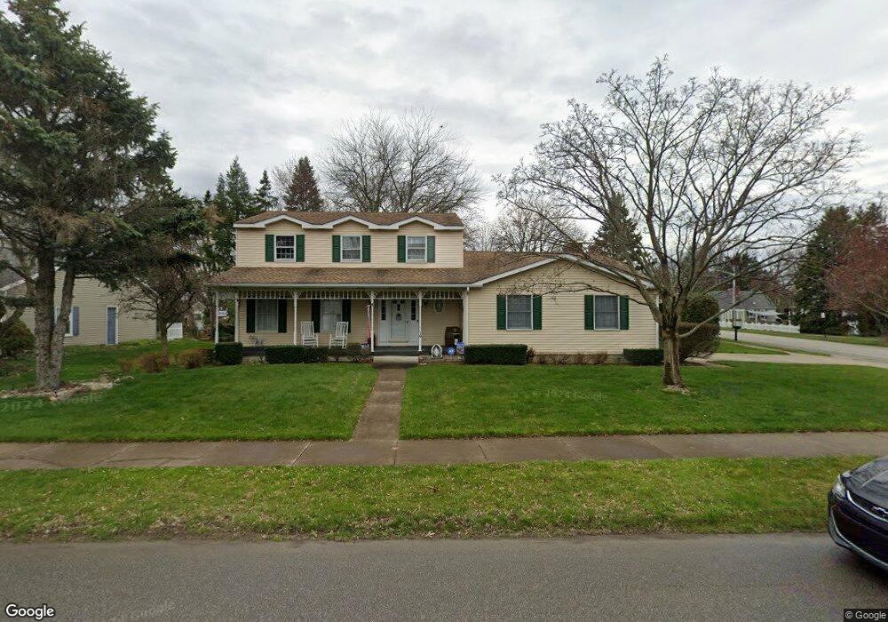
79 Niagara St North East, PA 16428
Estimated Value: $313,000 - $377,000
4
Beds
3
Baths
2,348
Sq Ft
$152/Sq Ft
Est. Value
About This Home
This home is located at 79 Niagara St, North East, PA 16428 and is currently estimated at $356,195, approximately $151 per square foot. 79 Niagara St is a home located in Erie County with nearby schools including Earle C. Davis Primary School, North East Intermediate Elementary School, and North East Middle School.
Ownership History
Date
Name
Owned For
Owner Type
Purchase Details
Closed on
Aug 2, 2019
Sold by
Hitchcock Victor J
Bought by
Ames Stephen P and Ames Christine L Fiiutze
Current Estimated Value
Home Financials for this Owner
Home Financials are based on the most recent Mortgage that was taken out on this home.
Original Mortgage
$224,627
Outstanding Balance
$197,135
Interest Rate
3.8%
Mortgage Type
VA
Estimated Equity
$159,060
Purchase Details
Closed on
Apr 26, 2019
Sold by
Hitchcock Victor J and Hain Mary Margaret
Bought by
Hitchcock Victor J
Create a Home Valuation Report for This Property
The Home Valuation Report is an in-depth analysis detailing your home's value as well as a comparison with similar homes in the area
Home Values in the Area
Average Home Value in this Area
Purchase History
| Date | Buyer | Sale Price | Title Company |
|---|---|---|---|
| Ames Stephen P | $219,900 | None Available | |
| Hitchcock Victor J | -- | None Available |
Source: Public Records
Mortgage History
| Date | Status | Borrower | Loan Amount |
|---|---|---|---|
| Open | Ames Stephen P | $224,627 |
Source: Public Records
Tax History Compared to Growth
Tax History
| Year | Tax Paid | Tax Assessment Tax Assessment Total Assessment is a certain percentage of the fair market value that is determined by local assessors to be the total taxable value of land and additions on the property. | Land | Improvement |
|---|---|---|---|---|
| 2025 | $5,626 | $202,450 | $35,300 | $167,150 |
| 2024 | $5,452 | $202,450 | $35,300 | $167,150 |
| 2023 | $5,205 | $202,450 | $35,300 | $167,150 |
| 2022 | $5,093 | $202,450 | $35,300 | $167,150 |
| 2021 | $5,039 | $202,450 | $35,300 | $167,150 |
| 2020 | $4,988 | $202,450 | $35,300 | $167,150 |
| 2019 | $4,988 | $202,450 | $35,300 | $167,150 |
| 2018 | $4,899 | $202,450 | $35,300 | $167,150 |
| 2017 | $4,846 | $202,450 | $35,300 | $167,150 |
| 2016 | $5,516 | $202,450 | $35,300 | $167,150 |
| 2015 | $5,465 | $202,450 | $35,300 | $167,150 |
| 2014 | $2,915 | $202,450 | $35,300 | $167,150 |
Source: Public Records
Map
Nearby Homes
- 51 E Main St
- 2165 Freeport Rd
- 0 Concord Dr
- 1648 Freeport Rd
- 4709 Cedar Dr
- 48 N Pearl St
- 128 Grahamville St
- 107 Jefferson St
- 55 S Pearl St
- 131 Wellington St
- 5321 Loomis St Unit 12
- 126 Pine Tree Ln
- 0 Ackerman Ln
- 10644 W Main Rd Unit 170
- 10644 W Main Rd Unit 155C
- 10644 W Main St Unit 155D
- 2085 Cemetery Rd
- 51 Freeport Rd
- 11697 Old Lake Rd
- 8552 Ox Bow Rd
- 81 Niagara St
- 80 E Division St
- 15 N Washington St
- 90 E Division St
- 77 Isabella St
- 76 Catawba Dr
- 83 Niagara St
- 78 E Division St
- 76 E Division St
- 94 E Division St
- 78 Isabella St
- 74 E Division St
- 71 Catawba Dr
- 79 Isabella St
- 78 Catawba Dr
- 96 E Division St
- 85 Niagara St
- 72 E Division St
- 87 E Division St
- 73 Catawba Dr