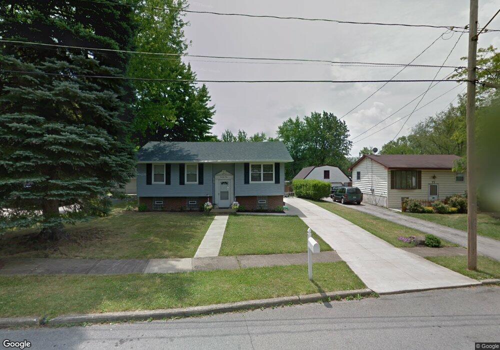
79 Notre Dame Dr Campbell, OH 44405
Estimated Value: $113,000 - $134,000
3
Beds
2
Baths
1,304
Sq Ft
$94/Sq Ft
Est. Value
About This Home
This home is located at 79 Notre Dame Dr, Campbell, OH 44405 and is currently estimated at $122,341, approximately $93 per square foot. 79 Notre Dame Dr is a home located in Mahoning County with nearby schools including Campbell Elementary School, Northeast Ohio Impact Academy, and Memorial High School.
Ownership History
Date
Name
Owned For
Owner Type
Purchase Details
Closed on
Feb 12, 2007
Sold by
Pizarro Raul
Bought by
Pizarro Nancy
Current Estimated Value
Purchase Details
Closed on
Feb 12, 2001
Sold by
Noseworthy Thomas V
Bought by
Pizarro Raul and Pizarro Nancy
Home Financials for this Owner
Home Financials are based on the most recent Mortgage that was taken out on this home.
Original Mortgage
$40,000
Interest Rate
7.06%
Purchase Details
Closed on
May 27, 1994
Bought by
Noseworthy Thomas and E L
Create a Home Valuation Report for This Property
The Home Valuation Report is an in-depth analysis detailing your home's value as well as a comparison with similar homes in the area
Home Values in the Area
Average Home Value in this Area
Purchase History
| Date | Buyer | Sale Price | Title Company |
|---|---|---|---|
| Pizarro Nancy | -- | Attorney | |
| Pizarro Raul | $51,000 | -- | |
| Noseworthy Thomas | $36,000 | -- |
Source: Public Records
Mortgage History
| Date | Status | Borrower | Loan Amount |
|---|---|---|---|
| Previous Owner | Pizarro Raul | $40,000 |
Source: Public Records
Tax History
| Year | Tax Paid | Tax Assessment Tax Assessment Total Assessment is a certain percentage of the fair market value that is determined by local assessors to be the total taxable value of land and additions on the property. | Land | Improvement |
|---|---|---|---|---|
| 2025 | $1,324 | $25,230 | $2,970 | $22,260 |
| 2024 | $1,324 | $25,230 | $2,970 | $22,260 |
| 2023 | $1,308 | $25,230 | $2,970 | $22,260 |
| 2022 | $1,160 | $18,720 | $2,980 | $15,740 |
| 2021 | $1,051 | $18,150 | $2,980 | $15,170 |
| 2020 | $1,068 | $18,150 | $2,980 | $15,170 |
| 2019 | $1,062 | $16,060 | $2,640 | $13,420 |
| 2018 | $1,088 | $16,060 | $2,640 | $13,420 |
| 2017 | $1,085 | $16,060 | $2,640 | $13,420 |
| 2016 | $1,122 | $17,630 | $3,000 | $14,630 |
| 2015 | $1,099 | $17,630 | $3,000 | $14,630 |
| 2014 | -- | $17,630 | $3,000 | $14,630 |
| 2013 | $1,074 | $17,630 | $3,000 | $14,630 |
Source: Public Records
Map
Nearby Homes
- 97 Rosary Dr
- 3307 Upland Ave
- 3343 Lawnview Ave
- 127 Blackburn St
- 1414 Overlook Ave
- 611 Matawan Dr
- 653 Chapel Ln
- 51 Highland Ave
- 628 Matawan Dr
- 121 Princess St
- 151 Regent St
- 159 Piccadilly St
- 204 Tremble Ave
- 165 Piccadilly St
- 291 Struthers Liberty Rd
- 664 Tenney Ave
- 459 Tenney Ave
- 629 Hyatt Ave
- 667 Hyatt Ave
- 130 12th St
- 81 Notre Dame Dr
- 77 Notre Dame Dr
- 83 Notre Dame Dr
- 75 Notre Dame Dr
- 85 Notre Dame Dr
- 73 Notre Dame Dr
- 408 Lourdes Ln
- 86 Notre Dame Dr
- 87 Notre Dame Dr
- 71 Notre Dame Dr
- 404 Lourdes Ln
- 89 Notre Dame Dr
- 69 Notre Dame Dr
- 88 Notre Dame Dr
- 395 Lourdes Ln
- 400 Lourdes Ln
- 90 Notre Dame Dr
- 91 Notre Dame Dr
- 388 Maryknoll Ave
- 396 Lourdes Ln
Your Personal Tour Guide
Ask me questions while you tour the home.