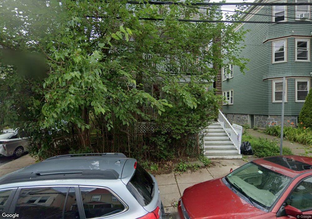
79 Paul Gore St Jamaica Plain, MA 02130
Jamaica Plain NeighborhoodEstimated Value: $1,106,000 - $1,820,000
6
Beds
3
Baths
3,688
Sq Ft
$382/Sq Ft
Est. Value
About This Home
This home is located at 79 Paul Gore St, Jamaica Plain, MA 02130 and is currently estimated at $1,410,426, approximately $382 per square foot. 79 Paul Gore St is a home located in Suffolk County with nearby schools including Nativity Preparatory School and Meridian Academy.
Ownership History
Date
Name
Owned For
Owner Type
Purchase Details
Closed on
Dec 22, 2015
Sold by
Gibbs Terrell Est
Bought by
Kaiser Cathleen G
Current Estimated Value
Purchase Details
Closed on
Jun 8, 2000
Sold by
Sarango Pedro and Sarango Patricia
Bought by
Gibbs Terrell T
Create a Home Valuation Report for This Property
The Home Valuation Report is an in-depth analysis detailing your home's value as well as a comparison with similar homes in the area
Home Values in the Area
Average Home Value in this Area
Purchase History
| Date | Buyer | Sale Price | Title Company |
|---|---|---|---|
| Kaiser Cathleen G | -- | -- | |
| Gibbs Terrell T | $380,000 | -- |
Source: Public Records
Mortgage History
| Date | Status | Borrower | Loan Amount |
|---|---|---|---|
| Previous Owner | Gibbs Terrell T | $312,218 | |
| Previous Owner | Gibbs Terrell T | $330,000 | |
| Previous Owner | Gibbs Terrell T | $344,000 |
Source: Public Records
Tax History Compared to Growth
Tax History
| Year | Tax Paid | Tax Assessment Tax Assessment Total Assessment is a certain percentage of the fair market value that is determined by local assessors to be the total taxable value of land and additions on the property. | Land | Improvement |
|---|---|---|---|---|
| 2025 | $15,412 | $1,330,900 | $472,200 | $858,700 |
| 2024 | $14,649 | $1,343,900 | $351,700 | $992,200 |
| 2023 | $14,433 | $1,343,900 | $351,700 | $992,200 |
| 2022 | $13,664 | $1,255,900 | $328,700 | $927,200 |
| 2021 | $12,523 | $1,173,700 | $307,200 | $866,500 |
| 2020 | $11,790 | $1,116,500 | $294,400 | $822,100 |
| 2019 | $10,695 | $1,014,700 | $227,300 | $787,400 |
| 2018 | $9,848 | $939,700 | $227,300 | $712,400 |
| 2017 | $9,951 | $939,700 | $227,300 | $712,400 |
| 2016 | $9,483 | $862,100 | $227,300 | $634,800 |
| 2015 | $8,138 | $672,000 | $159,000 | $513,000 |
| 2014 | $7,328 | $582,500 | $159,000 | $423,500 |
Source: Public Records
Map
Nearby Homes
- 43 Boylston St
- 23 Burr St
- 90 Boylston St Unit 1
- 11 Spring Park Ave Unit B
- 32 Forbes St
- 71 Mozart St Unit 3
- 11 Robinwood Ave
- 68 Perkins St Unit 1
- 10 Bynner St
- 8 Marbury Terrace Unit 3
- 45 Parley Ave
- 277 Lamartine St Unit 1
- 277 Lamartine St
- 12 Zamora St
- 584 Centre St
- 285 Lamartine St Unit 2
- 285 Lamartine St
- 65-67 Halifax St
- 175 School St Unit 2
- 11 Gay Head St
- 79 Paul Gore St Unit 3
- 79 Paul Gore St Unit 1
- 75 Paul Gore St Unit 3
- 75 Paul Gore St Unit 2
- 75 Paul Gore St Unit 1
- 75 Paul Gore St
- 83 Paul Gore St Unit 1R
- 71 Paul Gore St Unit 3
- 71 Paul Gore St Unit 2
- 71 Paul Gore St Unit 1
- 9 Saint Peter St Unit 11
- 82 Paul Gore St Unit 84
- 88 Paul Gore St
- 8 Saint Peter St Unit 3
- 8 Saint Peter St Unit 2
- 8 Saint Peter St Unit 1
- 87 Paul Gore St Unit 3
- 87 Paul Gore St Unit 2
- 87 Paul Gore St Unit 1
- 80 Paul Gore St Unit 2