Estimated Value: $145,000 - $164,000
3
Beds
1
Bath
1,240
Sq Ft
$127/Sq Ft
Est. Value
About This Home
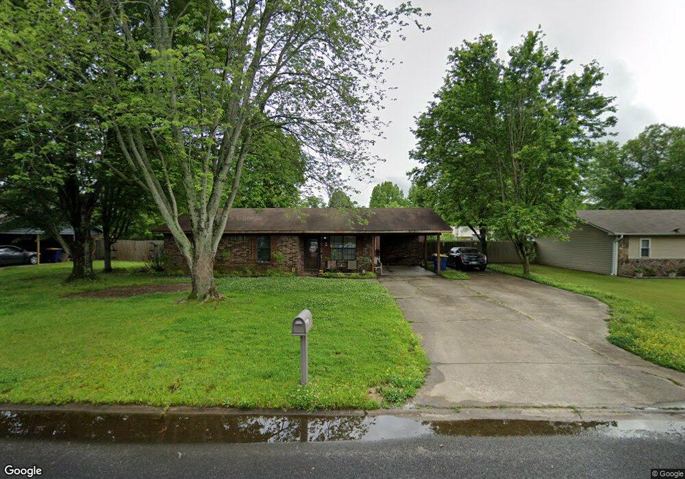
This home is located at 79 Pear St, Cabot, AR 72023 and is currently estimated at $156,965, approximately $126 per square foot. 79 Pear St is a home located in Lonoke County with nearby schools including Central Elementary School, Cabot Junior High South, and Cabot Middle School South.
Ownership History
Date
Name
Owned For
Owner Type
Purchase Details
Closed on
Nov 9, 2017
Sold by
Young Jami M and Garrett Jami M
Bought by
Meleney Douglas Charles
Current Estimated Value
Home Financials for this Owner
Home Financials are based on the most recent Mortgage that was taken out on this home.
Original Mortgage
$85,000
Outstanding Balance
$71,339
Interest Rate
3.91%
Mortgage Type
VA
Estimated Equity
$85,626
Purchase Details
Closed on
Aug 6, 2010
Sold by
Hutchinson John P and Hutchinson Debra L
Bought by
Davis Layton Shane and Garrett Jami M
Purchase Details
Closed on
Jul 28, 2010
Sold by
Hutchinson John P and Hutchinson Debra L
Bought by
Davis Layton Shane and Garrett Jami M
Purchase Details
Closed on
Feb 14, 1983
Bought by
Hutchinson and Wife Debra
Purchase Details
Closed on
Sep 29, 1982
Bought by
George
Create a Home Valuation Report for This Property
The Home Valuation Report is an in-depth analysis detailing your home's value as well as a comparison with similar homes in the area
Purchase History
| Date | Buyer | Sale Price | Title Company |
|---|---|---|---|
| Meleney Douglas Charles | $85,000 | Lenders Title Company | |
| Davis Layton Shane | -- | -- | |
| Davis Layton Shane | -- | -- | |
| Hutchinson | $41,000 | -- | |
| Hutchinson | $41,000 | -- | |
| George | $7,000 | -- |
Source: Public Records
Mortgage History
| Date | Status | Borrower | Loan Amount |
|---|---|---|---|
| Open | Meleney Douglas Charles | $85,000 |
Source: Public Records
Tax History
| Year | Tax Paid | Tax Assessment Tax Assessment Total Assessment is a certain percentage of the fair market value that is determined by local assessors to be the total taxable value of land and additions on the property. | Land | Improvement |
|---|---|---|---|---|
| 2025 | $555 | $19,260 | $2,000 | $17,260 |
| 2024 | $555 | $19,260 | $2,000 | $17,260 |
| 2023 | $555 | $19,260 | $2,000 | $17,260 |
| 2022 | $605 | $19,260 | $2,000 | $17,260 |
| 2021 | $605 | $19,260 | $2,000 | $17,260 |
| 2020 | $583 | $18,830 | $2,000 | $16,830 |
| 2019 | $583 | $18,830 | $2,000 | $16,830 |
| 2018 | $580 | $18,830 | $2,000 | $16,830 |
| 2017 | $864 | $18,830 | $2,000 | $16,830 |
| 2016 | $930 | $18,830 | $2,000 | $16,830 |
| 2015 | $891 | $18,030 | $2,000 | $16,030 |
| 2014 | $891 | $18,030 | $2,000 | $16,030 |
Source: Public Records
Map
Nearby Homes
- 49 Oak Meadows Dr
- 92 Sycamore Cir
- 51 Meadowlark Dr
- 34 Bent Tree Dr
- 16 Meadowlark Dr
- 00 Kerr Station Rd
- 37 Pond St
- 23 Robinson St
- 20 Paige Ave
- 509 E Myrtle St
- 00 Plaza Blvd
- 19 Sycamore St
- 28 Pheasant Run Dr
- 113 Walnut St
- 37 Saint John St
- 110 N Monroe St
- 12 Bellaire Dr
- 38 S 10th St
- 211 N Jackson St
- 22 Century Cir
Your Personal Tour Guide
Ask me questions while you tour the home.