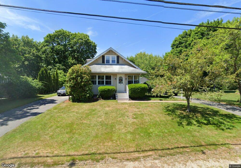
79 Phillips St Hanson, MA 02341
Estimated Value: $418,089 - $531,000
4
Beds
2
Baths
1,336
Sq Ft
$364/Sq Ft
Est. Value
About This Home
This home is located at 79 Phillips St, Hanson, MA 02341 and is currently estimated at $486,272, approximately $363 per square foot. 79 Phillips St is a home located in Plymouth County.
Ownership History
Date
Name
Owned For
Owner Type
Purchase Details
Closed on
Jun 29, 2004
Sold by
Travers David C
Bought by
Travers David C and Rego Ann
Current Estimated Value
Purchase Details
Closed on
Aug 15, 2003
Sold by
Cole Donald D
Bought by
Travers David C
Purchase Details
Closed on
Feb 20, 1990
Sold by
Ford George
Bought by
Cole Donald D
Create a Home Valuation Report for This Property
The Home Valuation Report is an in-depth analysis detailing your home's value as well as a comparison with similar homes in the area
Home Values in the Area
Average Home Value in this Area
Purchase History
| Date | Buyer | Sale Price | Title Company |
|---|---|---|---|
| Travers David C | -- | -- | |
| Travers David C | $259,900 | -- | |
| Cole Donald D | $125,000 | -- |
Source: Public Records
Mortgage History
| Date | Status | Borrower | Loan Amount |
|---|---|---|---|
| Open | Cole Donald D | $90,000 | |
| Open | Cole Donald D | $327,200 | |
| Closed | Cole Donald D | $50,000 |
Source: Public Records
Tax History Compared to Growth
Tax History
| Year | Tax Paid | Tax Assessment Tax Assessment Total Assessment is a certain percentage of the fair market value that is determined by local assessors to be the total taxable value of land and additions on the property. | Land | Improvement |
|---|---|---|---|---|
| 2025 | $3,610 | $269,800 | $162,300 | $107,500 |
| 2024 | $3,603 | $269,300 | $157,600 | $111,700 |
| 2023 | $3,718 | $262,200 | $157,600 | $104,600 |
| 2022 | $3,662 | $242,700 | $143,300 | $99,400 |
| 2021 | $3,407 | $225,600 | $137,800 | $87,800 |
| 2020 | $3,295 | $215,800 | $133,100 | $82,700 |
| 2019 | $5,285 | $208,400 | $130,500 | $77,900 |
| 2018 | $6,183 | $202,500 | $125,500 | $77,000 |
| 2017 | $3,118 | $195,100 | $119,600 | $75,500 |
| 2016 | $3,201 | $193,400 | $119,600 | $73,800 |
| 2015 | $3,049 | $191,500 | $119,600 | $71,900 |
Source: Public Records
Map
Nearby Homes
- 69 Phillips St
- 91 Phillips St
- 86 Phillips St
- 98 Phillips St
- 105 Phillips St
- 59 Phillips St
- 60 Phillips St
- 48 Phillips St
- 123 Phillips St
- 35 Phillips St
- 38 Phillips St
- 27 Phillips St
- 30 Phillips St
- 141 Phillips St
- 1158 Main St
- 1150 Main St
- 1080 Main St
- 032 Phillips St
- 32 Phillips St
- 32 Phillips St Unit 2