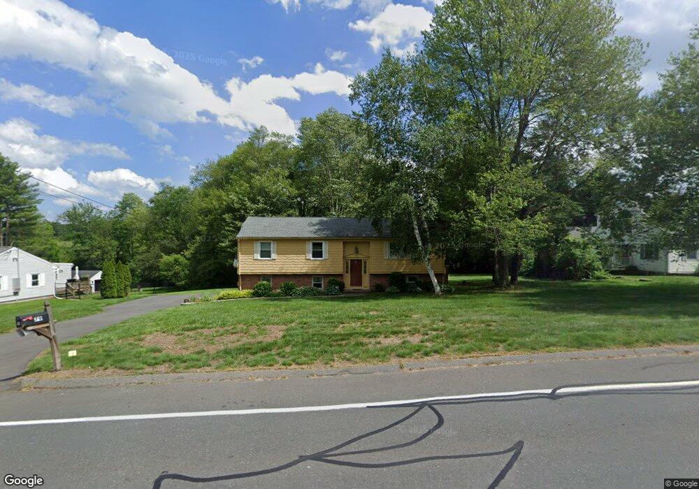
79 Porter Rd East Longmeadow, MA 01028
Estimated Value: $377,000 - $434,000
3
Beds
2
Baths
1,294
Sq Ft
$312/Sq Ft
Est. Value
About This Home
This home is located at 79 Porter Rd, East Longmeadow, MA 01028 and is currently estimated at $403,993, approximately $312 per square foot. 79 Porter Rd is a home located in Hampden County with nearby schools including Meadowbrook Elementary School, Birchland Park Middle School, and East Longmeadow High School.
Ownership History
Date
Name
Owned For
Owner Type
Purchase Details
Closed on
Dec 8, 2016
Sold by
Richards Janet M
Bought by
Richards Donald G and Richards Robert R
Current Estimated Value
Purchase Details
Closed on
Nov 9, 1979
Bought by
Richards Janet M
Create a Home Valuation Report for This Property
The Home Valuation Report is an in-depth analysis detailing your home's value as well as a comparison with similar homes in the area
Home Values in the Area
Average Home Value in this Area
Purchase History
| Date | Buyer | Sale Price | Title Company |
|---|---|---|---|
| Richards Donald G | -- | -- | |
| Richards Janet M | -- | -- |
Source: Public Records
Mortgage History
| Date | Status | Borrower | Loan Amount |
|---|---|---|---|
| Previous Owner | Richards Janet M | $20,000 | |
| Previous Owner | Richards Janet M | $22,000 | |
| Previous Owner | Richards Janet M | $10,000 |
Source: Public Records
Tax History Compared to Growth
Tax History
| Year | Tax Paid | Tax Assessment Tax Assessment Total Assessment is a certain percentage of the fair market value that is determined by local assessors to be the total taxable value of land and additions on the property. | Land | Improvement |
|---|---|---|---|---|
| 2025 | $6,039 | $326,800 | $130,200 | $196,600 |
| 2024 | $5,848 | $315,400 | $130,200 | $185,200 |
| 2023 | $5,583 | $290,800 | $117,700 | $173,100 |
| 2022 | $5,450 | $268,600 | $105,900 | $162,700 |
| 2021 | $5,360 | $254,500 | $98,000 | $156,500 |
| 2020 | $5,195 | $249,300 | $98,000 | $151,300 |
| 2019 | $4,985 | $242,600 | $95,100 | $147,500 |
| 2018 | $4,676 | $223,300 | $95,100 | $128,200 |
| 2017 | $4,692 | $225,900 | $93,400 | $132,500 |
| 2016 | $4,682 | $221,700 | $90,500 | $131,200 |
| 2015 | $4,594 | $221,700 | $90,500 | $131,200 |
Source: Public Records
Map
Nearby Homes
- 77 Porter Rd
- 87 Porter Rd
- 213 Mountainview Rd
- 84 Porter Rd
- 205 Mountainview Rd
- 80 Porter Rd
- 80 Porter Rd Unit 1
- 88 Porter Rd
- 93 Porter Rd
- 73 Porter Rd
- 3 Ridge Rd
- 94 Porter Rd
- 199 Mountainview Rd
- 98 Porter Rd
- 7 E Circle Dr
- 9 E Circle Dr
- 15 Ridge Rd
- 11 E Circle Dr
- 206 Mountainview Rd
- 214 Mountainview Rd