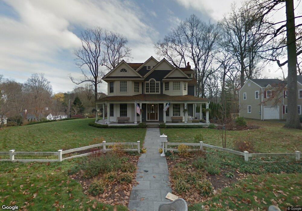
79 Rock Major Rd Fairfield, CT 06824
University NeighborhoodEstimated Value: $2,093,000 - $2,674,379
5
Beds
7
Baths
5,416
Sq Ft
$452/Sq Ft
Est. Value
About This Home
This home is located at 79 Rock Major Rd, Fairfield, CT 06824 and is currently estimated at $2,447,345, approximately $451 per square foot. 79 Rock Major Rd is a home located in Fairfield County with nearby schools including Osborn Hill Elementary School, Fairfield Woods Middle School, and Fairfield Ludlowe High School.
Ownership History
Date
Name
Owned For
Owner Type
Purchase Details
Closed on
Mar 5, 2019
Sold by
Hruschka Marc R and Hruschka Shawn A
Bought by
Rowland Sandra E and Rowland Mark W
Current Estimated Value
Purchase Details
Closed on
Oct 2, 2013
Sold by
Bayonne Carolyn
Bought by
Hruschka Marcd
Purchase Details
Closed on
Dec 28, 2007
Sold by
79 Rock Major Road
Bought by
Hruschka Marc R and Hruschka Shawn A
Home Financials for this Owner
Home Financials are based on the most recent Mortgage that was taken out on this home.
Original Mortgage
$1,200,000
Interest Rate
6.27%
Purchase Details
Closed on
Apr 27, 2005
Sold by
Forester Patricia J
Bought by
Rd 79 Rock Major
Create a Home Valuation Report for This Property
The Home Valuation Report is an in-depth analysis detailing your home's value as well as a comparison with similar homes in the area
Home Values in the Area
Average Home Value in this Area
Purchase History
| Date | Buyer | Sale Price | Title Company |
|---|---|---|---|
| Rowland Sandra E | $1,325,000 | -- | |
| Rowland Sandra E | $1,325,000 | -- | |
| Hruschka Marcd | $435,000 | -- | |
| Hruschka Marcd | $435,000 | -- | |
| Hruschka Marc R | $1,600,000 | -- | |
| Hruschka Marc R | $1,600,000 | -- | |
| Rd 79 Rock Major | $640,000 | -- | |
| 79 Rock Major Rd | $640,000 | -- |
Source: Public Records
Mortgage History
| Date | Status | Borrower | Loan Amount |
|---|---|---|---|
| Previous Owner | 79 Rock Major Rd | $80,000 | |
| Previous Owner | 79 Rock Major Rd | $1,200,000 |
Source: Public Records
Tax History Compared to Growth
Tax History
| Year | Tax Paid | Tax Assessment Tax Assessment Total Assessment is a certain percentage of the fair market value that is determined by local assessors to be the total taxable value of land and additions on the property. | Land | Improvement |
|---|---|---|---|---|
| 2025 | $26,153 | $921,200 | $334,180 | $587,020 |
| 2024 | $25,701 | $921,200 | $334,180 | $587,020 |
| 2023 | $25,342 | $921,200 | $334,180 | $587,020 |
| 2022 | $25,093 | $921,200 | $334,180 | $587,020 |
| 2021 | $24,854 | $921,200 | $334,180 | $587,020 |
| 2020 | $27,801 | $1,037,750 | $299,390 | $738,360 |
| 2019 | $27,801 | $1,037,750 | $299,390 | $738,360 |
| 2018 | $27,355 | $1,037,750 | $299,390 | $738,360 |
| 2017 | $26,795 | $1,037,750 | $299,390 | $738,360 |
| 2016 | $26,411 | $1,037,750 | $299,390 | $738,360 |
| 2015 | $26,699 | $1,077,020 | $329,280 | $747,740 |
| 2014 | $26,279 | $1,077,020 | $329,280 | $747,740 |
Source: Public Records
Map
Nearby Homes
- 103 Rock Major Rd
- 250 Glen Arden Dr
- 209 Glen Arden Dr
- 198 Glen Arden Dr
- 133 Rock Major Rd
- 78 Rock Major Rd
- 187 Glen Arden Dr
- 96 Rock Major Rd
- 56 Rock Major Rd
- 110 Rock Major Rd
- 178 Glen Arden Dr
- 140 Rock Major Rd
- 169 Rock Major Rd
- 26 Rock Major Rd
- 165 Glen Arden Dr
- 165 Rock Major Rd
- 154 Glen Arden Dr
- 167 Rock Major Rd
- 24 Larkspur Rd