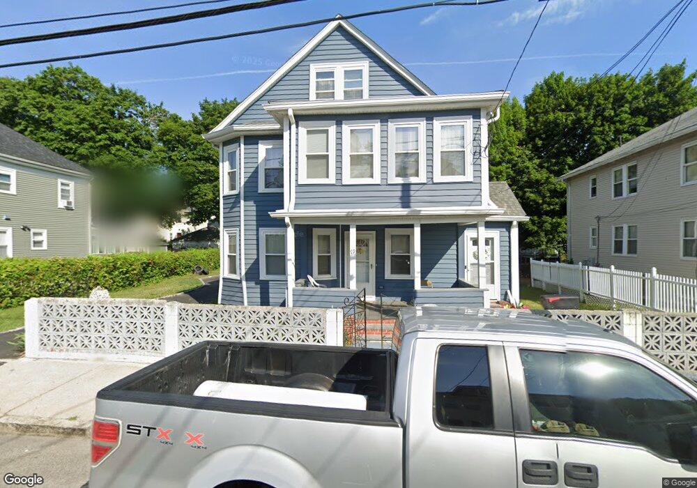
79 Rockdale St Mattapan, MA 02126
Southern Mattapan NeighborhoodEstimated Value: $860,048 - $975,000
6
Beds
2
Baths
3,030
Sq Ft
$299/Sq Ft
Est. Value
About This Home
This home is located at 79 Rockdale St, Mattapan, MA 02126 and is currently estimated at $907,262, approximately $299 per square foot. 79 Rockdale St is a home located in Suffolk County with nearby schools including KIPP Academy Boston Charter School, Boston Preparatory Charter Public School, and Berea Seventh-day Adventist Academy.
Ownership History
Date
Name
Owned For
Owner Type
Purchase Details
Closed on
Mar 20, 1991
Sold by
Rockdale St T 79
Bought by
King Curtis N
Current Estimated Value
Purchase Details
Closed on
Feb 12, 1991
Sold by
Resource Mtg Corp
Bought by
Rockdale St T 79
Create a Home Valuation Report for This Property
The Home Valuation Report is an in-depth analysis detailing your home's value as well as a comparison with similar homes in the area
Home Values in the Area
Average Home Value in this Area
Purchase History
| Date | Buyer | Sale Price | Title Company |
|---|---|---|---|
| King Curtis N | $115,000 | -- | |
| Rockdale St T 79 | $65,000 | -- |
Source: Public Records
Mortgage History
| Date | Status | Borrower | Loan Amount |
|---|---|---|---|
| Open | Rockdale St T 79 | $278,000 | |
| Closed | Rockdale St T 79 | $260,000 |
Source: Public Records
Tax History Compared to Growth
Tax History
| Year | Tax Paid | Tax Assessment Tax Assessment Total Assessment is a certain percentage of the fair market value that is determined by local assessors to be the total taxable value of land and additions on the property. | Land | Improvement |
|---|---|---|---|---|
| 2025 | $8,489 | $733,100 | $330,300 | $402,800 |
| 2024 | $7,219 | $662,300 | $297,700 | $364,600 |
| 2023 | $6,710 | $624,800 | $280,800 | $344,000 |
| 2022 | $6,798 | $624,800 | $280,800 | $344,000 |
| 2021 | $6,061 | $568,000 | $255,300 | $312,700 |
| 2020 | $5,944 | $562,900 | $257,200 | $305,700 |
| 2019 | $5,513 | $523,100 | $194,400 | $328,700 |
| 2018 | $4,895 | $467,100 | $194,400 | $272,700 |
| 2017 | $4,757 | $449,200 | $194,400 | $254,800 |
| 2016 | $4,491 | $408,300 | $194,400 | $213,900 |
| 2015 | $3,947 | $325,900 | $148,500 | $177,400 |
| 2014 | $3,677 | $292,300 | $148,500 | $143,800 |
Source: Public Records
Map
Nearby Homes
- 48-50 Rockdale St
- 90 Hollingsworth St
- 645 River St
- 23 Caton St
- 25 Alpine St Unit 7
- 770 Cummins Hwy Unit 1
- 770 Cummins Hwy Unit 22
- 16 Blue Hill Ave
- 10 Brockton St
- 20 Massasoit St
- 84 Blue Hills Pkwy
- 95 Woodhaven St
- 839-843 Cummins Hwy
- 112 Brush Hill Rd
- 96 Brook Rd
- 7 Winborough St
- 42 Osceola St
- 128 Blue Hills Pkwy
- 27 Hawthorn Rd
- 34 Ridlon Rd
- 81 Rockdale St
- 71 Rockdale St
- 76 Rosewood St
- 85 Rockdale St
- 66 Rosewood St
- 78 Rosewood St Unit 78A
- 67 Rockdale St Unit 69
- 82 Rosewood St
- 89 Rockdale St
- 68 Rockdale St
- 62 Rosewood St
- 82 Rockdale St
- 80 Rockdale St
- 64 Rockdale St
- 76 Rockdale St
- 74 Rockdale St
- 84 Rosewood St
- 63 Rockdale St
- 86 Rockdale St
- 84 Rockdale St