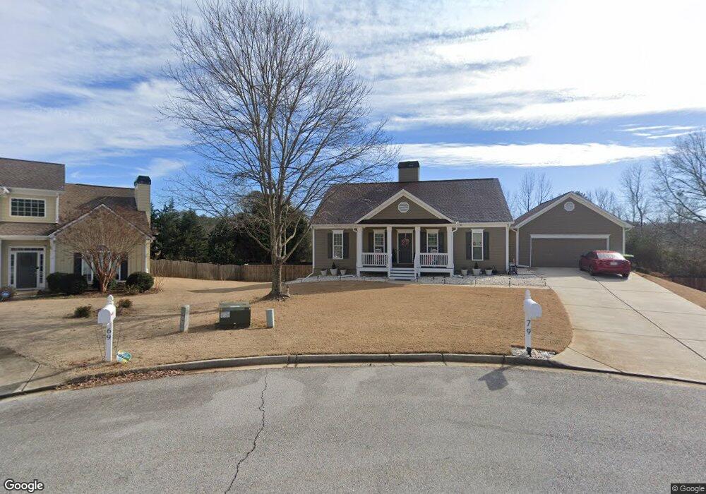
79 Safe Harbor Trail Dallas, GA 30157
Estimated Value: $320,719 - $350,000
3
Beds
2
Baths
1,512
Sq Ft
$223/Sq Ft
Est. Value
About This Home
This home is located at 79 Safe Harbor Trail, Dallas, GA 30157 and is currently estimated at $337,430, approximately $223 per square foot. 79 Safe Harbor Trail is a home located in Paulding County with nearby schools including Union Elementary School, Carl Scoggins Sr. Middle School, and South Paulding High School.
Ownership History
Date
Name
Owned For
Owner Type
Purchase Details
Closed on
May 3, 2024
Sold by
Tejera Carlos J
Bought by
Tejera Carlos J and Tejera Gelis
Current Estimated Value
Purchase Details
Closed on
May 12, 2006
Sold by
Hills At Safe Harbor Llc
Bought by
Tejera Carlos J
Home Financials for this Owner
Home Financials are based on the most recent Mortgage that was taken out on this home.
Original Mortgage
$152,000
Interest Rate
10.8%
Mortgage Type
New Conventional
Purchase Details
Closed on
Apr 14, 2005
Sold by
West Metro Investments Inc
Bought by
Hills At Safe Harbor Llc
Create a Home Valuation Report for This Property
The Home Valuation Report is an in-depth analysis detailing your home's value as well as a comparison with similar homes in the area
Home Values in the Area
Average Home Value in this Area
Purchase History
| Date | Buyer | Sale Price | Title Company |
|---|---|---|---|
| Tejera Carlos J | -- | -- | |
| Tejera Carlos J | $190,000 | -- | |
| Hills At Safe Harbor Llc | $1,026,000 | -- |
Source: Public Records
Mortgage History
| Date | Status | Borrower | Loan Amount |
|---|---|---|---|
| Previous Owner | Tejera Carlos J | $152,000 |
Source: Public Records
Tax History Compared to Growth
Tax History
| Year | Tax Paid | Tax Assessment Tax Assessment Total Assessment is a certain percentage of the fair market value that is determined by local assessors to be the total taxable value of land and additions on the property. | Land | Improvement |
|---|---|---|---|---|
| 2024 | $3,332 | $137,200 | $12,000 | $125,200 |
| 2023 | $3,704 | $144,600 | $12,000 | $132,600 |
| 2022 | $2,601 | $101,640 | $12,000 | $89,640 |
| 2021 | $2,744 | $96,280 | $10,000 | $86,280 |
| 2020 | $2,551 | $87,760 | $10,000 | $77,760 |
| 2019 | $2,232 | $75,920 | $10,000 | $65,920 |
| 2018 | $1,912 | $65,320 | $9,600 | $55,720 |
| 2017 | $1,865 | $62,920 | $9,600 | $53,320 |
| 2016 | $1,732 | $59,160 | $9,600 | $49,560 |
| 2015 | $1,611 | $54,200 | $9,600 | $44,600 |
| 2014 | $1,536 | $50,520 | $9,600 | $40,920 |
| 2013 | -- | $47,920 | $9,600 | $38,320 |
Source: Public Records
Map
Nearby Homes
- 0 Billy Bullock Rd Unit 10622076
- 363 Safe Harbor Dr
- 270 Harmony Woods Dr
- 281 Harmony Woods Dr
- 00 Billy Bullock Rd
- 0 Buchanan Hwy Unit 10367629
- 728 Harmony Rd
- 703 Mulberry Rock Rd
- 59 Mullberry Path
- 232 Cynthia Ct
- 65 Cynthia Ct
- 00002 Boulder View Pkwy
- 177 Rustin Dr
- 12 Shingle Oak Ct
- 334 Stonehenge Dr
- 370 Buchanan Cir Unit TRACT 1
- 370 Buchanan Circle Tract 1
- 14 Clint Ct
- 15 Quarry Ln
- 69 Safe Harbor Trail
- 74 Safe Harbor Trail
- 53 Safe Harbor Trail
- 53 Safe Harbor Trail
- 72 Safe Harbor Trail
- 60 Safe Harbor Trail
- 19 Safe Harbor Trail
- 42 Safe Harbor Trail
- 22 Safe Harbor Trail
- 7768 Buchanan Hwy
- 271 Safe Harbor Dr
- 241 Safe Harbor Dr
- 239 Bullock Farm Rd
- 331 Safe Harbor Dr
- 290 Safe Harbor Dr
- 244 Safe Harbor Dr
- 26 Bullock Farm Rd
- 332 Safe Harbor Dr
- 343 Safe Harbor Dr
- 209 Safe Harbor Dr