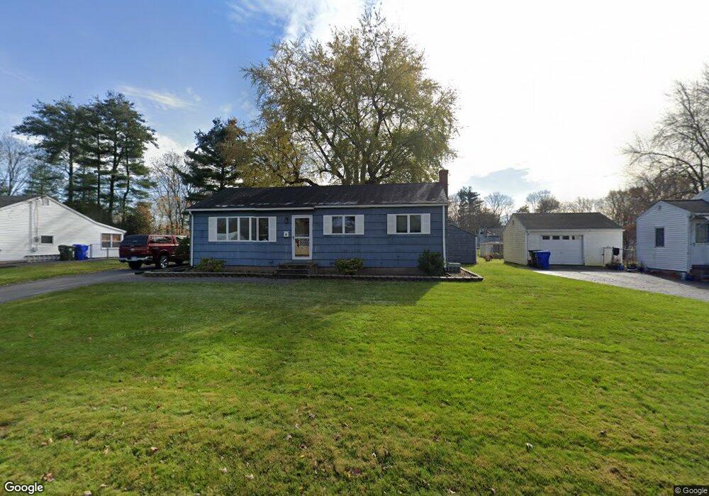
79 Sandra Dr East Hartford, CT 06118
Estimated Value: $310,000 - $538,000
3
Beds
1
Bath
960
Sq Ft
$447/Sq Ft
Est. Value
About This Home
This home is located at 79 Sandra Dr, East Hartford, CT 06118 and is currently estimated at $429,074, approximately $446 per square foot. 79 Sandra Dr is a home located in Hartford County with nearby schools including Governor William Pitkin School, East Hartford Middle School, and East Hartford High School.
Ownership History
Date
Name
Owned For
Owner Type
Purchase Details
Closed on
Jul 31, 2024
Sold by
King Jennifer A and Twohig Patrick J
Bought by
Shah Jigesh R
Current Estimated Value
Home Financials for this Owner
Home Financials are based on the most recent Mortgage that was taken out on this home.
Original Mortgage
$300,181
Outstanding Balance
$296,784
Interest Rate
6.87%
Mortgage Type
Purchase Money Mortgage
Estimated Equity
$132,290
Purchase Details
Closed on
Apr 20, 1990
Sold by
Serksnas Paul S
Bought by
Elliott Matthew J
Create a Home Valuation Report for This Property
The Home Valuation Report is an in-depth analysis detailing your home's value as well as a comparison with similar homes in the area
Home Values in the Area
Average Home Value in this Area
Purchase History
| Date | Buyer | Sale Price | Title Company |
|---|---|---|---|
| Shah Jigesh R | $510,000 | None Available | |
| Shah Jigesh R | $510,000 | None Available | |
| Elliott Matthew J | $134,000 | -- |
Source: Public Records
Mortgage History
| Date | Status | Borrower | Loan Amount |
|---|---|---|---|
| Open | Shah Jigesh R | $300,181 | |
| Closed | Shah Jigesh R | $300,181 | |
| Previous Owner | Elliott Matthew J | $48,000 | |
| Previous Owner | Elliott Matthew J | $100,761 | |
| Previous Owner | Elliott Matthew J | $113,169 | |
| Previous Owner | Elliott Matthew J | $128,763 |
Source: Public Records
Tax History Compared to Growth
Tax History
| Year | Tax Paid | Tax Assessment Tax Assessment Total Assessment is a certain percentage of the fair market value that is determined by local assessors to be the total taxable value of land and additions on the property. | Land | Improvement |
|---|---|---|---|---|
| 2025 | $5,540 | $120,690 | $44,580 | $76,110 |
| 2024 | $5,310 | $120,690 | $44,580 | $76,110 |
| 2023 | $5,134 | $120,690 | $44,580 | $76,110 |
| 2022 | $4,948 | $120,690 | $44,580 | $76,110 |
| 2021 | $4,407 | $89,300 | $33,770 | $55,530 |
| 2020 | $4,458 | $89,300 | $33,770 | $55,530 |
| 2019 | $4,386 | $89,300 | $33,770 | $55,530 |
| 2018 | $4,256 | $89,300 | $33,770 | $55,530 |
| 2017 | $4,202 | $89,300 | $33,770 | $55,530 |
| 2016 | $4,134 | $90,140 | $33,770 | $56,370 |
| 2015 | $4,134 | $90,140 | $33,770 | $56,370 |
| 2014 | $4,092 | $90,140 | $33,770 | $56,370 |
Source: Public Records
Map
Nearby Homes
- 0 Deborah Dr Unit 115
- 0 Deborah Dr Unit 117 24077631
- 6 Judy Dr
- 49 Deborah Dr Unit 123
- 122 Janet Dr
- 218 Wakefield Cir Unit 218
- 441 Forest St
- 21 Forest Ln
- 334 Forbes St
- 50 Hilton Dr
- 127 Ridgewood Rd
- 30 Shaughnessy Dr
- 77 Madison St
- 143R Oak St
- 604 Forest St
- 42 Patton St
- 4 Gladys Rd
- 164 Roxbury Rd
- 642 Silver Ln
- 1060 Forbes St